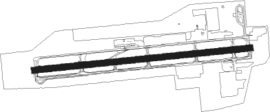
Portland - Portland Troutdale
Airport details
| Country | United States of America |
| State | Oregon |
| Region | K1 |
| Airspace | Seattle Ctr |
| Municipality | Troutdale |
| Elevation | 39ft (12m) |
| Timezone | GMT -8 |
| Coordinates | 45.54936, -122.40125 |
| Magnetic var | |
| Type | land |
| Available since | X-Plane v10.40 |
| ICAO code | KTTD |
| IATA code | TTD |
| FAA code | TTD |
Communication
| Portland Troutdale ATIS | 135.625 |
| Portland Troutdale ASOS | 135.125 |
| Portland Troutdale CTAF | 120.900 |
| Portland Troutdale UNICOM | 122.950 |
| Portland Troutdale Ground Control | 121.800 |
| Portland Troutdale TROUTDALE Tower | 120.900 |
| Portland Troutdale Approach | 124.350 |
| Portland Troutdale Approach | 118.100 |
| Portland Troutdale Departure | 124.350 |
Nearby Points of Interest:
Multnomah County Poor Farm
-Troutdale Methodist Episcopal Church
-Louise Home Hospital and Residence Hall
-Farrell Building
-John Roffler House
-William Gedamke House
-Gresham Carnegie Library
-Roy E. and Hildur L. Amundsen House
-Springdale School
-Dr. Herbert H. Hughes House
-Jacob Zimmerman House
-Charles and Fae Olson House
-Emanuel and Christina Anderson House
-Pittock House
-Vista House
-Claude Hayes Miller House
-Shriners Hospital for Crippled Children
-John Stanger House
-Damascus School
-Wells–Guthrie House
-Mount Tabor Park
-Jacobs–Wilson House
-Andreas Graf House
-William B. Holden House
-Thomas Graham Building
Nearby beacons
| code | identifier | dist | bearing | frequency |
|---|---|---|---|---|
| CBU | COLUMBIA (PORTLAND) TACAN | 9.1 | 281° | 109.20 |
| BTG | BATTLE GROUND VORTAC | 14.3 | 316° | 116.60 |
| UBG | NEWBERG VOR/DME | 27 | 251° | 117.40 |
| PND | BANKS (PORTLAND) NDB | 27.5 | 277° | 356 |
| SL | TURNO (SALEM) NDB | 48.1 | 218° | 266 |
| LWG | LEWISBURG (CORVALLIS) NDB | 67.2 | 223° | 225 |
Departure and arrival routes
| Transition altitude | 18000ft |
| Transition level | 18000ft |
| SID end points | distance | outbound heading | |
|---|---|---|---|
| RW07 | |||
| BLUE3 | 62mi | 225° | |
| RW25 | |||
| BLUE3 | 62mi | 225° | |
| STAR starting points | distance | inbound heading | |
|---|---|---|---|
| RW07 | |||
| OCITY3 | 10.5 | 69° | |
| HELNS6 | 14.3 | 136° | |
| RW25 | |||
| OCITY3 | 10.5 | 69° | |
| HELNS6 | 14.3 | 136° | |
Instrument approach procedures
| runway | airway (heading) | route (dist, bearing) |
|---|---|---|
| RWNVA | GLARA (37°) | GLARA SSHAM (6mi, 32°) 2900ft |
| RNAV | SSHAM 2900ft WOODD (6mi, 32°) 2100ft FAIYR (3mi, 45°) 1180ft APACE (3mi, 45°) 1040ft (6729mi, 110°) 1040ft MILLL (6729mi, 290°) BTG (5mi, 295°) 4200ft BTG (turn) |
Holding patterns
| STAR name | hold at | type | turn | heading* | altitude | leg | speed limit |
|---|---|---|---|---|---|---|---|
| HELNS6 | HELNS | VHF | left | 360 (180)° | < 17999ft | 1.0min timed | ICAO rules |
| OCITY3 | MOXEE | VHF | right | 163 (343)° | 1.5min timed | ICAO rules | |
| OCITY3 | PORTL | VHF | right | 163 (343)° | DME 8.0mi | ICAO rules | |
| OCITY3 | VANTZ | VHF | right | 163 (343)° | 1.5min timed | ICAO rules | |
| *) magnetic outbound (inbound) holding course | |||||||
Disclaimer
The information on this website is not for real aviation. Use this data with the X-Plane flight simulator only! Data taken with kind consent from X-Plane 12 source code and data files. Content is subject to change without notice.