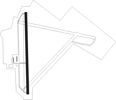
Sturgis - Sturgis Muni
Airport details
| Country | United States of America |
| State | Kentucky |
| Region | K5 |
| Airspace | Memphis Ctr |
| Municipality | Union County |
| Elevation | 372ft (113m) |
| Timezone | GMT -6 |
| Coordinates | 37.54178, -87.95436 |
| Magnetic var | |
| Type | land |
| Available since | X-Plane v10.40 |
| ICAO code | KTWT |
| IATA code | n/a |
| FAA code | TWT |
Communication
| Sturgis Muni AWOS 3 | 118.775 |
| Sturgis Muni CTAF/UNICOM | 122.800 |
| Sturgis Muni EVANSVILLE Approach/Departure | 126.400 |
Nearby Points of Interest:
Battery Rock
-Daniel H. Hughes House
-Union County Courthouse
-Morganfield Commercial District
-Camp Breckinridge Non-Commissioned Officers' Club
-George N. Proctor House
-Robert and John McKee Peeples Houses
-Camp Mather-Camp Logan
-Hovey Lake Archaeological District
-Ashworth Archaeological Site
-Orr-Herl Mound and Village Site
-Illinois Salines
-Crenshaw House
-Duffy Site
-Fredonia Cumberland Presbyterian Church
-Beulah Lodge
-McMullin-Warren House
-Frances School Gymnasium
-Mann Site
-Frederick and Augusta Hagemann Farm
-William Gonnerman House
-Mount Vernon Downtown Historic District
-I.O.O.F. and Barker Buildings
-Posey County Courthouse Square
-Welborn Historic District
Runway info
| Runway 1 / 19 | ||
| length | 1527m (5010ft) | |
| bearing | 4° / 184° | |
| width | 46m (150ft) | |
| surface | asphalt | |
Nearby beacons
| code | identifier | dist | bearing | frequency |
|---|---|---|---|---|
| PXV | POCKET CITY (EVANSVILLE) VORTAC | 24.9 | 26° | 113.30 |
| CCT | CITY DME | 34.2 | 103° | 109.80 |
| OWB | OWENSBORO VOR/DME | 39.4 | 76° | 108.60 |
| EVV | VICCI (EVANSVILLE) NDB | 42.7 | 41° | 219 |
| EU | MUREY (MURRAY) NDB | 51.8 | 202° | 368 |
| CNG | CUNNINGHAM (PADUCAH) VOR/DME | 52.9 | 239° | 113.10 |
| FWC | WAYNE CO (FAIRFIELD) NDB | 54.7 | 332° | 257 |
| FK | AIRBE(FT CAMPBELL/HOPKINSVILLE NDB | 54.8 | 146° | 273 |
| SAM | SAMSVILLE VOR/DME | 56.9 | 352° | 116.60 |
| HXW | SCREAMING EAGLE TACAN | 57 | 153° | 114.90 |
| CKV | CLARKSVILLE VOR/DME | 61 | 150° | 110.60 |
| VNN | VERNON DME | 63.7 | 314° | 113.80 |
Instrument approach procedures
| runway | airway (heading) | route (dist, bearing) |
|---|---|---|
| RW01 | CIVOM (26°) | CIVOM FITIP (5mi, 68°) 2500ft |
| RW01 | FITIP (4°) | FITIP 2500ft |
| RW01 | ZABUX (341°) | ZABUX FITIP (5mi, 298°) 2500ft |
| RNAV | FITIP 2500ft LOXFY (6mi, 4°) 1700ft WAKAK (2mi, 4°) 1080ft KTWT (3mi, 4°) 417ft (5308mi, 113°) 658ft OLGEW (5307mi, 293°) 2500ft OLGEW (turn) | |
| RW19 | HETEP (206°) | HETEP 2500ft OLGEW (5mi, 248°) 2500ft |
| RW19 | IKELE (161°) | IKELE 2500ft OLGEW (5mi, 117°) 2500ft |
| RW19 | OLGEW (184°) | OLGEW 2500ft |
| RNAV | OLGEW 2500ft COVOS (7mi, 184°) 1700ft KTWT (4mi, 184°) 400ft (5308mi, 113°) 772ft FITIP (5308mi, 293°) 2500ft FITIP (turn) |
Disclaimer
The information on this website is not for real aviation. Use this data with the X-Plane flight simulator only! Data taken with kind consent from X-Plane 12 source code and data files. Content is subject to change without notice.
