Tyler - Tyler Pounds Rgnl
Airport details
| Country | United States of America |
| State | Texas |
| Region | K4 |
| Airspace | Ft Worth Ctr |
| Municipality | Smith County |
| Elevation | 541ft (165m) |
| Timezone | GMT -6 |
| Coordinates | 32.35369, -95.39228 |
| Magnetic var | |
| Type | land |
| Available since | X-Plane v10.40 |
| ICAO code | KTYR |
| IATA code | TYR |
| FAA code | TYR |
Communication
| Tyler Pounds Rgnl ATIS | 126.250 |
| Tyler Pounds Rgnl CTAF | 120.100 |
| Tyler Pounds Rgnl UNICOM | 122.950 |
| Tyler Pounds Rgnl Ground Control | 121.900 |
| Tyler Pounds Rgnl Tower | 120.100 |
| Tyler Pounds Rgnl LONGVIEW Approach | 135.250 |
| Tyler Pounds Rgnl LONGVIEW Departure | 135.250 |
Approach frequencies
| ILS-cat-I | RW04 | 111.95 | 18.00mi |
| 3° GS | RW04 | 111.95 | 18.00mi |
Nearby Points of Interest:
Whitaker-McClendon House
-St. James Colored Methodist Episcopal Church
-Tyler City Hall
-St. John's AF & AM Lodge
-Marvin Methodist Episcopal Church, South
-William M. Steger Federal Building and United States Courthouse
-Carnegie Public Library
-People's National Bank Building
-Jenkins-Harvey Super Service Station and Garage
-Blackstone Building
-Elks Club Building
-Cotton Belt Depot Museum
-Ramey House
-Florence Robinson Cottage
-Howard L. and Vivian W. Lott House
-Faulk and Gauntt Building
-Anderson Camp Ground
-Henderson Commercial Historic District
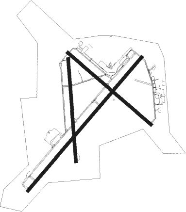
Runway info
Runway 4 / 22  | ||
| length | 2534m (8314ft) | |
| bearing | 50° / 230° | |
| width | 46m (151ft) | |
| surface | concrete | |
| displ threshold | 0m (0ft) / 174m (571ft) | |
| Runway 13 / 31 | ||
| length | 1586m (5203ft) | |
| bearing | 130° / 310° | |
| width | 46m (151ft) | |
| surface | asphalt | |
| displ threshold | 2m (7ft) / 0m (0ft) | |
| blast zone | 1m (3ft) / 0m (0ft) | |
| Runway 18 / 36 | ||
| length | 1482m (4862ft) | |
| bearing | 180° / 0° | |
| width | 46m (151ft) | |
| surface | asphalt | |
| displ threshold | 7m (23ft) / 0m (0ft) | |
Nearby beacons
| code | identifier | dist | bearing | frequency |
|---|---|---|---|---|
| TYR | TYLER VOR/DME | 0.5 | 281° | 114.20 |
| FZT | FRANKSTON VOR/DME | 18.1 | 206° | 111.40 |
| ABG | AMBASSADOR (BIG SANDY) NDB | 19.8 | 50° | 404 |
| GG | VEELS (LONGVIEW) NDB | 30.7 | 80° | 410 |
| UIM | DME | 31.6 | 3° | 114 |
| GGG | GREGG CO. (LONGVIEW) VORTAC | 32.6 | 84° | 112.90 |
| CSZ | CROSSROADS NDB | 33.6 | 243° | 215 |
| CQY | CEDAR CREEK VORTAC | 43.1 | 259° | 114.80 |
| SLR | SULPHUR SPRINGS VOR/DME | 51.3 | 350° | 109 |
| MJF | ARVILLA (GREENVILLE) TACAN | 54.5 | 317° | 109.60 |
| GV | MAJOR (GREENVILLE) NDB | 58.9 | 320° | 201 |
| OC | NADOS (NACOGDOCHES) NDB | 62.3 | 142° | 253 |
Instrument approach procedures
| runway | airway (heading) | route (dist, bearing) |
|---|---|---|
| RW04 | FZT (26°) | FZT IPEME (9mi, 347°) 3000ft |
| RW04 | OTTIF (272°) | OTTIF IPEME (19mi, 249°) 3000ft IPEME (turn) 3000ft |
| RW04 | SNOWE (76°) | SNOWE IPEME (12mi, 99°) 3000ft |
| RNAV | IPEME 3000ft DAYAY (6mi, 50°) 2200ft KTYR (6mi, 53°) 595ft (5679mi, 109°) 1100ft OTTIF (5670mi, 289°) 2500ft OTTIF (turn) | |
| RW13 | FZT (26°) | FZT IJEQU (25mi, 357°) 2200ft IJEQU (turn) 2200ft |
| RW13 | LELPE (115°) | LELPE IJEQU (6mi, 90°) 2200ft |
| RW13 | OVLAE (146°) | OVLAE IJEQU (6mi, 180°) 2200ft |
| RNAV | IJEQU 2200ft EQANY (6mi, 130°) 2000ft WURLO (3mi, 130°) 1100ft KTYR (2mi, 127°) 571ft (5679mi, 109°) 739ft JUHWO (5671mi, 289°) 3000ft JUHWO (turn) | |
| RW18 | BOLRE (175°) | BOLRE CAKEL (6mi, 173°) 2500ft |
| RW18 | CAKEL (176°) | CAKEL 2500ft |
| RW18 | ZIYCO (213°) | ZIYCO CAKEL (9mi, 250°) 2500ft |
| RNAV | CAKEL 2500ft HORDA (5mi, 180°) 2200ft XOLSE (3mi, 180°) 1200ft KTYR (2mi, 162°) 563ft (5679mi, 109°) 789ft FOBUM (5680mi, 289°) 2500ft FOBUM (turn) | |
| RW22 | GODHO (266°) | GODHO DICKA (11mi, 300°) 2800ft CEJZI (6mi, 270°) 2800ft |
| RW22 | ZIYCO (213°) | ZIYCO CEJZI (6mi, 180°) 2800ft |
| RNAV | CEJZI 2800ft WAGED (6mi, 230°) 2200ft KTYR (5mi, 226°) 586ft (5679mi, 109°) 739ft UHIZO (5683mi, 289°) CAPTI (9mi, 265°) 2500ft CAPTI (turn) | |
| RW31 | FZT (26°) | FZT IYFEL (14mi, 80°) 3000ft JUHWO (6mi, 12°) 3000ft |
| RW31 | GGG (264°) | GGG HIDOB (22mi, 242°) 3000ft JUHWO (6mi, 270°) 3000ft |
| RW31 | JUHWO (311°) | JUHWO 6000ft JUHWO (turn) 3000ft |
| RNAV | JUHWO 3000ft TUZYI (6mi, 311°) 2200ft PACIP (3mi, 311°) 1200ft KTYR (2mi, 315°) 597ft (5679mi, 109°) 794ft IJEQU (5686mi, 289°) 2200ft IJEQU (turn) | |
| RW36 | FOBUM (5°) | FOBUM 2500ft |
| RW36 | FZT (26°) | FZT FOBUM (9mi, 50°) 2500ft |
| RNAV | FOBUM 2500ft NERBE (5mi, 0°) 2200ft HANAS (3mi, 0°) 1320ft KTYR (3mi, 16°) 589ft (5679mi, 109°) 794ft CAKEL (5679mi, 289°) 2500ft CAKEL (turn) |
Disclaimer
The information on this website is not for real aviation. Use this data with the X-Plane flight simulator only! Data taken with kind consent from X-Plane 12 source code and data files. Content is subject to change without notice.