Knoxville - Mc Ghee Tyson
Airport details
| Country | United States of America |
| State | Tennessee |
| Region | K7 |
| Airspace | Atlanta Ctr |
| Municipality | Blount County |
| Elevation | 979ft (298m) |
| Timezone | GMT -5 |
| Coordinates | 35.81873, -83.99166 |
| Magnetic var | |
| Type | land |
| Available since | X-Plane v10.40 |
| ICAO code | KTYS |
| IATA code | TYS |
| FAA code | TYS |
Communication
| Mc Ghee Tyson ATIS | 128.350 |
| Mc Ghee Tyson Clearance DEL | 121.650 |
| Mc Ghee Tyson KNOXVILLE Ground Control | 121.900 |
| Mc Ghee Tyson KNOXVILLE Tower | 121.200 |
| Mc Ghee Tyson KNOXVILLE Approach/Departure | 118.000 |
Approach frequencies
| ILS-cat-II | RW23R | 111.7 | 18.00mi |
| ILS-cat-I | RW23L | 110.75 | 18.00mi |
| ILS-cat-I | RW05L | 110.3 | 18.00mi |
| 3° GS | RW23R | 111.7 | 18.00mi |
| 3° GS | RW23L | 110.75 | 18.00mi |
| 3° GS | RW05L | 110.3 | 18.00mi |
Nearby Points of Interest:
Samuel George House
-David Jones House
-Anderson Hall
-Isaac Yearout House
-Sam Houston Schoolhouse
-Willard-Clark House
-Morningside
-Statesview
-Daniel House
-Marble Springs
-Benjamin Morton House
-Forest Heights
-Candoro Marble Works
-Kingston Pike
-Westwood
-Bleak House
-University of Tennessee Agriculture Farm Mound
-Lindbergh Forest
-Ayres Hall
-Avery Russell House
-Medical Arts Building
-United States Post Office and Courthouse
-Boyd-Harvey House
-Knox County Courthouse
-James Park House
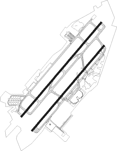
Runway info
Runway 5L / 23R  | ||
| length | 3048m (10000ft) | |
| bearing | 51° / 231° | |
| width | 46m (151ft) | |
| surface | concrete | |
| displ threshold | 149m (489ft) / 1064m (3491ft) | |
| blast zone | 62m (203ft) / 62m (203ft) | |
| Runway 5R / 23L | ||
| length | 2744m (9003ft) | |
| bearing | 51° / 231° | |
| width | 46m (151ft) | |
| surface | asphalt | |
| displ threshold | 0m (0ft) / 122m (400ft) | |
| blast zone | 61m (200ft) / 61m (200ft) | |
Nearby beacons
| code | identifier | dist | bearing | frequency |
|---|---|---|---|---|
| VXV | VOLUNTEER (KNOXVILLE) VORTAC | 7 | 48° | 116.40 |
| JXT | JEFFERSON (MORRISTOWN) NDB | 30.6 | 61° | 346 |
| SOT | SNOWBIRD VORTAC | 45.7 | 92° | 108.80 |
| SCX | SCOTT (ONEIDA) NDB | 47.9 | 317° | 403 |
| HCH | HINCH MTN (CROSSVILLE) VOR/DME | 48.1 | 268° | 117.60 |
| DTE | MARK ANTON (DAYTON) NDB | 50.1 | 250° | 394 |
| HRS | HARRIS VORTAC | 52.7 | 175° | 109.80 |
Departure and arrival routes
| Transition altitude | 18000ft |
| Transition level | 18000ft |
| SID end points | distance | outbound heading | |
|---|---|---|---|
| RW05 (ALL) | |||
| KNOXV7 | 75mi | 70° | |
| RW23 (ALL) | |||
| KNOXV7 | 75mi | 70° | |
Instrument approach procedures
| runway | airway (heading) | route (dist, bearing) |
|---|---|---|
| RW05L | GROSS (55°) | GROSS ATOMC (10mi, 61°) 2800ft |
| RNAV | ATOMC 2800ft ALKOA (6mi, 51°) 2700ft XEWKA (3mi, 51°) 1700ft KTYS (3mi, 48°) 985ft (5113mi, 113°) 1500ft VXV (5108mi, 293°) 4000ft VXV (turn) 4000ft | |
| RW05R | GROSS (55°) | GROSS WUPUL (10mi, 63°) 3100ft |
| RNAV | WUPUL 3100ft VOYUR (6mi, 51°) 2700ft XIZMO (3mi, 51°) 1840ft KTYS (4mi, 45°) 982ft (5113mi, 113°) 1500ft VXV (5108mi, 293°) 4000ft VXV (turn) | |
| RW23L | GOODL (232°) | GOODL 3500ft |
| RNAV | GOODL 3500ft RKYTP (8mi, 231°) 2800ft XEKEF (3mi, 231°) 1800ft KTYS (3mi, 238°) 1015ft (5113mi, 113°) 1600ft GROSS (5129mi, 293°) 3000ft GROSS (turn) | |
| RW23R | NEYLN (231°) | NEYLN 3500ft |
| RNAV | NEYLN 3500ft AWOKI (6mi, 231°) 2800ft XIVZU (3mi, 231°) 1820ft KTYS (3mi, 233°) 1037ft (5113mi, 113°) 1600ft GROSS (5129mi, 293°) 3000ft GROSS (turn) |
Disclaimer
The information on this website is not for real aviation. Use this data with the X-Plane flight simulator only! Data taken with kind consent from X-Plane 12 source code and data files. Content is subject to change without notice.