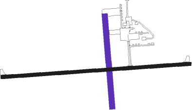
Cumberland - Cumberland Muni
Airport details
| Country | United States of America |
| State | Wisconsin |
| Region | K5 |
| Airspace | Minneapolis Ctr |
| Municipality | Town of Cumberland |
| Elevation | 1241ft (378m) |
| Timezone | GMT -6 |
| Coordinates | 45.50811, -91.97838 |
| Magnetic var | |
| Type | land |
| Available since | X-Plane v10.40 |
| ICAO code | KUBE |
| IATA code | n/a |
| FAA code | UBE |
Communication
| CUMBERLAND MUNI CTAF/UNICOM | 122.800 |
Nearby Points of Interest:
Cumberland Public Library
-Edward N. and Mary T. Stebbins House
-Rice Lake station
-ZCBJ Hall
-George V. Siegner House
-Polk County Courthouse
-Mrs. Richard Polson House
-Lamar Community Center
-Daniels Town Hall
Nearby beacons
| code | identifier | dist | bearing | frequency |
|---|---|---|---|---|
| RP | WICKR (RICE LAKE) NDB | 13.6 | 137° | 221 |
| BXR | BIG DOCTOR (SIREN) NDB | 24.8 | 309° | 203 |
| RZN | DME | 25 | 308° | 109.40 |
| HYR | DME | 37.9 | 46° | 113.40 |
| RCX | RUSK COUNTY (LADYSMITH) NDB | 41.1 | 90° | 356 |
| EAU | EAU CLAIRE VORTAC | 42.3 | 141° | 113.65 |
| ROS | RUSH CITY NDB | 42.5 | 281° | 282 |
| RG | REGUE (RED WING) NDB | 61.6 | 216° | 274 |
Instrument approach procedures
| runway | airway (heading) | route (dist, bearing) |
|---|---|---|
| RW09 | DESTE (90°) | DESTE 3400ft |
| RNAV | DESTE 3400ft ASOCU (8mi, 90°) 2500ft CAGNO (2mi, 90°) 1920ft KUBE (2mi, 88°) 1283ft (5488mi, 116°) 1493ft BURPS (5476mi, 296°) 3400ft BURPS (turn) | |
| RW27 | BURPS (271°) | BURPS 3400ft |
| RNAV | BURPS 3400ft ZEBPA (8mi, 270°) 2500ft ELONE (2mi, 270°) 1860ft KUBE (2mi, 273°) 1273ft (5488mi, 116°) 1490ft DESTE (5501mi, 296°) 3400ft DESTE (turn) |
Disclaimer
The information on this website is not for real aviation. Use this data with the X-Plane flight simulator only! Data taken with kind consent from X-Plane 12 source code and data files. Content is subject to change without notice.

