Darlington - Darlington County Jetport
Airport details
| Country | United States of America |
| State | South Carolina |
| Region | K7 |
| Airspace | Jacksonville Ctr |
| Municipality | Darlington County |
| Elevation | 190ft (58m) |
| Timezone | GMT -5 |
| Coordinates | 34.44938, -79.89006 |
| Magnetic var | |
| Type | land |
| Available since | X-Plane v10.40 |
| ICAO code | KUDG |
| IATA code | UDG |
| FAA code | UDG |
Communication
| Darlington County Jetport AWOS 3 | 119.925 |
| Darlington County Jetport CTAF/UNICOM | 123.000 |
| Darlington County Jetport FLORENCE Approach/Departure | 118.600 |
Nearby Points of Interest:
Clarence McCall House
-Mrs. B.F. Williamson House
-Cashua Street-Spring Street Historic District
-South Carolina Western Railway Station
-Darlington Downtown Historic District
-Manne Building
-Charles S. McCullough House
-Julius A. Dargan House
-Wilds-Edwards House
-Edmund H. Deas House
-Memorial Hall
-Davidson Hall, Coker College
-J.B. Gilbert House
-John L. Hart House (Hartsville, South Carolina)
-J. L. Coker Company Building
-Hartsville Community Center-Hartsville Community Market
-Hartsville Post Office
-Hartsville Passenger Station
-A.M. McNair House
-Wade Hampton Hicks House
-Seaboard Air Line Railway Depot in Patrick
-Hartsville Armory
-E. W. Cannon House and Store
-Paul H. Rogers House
-Robert R. Coker House
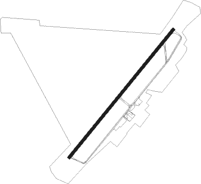
Runway info
| Runway 5 / 23 | ||
| length | 1678m (5505ft) | |
| bearing | 49° / 229° | |
| width | 30m (100ft) | |
| surface | asphalt | |
Nearby beacons
| code | identifier | dist | bearing | frequency |
|---|---|---|---|---|
| UDG | DARLINGTON NDB | 0.3 | 156° | 245 |
| HVS | HARTSVILLE NDB | 11.6 | 259° | 341 |
| BES | BENNETTSVILLE NDB | 12.8 | 43° | 230 |
| FL | ALCOT (FLORENCE) NDB | 16.6 | 172° | 335 |
| FLO | FLORENCE VORTAC | 17.3 | 133° | 115.20 |
| CTF | CHESTERFIELD VOR/DME | 22.5 | 298° | 108.20 |
| DLC | DILLON NDB | 25.8 | 90° | 274 |
| ME | MAXTN (MAXTON) NDB | 27.8 | 58° | 257 |
| SMS | SUMTER NDB | 36 | 226° | 252 |
| CFY | EVANS (LAKE CITY) NDB | 36.1 | 168° | 420 |
| JB | JIGEL (LUMBERTON) NDB | 37.6 | 83° | 384 |
| SSC | SHAW (SUMTER) TACAN | 40.2 | 231° | 110.10 |
| SDZ | SANDHILLS (SOUTHERN PINES VORTAC | 48.3 | 22° | 111.80 |
| LKR | LANCASTER NDB | 50.6 | 286° | 400 |
| HYW | HORRY (CONWAY) NDB | 53.3 | 129° | 370 |
| MNI | MANNING NDB | 54 | 200° | 381 |
| MMT | MC ENTIRE (COLUMBIA) VORTAC | 55.2 | 240° | 113.20 |
| POB | POPE (FAYETTEVILLE) TACAN | 60.8 | 50° | 113.80 |
| PHH | ANDREWS NDB | 62.5 | 160° | 255 |
| VAN | VANCE VORTAC | 64.8 | 210° | 110.40 |
| POB | POPE (FAYETTEVILLE) NDB | 65.6 | 50° | 338 |
Instrument approach procedures
| runway | airway (heading) | route (dist, bearing) |
|---|---|---|
| RW05 | FLO (313°) | FLO WOMUT (20mi, 281°) 2000ft WOMUT (turn) 2000ft |
| RW05 | WARNR (100°) | WARNR WOMUT (10mi, 193°) 2000ft WOMUT (turn) 2000ft |
| RNAV | WOMUT 2000ft UMAGE (6mi, 49°) 1800ft KUDG (5mi, 47°) 241ft (4905mi, 113°) 493ft PIDCI (4904mi, 293°) DUNGY (11mi, 76°) 2000ft DUNGY (turn) | |
| RW23 | CTF (118°) | CTF WIGAS (23mi, 91°) 2100ft JUDUX (5mi, 128°) 2000ft |
| RW23 | DUNGY (253°) | DUNGY JUDUX (6mi, 303°) 2000ft |
| RW23 | TESYU (213°) | TESYU JUDUX (19mi, 201°) 2000ft |
| RNAV | JUDUX 2000ft ZIGUP (6mi, 229°) 1800ft KUDG (5mi, 231°) 223ft LOTIY (2mi, 223°) LARDS (17mi, 191°) 2000ft LARDS (turn) |
Disclaimer
The information on this website is not for real aviation. Use this data with the X-Plane flight simulator only! Data taken with kind consent from X-Plane 12 source code and data files. Content is subject to change without notice.