Quincy - Quincy Rgnl Baldwin Fld
Airport details
| Country | United States of America |
| State | Illinois |
| Region | K5 |
| Airspace | Kansas City Ctr |
| Municipality | Adams County |
| Elevation | 769ft (234m) |
| Timezone | GMT -6 |
| Coordinates | 39.94302, -91.19447 |
| Magnetic var | |
| Type | land |
| Available since | X-Plane v10.40 |
| ICAO code | KUIN |
| IATA code | UIN |
| FAA code | UIN |
Communication
| Quincy Rgnl Baldwin Fld ASOS | 121.425 |
| Quincy Rgnl Baldwin Fld CTAF/UNICOM | 123.000 |
Approach frequencies
| ILS-cat-I | RW04 | 110.1 | 18.00mi |
| 3° GS | RW04 | 110.1 | 18.00mi |
Nearby Points of Interest:
Fall Creek Stone Arch Bridge
-F. D. Thomas House
-Coca-Cola Bottling Company Building
-William S. Warfield House
-Richard F. Newcomb House
-United States Post Office and Courthouse
-One Thirty North Eighth Building
-Ernest M. Wood Office and Studio
-Lewis Round Barn
-South Side German Historic District
-Quincy Northwest Historic District
-Robert W. Gardner House
-Morgan-Wells House
-S.J. Lesem Building
-Ursa Town Hall
-Lock and Dam No. 21
-John Roy Site
-Exchange Bank
-Ebenezer Methodist Episcopal Chapel and Cemetery
-A.C. Waltman House
-William Gray House
-First Presbyterian Church
-Dr. J.A. Hay House
-John McKoon House
-Davidson Building
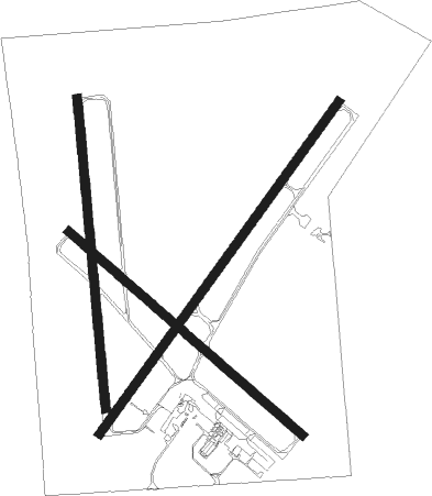
Runway info
Runway 4 / 22  | ||
| length | 2164m (7100ft) | |
| bearing | 48° / 228° | |
| width | 46m (151ft) | |
| surface | asphalt | |
| Runway 18 / 36 | ||
| length | 1647m (5404ft) | |
| bearing | 179° / 359° | |
| width | 46m (151ft) | |
| surface | concrete | |
| Runway 13 / 31 | ||
| length | 1638m (5374ft) | |
| bearing | 128° / 308° | |
| width | 46m (151ft) | |
| surface | asphalt | |
Nearby beacons
| code | identifier | dist | bearing | frequency |
|---|---|---|---|---|
| UI | QUINCY NDB | 4.3 | 227° | 293 |
| UIN | QUINCY VORTAC | 6.9 | 222° | 113.60 |
| EOK | KEOKUK NDB | 33.1 | 335° | 366 |
| BR | BURNS (BURLINGTON) NDB | 42.8 | 6° | 390 |
| IJX | DME | 45.1 | 100° | 108.60 |
| JZY | MACOMB NDB | 45.1 | 48° | 251 |
| BRL | BURLINGTON VOR/DME | 48.4 | 19° | 111.40 |
| HLV | HALLSVILLE VORTAC | 65.9 | 228° | 114.20 |
| GBG | DME | 69 | 37° | 109.80 |
Instrument approach procedures
| runway | airway (heading) | route (dist, bearing) |
|---|---|---|
| RW04 | JISNA (47°) | JISNA 2700ft |
| RW04 | UKUCU (19°) | UKUCU JISNA (5mi, 303°) 2700ft |
| RW04 | WETIN (70°) | WETIN JISNA (5mi, 123°) 2700ft |
| RNAV | JISNA 2700ft WUSIS (6mi, 48°) 2100ft KUIN (5mi, 47°) 797ft (5460mi, 114°) 960ft FANUT (5452mi, 294°) 2400ft FANUT (turn) | |
| RW13 | JUVLI (153°) | JUVLI TAVSE (5mi, 233°) 2700ft |
| RW13 | TAVSE (127°) | TAVSE 2700ft |
| RW13 | ZOGOS (107°) | ZOGOS TAVSE (5mi, 53°) 2700ft |
| RNAV | TAVSE 2700ft BIPZE (6mi, 128°) 2400ft YIPUS (2mi, 128°) 1600ft KUIN (3mi, 126°) 810ft (5460mi, 114°) 1116ft UYAPI (5452mi, 294°) 2700ft UYAPI (turn) | |
| RW18 | JUPIM (178°) | JUPIM 2700ft |
| RW18 | WIKUP (149°) | WIKUP JUPIM (5mi, 89°) 2700ft |
| RW18 | YIPTU (207°) | YIPTU JUPIM (5mi, 270°) 2700ft |
| RNAV | JUPIM 2700ft ZIDLI (6mi, 179°) 2400ft JUXAK (2mi, 179°) 1600ft KUIN (3mi, 174°) 802ft (5460mi, 114°) 1115ft HOSNO (5460mi, 294°) 2700ft HOSNO (turn) | |
| RW22 | ALUGE (249°) | ALUGE FANUT (5mi, 303°) 2400ft |
| RW22 | COBOD (192°) | COBOD FANUT (8mi, 123°) 2400ft |
| RW22 | UIN (42°) | UIN FANUT (20mi, 46°) 2400ft FANUT (turn) 2400ft |
| RNAV | FANUT 2400ft LASSI (7mi, 228°) 2400ft KUIN (6mi, 229°) 789ft (5460mi, 114°) 997ft ASIPE (5461mi, 294°) UIN (6mi, 221°) 2400ft UIN (turn) | |
| RW31 | UYAPI (308°) | UYAPI 2700ft |
| RW31 | WEKIK (288°) | WEKIK UYAPI (5mi, 233°) 2700ft |
| RW31 | ZIMOK (333°) | ZIMOK UYAPI (5mi, 53°) 2700ft |
| RNAV | UYAPI 2700ft BIVEW (6mi, 308°) 2400ft WIRUG (2mi, 308°) 1600ft KUIN (3mi, 309°) 809ft (5460mi, 114°) 1057ft TAVSE (5468mi, 294°) 2700ft TAVSE (turn) | |
| RW36 | HOSNO (1°) | HOSNO 2700ft |
| RW36 | HURAP (331°) | HURAP HOSNO (5mi, 270°) 2700ft |
| RW36 | VURUY (30°) | VURUY HOSNO (5mi, 89°) 2700ft |
| RNAV | HOSNO 2700ft UCUKI (6mi, 359°) 2400ft KUIN (5mi, 2°) 802ft (5460mi, 114°) 1073ft JUPIM (5460mi, 294°) 2700ft JUPIM (turn) |
Disclaimer
The information on this website is not for real aviation. Use this data with the X-Plane flight simulator only! Data taken with kind consent from X-Plane 12 source code and data files. Content is subject to change without notice.