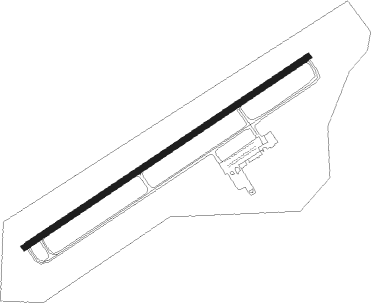
Athens/albany - Ohio University Snyder Field
Airport details
| Country | United States of America |
| State | Ohio |
| Region | K5 |
| Airspace | Indianapolis Ctr |
| Municipality | Athens County |
| Elevation | 766ft (233m) |
| Timezone | GMT -5 |
| Coordinates | 39.21189, -82.22926 |
| Magnetic var | |
| Type | land |
| Available since | X-Plane v10.40 |
| ICAO code | KUNI |
| IATA code | ATO |
| FAA code | UNI |
Communication
| Ohio University Snyder Field AWOS 3 | 128.325 |
| Ohio University Snyder Field CTAF/UNICOM | 123.075 |
| Ohio University Snyder Field HUNTINGTON Approach/Departure | 120.950 |
Approach frequencies
| ILS-cat-I | RW25 | 108.75 | 18.00mi |
| 3° GS | RW25 | 108.75 | 18.00mi |
Nearby Points of Interest:
Athens State Hospital Cow Barn
-Athens Lunatic Asylum
-Masonic Lodge No. 472
-Athens B & O Train Depot
-Beasley Building
-Manasseh Cutler Hall
-Athens Governmental Buildings
-Athens Downtown Historic District
-Wolf Plains
-Savage-Stewart House
-Meigs County Fairgrounds
-The Gold Houses
-Shumaker-Lewis House
-Stuart's Opera House
-Harvey Wells House
-William H. Grant House
-John Downing, Jr., House
-Morgan Mansion
-Clutts House
-Middleport Public Library
-Powell-Redmond House
-Old Meigs County Courthouse
-Haydenville
-Lewis-Capehart-Roseberry House
-Wood Old Homestead
Nearby beacons
| code | identifier | dist | bearing | frequency |
|---|---|---|---|---|
| UGS | UNIVERSITY (ATHENS) NDB | 5.5 | 66° | 250 |
| HNN | DME | 29 | 156° | 115.90 |
| EOP | WAVERLY NDB | 32.8 | 266° | 385 |
| PK | VERSI (PARKERSBURG) NDB | 34.7 | 87° | 388 |
| XUB | YELLOW BUD (CIRCLEVILLE) VOR | 39.5 | 293° | 112.50 |
| JPU | PARKERSBURG VOR/DME | 42 | 75° | 108.60 |
| ZZV | ZANESVILLE VOR/DME | 46.4 | 25° | 114.95 |
| LCK | RICKENBACKER (COLUMBUS) TACAN | 48.3 | 310° | 134.20 |
| DD | COBBS (COLUMBUS) NDB | 48.5 | 304° | 253 |
| YRK | YORK VORTAC | 48.8 | 233° | 112.80 |
| LC | PICKL (COLUMBUS) NDB | 49 | 318° | 376 |
| HVQ | CHARLESTON VOR/DME | 56 | 152° | 117.40 |
| BU | BOUTN (COLUMBUS) NDB | 58 | 302° | 230 |
| APE | APPLETON VORTAC | 58.7 | 339° | 116.70 |
| OS | FULER (COLUMBUS) NDB | 68.4 | 312° | 515 |
Instrument approach procedures
| runway | airway (heading) | route (dist, bearing) |
|---|---|---|
| RW07 | CIMIX (66°) | CIMIX 3000ft |
| RW07 | NETKE (89°) | NETKE CIMIX (7mi, 144°) 3000ft |
| RW07 | SOYLO (39°) | SOYLO CIMIX (7mi, 324°) 3000ft |
| RNAV | CIMIX 3000ft FEKLO (6mi, 66°) 2600ft UXREL (3mi, 66°) 1560ft KUNI (3mi, 66°) 803ft (5044mi, 115°) 1166ft HOPAX (5034mi, 296°) 3000ft HOPAX (turn) | |
| RW25 | CISBO (219°) | CISBO HOPAX (7mi, 144°) 3000ft |
| RW25 | DEVAY (269°) | DEVAY HOPAX (7mi, 324°) 3000ft |
| RW25 | HOPAX (247°) | HOPAX 3000ft |
| RNAV | HOPAX 3000ft TACOY (6mi, 247°) 2600ft ZEPEG (3mi, 246°) 1500ft KUNI (3mi, 246°) 810ft (5044mi, 115°) 965ft CIMIX (5054mi, 295°) 3000ft CIMIX (turn) |
Disclaimer
The information on this website is not for real aviation. Use this data with the X-Plane flight simulator only! Data taken with kind consent from X-Plane 12 source code and data files. Content is subject to change without notice.