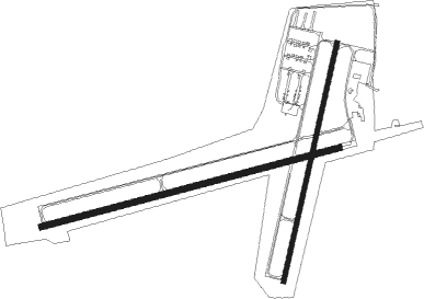
Juneau - Dodge Co
Airport details
| Country | United States of America |
| State | Wisconsin |
| Region | K5 |
| Airspace | Chicago Ctr |
| Municipality | Town of Oak Grove |
| Elevation | 934ft (285m) |
| Timezone | GMT -6 |
| Coordinates | 43.42647, -88.70386 |
| Magnetic var | |
| Type | land |
| Available since | X-Plane v10.30 |
| ICAO code | KUNU |
| IATA code | UNU |
| FAA code | UNU |
Communication
| Dodge Co AWOS 3 | 119.075 |
| Dodge Co CTAF/UNICOM | 122.700 |
| Dodge Co MADISON Approach/Departure | 119.150 |
Approach frequencies
| LOC | RW26 | 109.55 | 18.00mi |
Nearby Points of Interest:
Daniel C. Van Brunt House
-Horicon State Bank
-Chicago, Milwaukee and St. Paul Railway Company Passenger Depot
-Weyenberg Shoe Factory
-Williams Free Library
-John Hustis House
-Main Street Historic District
-White Limestone School
-Hollenstein Wagon and Carriage Factory
-St. Andrew's Church
-St. Joseph's Roman Catholic Church
-Waupun Correctional Institution
-Martin K. Dahl House
-Waupun Public Library
-Ferdinand C. Hartwig House
-North Washington Street Historic District
-Chicago and Northwest Railroad Passenger Station
-South Washington Street Historic District
-St. Paul's Episcopal Church
-August and Eliza Fuermann Jr. House
-Beals and Torrey Shoe Co. Building
-Farmers and Merchants Union Bank
-Richards Hill Residential Historic District
-John A. and Maggie Jones House
-Octagon House
Nearby beacons
| code | identifier | dist | bearing | frequency |
|---|---|---|---|---|
| UNU | JUNEAU NDB | 0.1 | 34° | 344 |
| RYV | ROCK RIVER (WATERTOWN) NDB | 15.2 | 185° | 371 |
| BJB | WEST BEND VOR | 25.2 | 90° | 109.80 |
| BAE | BADGER (MILWAUKEE) VOR/DME | 26.1 | 126° | 116.40 |
| OS | POBER (OSHKOSH) NDB | 27.6 | 18° | 395 |
| MSN | MADISON VORTAC | 32.5 | 246° | 108.60 |
| OSH | OSHKOSH VORTAC | 34.4 | 15° | 116.75 |
| LJT | (MILWAUKEE) DME | 34.8 | 115° | 115.65 |
| FAH | (SHEBOYGAN) DME | 42.4 | 68° | 110 |
| BUU | (BURLINGTON) DME | 47.6 | 151° | 114.50 |
| AQ | KOOKY (APPLETON) NDB | 49.2 | 21° | 407 |
| JVL | JANESVILLE VOR/DME | 55 | 205° | 114.30 |
| HRK | (RACINE) DME | 55.7 | 127° | 117.70 |
| RA | PASER (RACINE) NDB | 56.9 | 133° | 206 |
| ENW | DME | 60.1 | 137° | 109.20 |
| SG | DEPRE (GREEN BAY) NDB | 63.3 | 30° | 332 |
| UG | WAUKE (CHICAGO/WAUKEGAN) NDB | 70.1 | 137° | 379 |
Instrument approach procedures
| runway | airway (heading) | route (dist, bearing) |
|---|---|---|
| RW02 | DREAR (50°) | DREAR FIBVU (13mi, 70°) 3000ft |
| RW02 | FIBVU (22°) | FIBVU 3000ft |
| RW02 | WAITS (348°) | WAITS FIBVU (9mi, 308°) 3000ft |
| RNAV | FIBVU 3000ft EGACA (6mi, 23°) 2700ft KUNU (6mi, 21°) 970ft NUNEF (12mi, 24°) 3000ft NUNEF (turn) | |
| RW08 | DREAR (50°) | DREAR PEBIY (16mi, 17°) 3000ft |
| RW08 | PEBIY (82°) | PEBIY 3000ft |
| RW08 | RANDO (100°) | RANDO PEBIY (6mi, 149°) 3000ft |
| RNAV | PEBIY 3000ft GOPBE (6mi, 82°) 2700ft KUNU (6mi, 82°) 930ft (5349mi, 116°) 1334ft CORIR (5335mi, 296°) 3000ft CORIR (turn) | |
| RW20 | BAE (306°) | BAE NUNEF (33mi, 326°) 3000ft NUNEF (turn) 3000ft |
| RW20 | OSH (195°) | OSH NUNEF (23mi, 190°) 3000ft |
| RW20 | RANDO (100°) | RANDO SOTTE (16mi, 63°) 3000ft NUNEF (5mi, 103°) 3000ft |
| RNAV | NUNEF 3000ft HOMNY (6mi, 203°) 2700ft KUNU (6mi, 205°) 972ft FIBVU (12mi, 202°) 3000ft FIBVU (turn) | |
| RW26 | RANDO (100°) | RANDO CORIR (28mi, 91°) 3000ft CORIR (turn) 3000ft |
| RNAV | CORIR 3000ft DODGE (8mi, 263°) 2700ft KUNU (6mi, 262°) 968ft (5349mi, 116°) 1334ft PEBIY (5360mi, 296°) 3000ft PEBIY (turn) |
Disclaimer
The information on this website is not for real aviation. Use this data with the X-Plane flight simulator only! Data taken with kind consent from X-Plane 12 source code and data files. Content is subject to change without notice.

