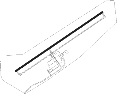
Sullivan - Sullivan Regl
Airport details
| Country | United States of America |
| State | Missouri |
| Region | K3 |
| Airspace | Kansas City Ctr |
| Municipality | Sullivan |
| Elevation | 933ft (284m) |
| Timezone | GMT -6 |
| Coordinates | 38.23347, -91.16428 |
| Magnetic var | |
| Type | land |
| Available since | X-Plane v10.40 |
| ICAO code | KUUV |
| IATA code | n/a |
| FAA code | UUV |
Communication
| Sullivan Regl AWOS 3 | 119.375 |
| Sullivan Regl CTAF/UNICOM | 122.700 |
Nearby Points of Interest:
Panhorst Feed Store
-International Shoe Company Building
-John Manson Munro House
-Cuba City Jail
-Cuba Lodge No. 312 A.F. and A.M.
-Cuba High School Annex
-Uptown Cuba Historic District
-Bartsch-Jasper House
-Henry and Elizabeth Ernst House
-John B. Busch Brewery Historic District
-Brehe Farmstead Historic District
-Paul Monje House
-Henry Beins House
-John Meyer House
-John H. Broeker House
-Louis Kohmueller House
-Henry F. Beinke House
-Henry Bartelmann House
-Mark O'Hara House
-Fore Shoe Company Building
-Dr. H. A. May House
-Joseph Raaf House
-Frank Mense House
-Henry Degen House
-Stafford-Olive Historic District
Nearby beacons
| code | identifier | dist | bearing | frequency |
|---|---|---|---|---|
| VIH | VICHY (ROLLA/VICHY) VOR/DME | 26 | 262° | 117.70 |
| FTZ | FORISTELL VORTAC | 29.1 | 23° | 110.80 |
| SU | SNOOP (ST LOUIS) NDB | 30.7 | 44° | 326 |
| FZ | EAVES (ST LOUIS) NDB | 39.4 | 54° | 227 |
| JE | ALGOA (JEFFERSON CITY) NDB | 46.7 | 289° | 397 |
| MAP | MAPLES TACAN | 48.6 | 224° | 113.40 |
| CSX | DME | 48.9 | 57° | 116.45 |
| STL | SAINT LOUIS VORTAC | 49.4 | 47° | 117.40 |
| TBN | FORNEY (FORT LEONARD WOOD VOR | 54.7 | 243° | 110 |
| BHN | BUCKHORN (FORT LEONARD WOOD) NDB | 54.9 | 240° | 391 |
| FAM | FARMINGTON VORTAC | 55.4 | 121° | 115.70 |
| HLV | HALLSVILLE VORTAC | 69.5 | 312° | 114.20 |
Instrument approach procedures
| runway | airway (heading) | route (dist, bearing) |
|---|---|---|
| RW06 | KAHHO (43°) | KAHHO 3100ft WINIL (5mi, 324°) 3000ft |
| RW06 | NARFU (85°) | NARFU 3000ft WINIL (5mi, 144°) 3000ft |
| RW06 | WINIL (66°) | WINIL 3000ft |
| RNAV | WINIL 3000ft BEXVE (6mi, 66°) 2600ft KUUV (5mi, 66°) 973ft OKUMY (11mi, 66°) 3000ft OKUMY (turn) | |
| RW24 | CELUL (224°) | CELUL 3000ft OKUMY (5mi, 144°) 3000ft |
| RW24 | FEBEM (265°) | FEBEM 3000ft OKUMY (5mi, 324°) 3000ft |
| RW24 | OKUMY (246°) | OKUMY 3000ft |
| RNAV | OKUMY 3000ft PAPSY (6mi, 246°) 2600ft KUUV (5mi, 246°) 976ft WINIL (11mi, 246°) 3000ft WINIL (turn) |
Disclaimer
The information on this website is not for real aviation. Use this data with the X-Plane flight simulator only! Data taken with kind consent from X-Plane 12 source code and data files. Content is subject to change without notice.
