Valdosta - Moody Afb
Airport details
| Country | United States of America |
| State | Georgia |
| Region | K7 |
| Airspace | Jacksonville Ctr |
| Municipality | Lowndes County |
| Elevation | 231ft (70m) |
| Timezone | GMT -5 |
| Coordinates | 30.96870, -83.19296 |
| Magnetic var | |
| Type | land |
| Available since | X-Plane v10.40 |
| ICAO code | KVAD |
| IATA code | VAD |
| FAA code | VAD |
Communication
| Moody AFB Ground Control | 120.625 |
| Moody AFB Tower | 128.450 |
| Moody AFB VALDOSTA Approach | 126.600 |
| Moody AFB VALDOSTA Approach | 127.925 |
| Moody AFB VALDOSTA Approach | 119.525 |
| Moody AFB VALDOSTA Departure | 126.600 |
Approach frequencies
| ILS-cat-I | RW36R | 109.9 | 18.00mi |
| ILS-cat-I | RW18L | 109.3 | 18.00mi |
| 3° GS | RW36R | 109.9 | 18.00mi |
| 3° GS | RW18L | 109.3 | 18.00mi |
Nearby Points of Interest:
Crestwood
-Brookwood North Historic District
-East End Historic District
-First Presbyterian Church
-Barber-Pittman House
-Converse-Dalton House
-Lowndes County Courthouse
-Lowndes County Historical Society Museum
-Southside Historic District
-Dasher High School
-William G. Harrison House
-Old Berrien County Jail
-Berrien County Courthouse
-United States Post Office–Adel, Georgia
-SOWEGA Building
-Cook County Courthouse
-Corbett Farm
-Ewell Brown General Store
-Henry Gray Turner House
-Brooks County Courthouse
-Brooks County Jail
-Harris-Ramsey-Norris House
-Clinch County Courthouse
-Liberty Baptist Church
-Alapaha Colored School
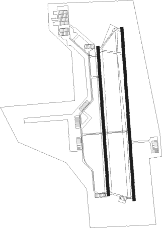
Runway info
Runway 18L / 36R  | ||
| length | 2837m (9308ft) | |
| bearing | 181° / 1° | |
| width | 46m (150ft) | |
| surface | concrete | |
| blast zone | 255m (837ft) / 255m (837ft) | |
| Runway 18R / 36L | ||
| length | 2441m (8009ft) | |
| bearing | 181° / 1° | |
| width | 46m (150ft) | |
| surface | asphalt | |
| blast zone | 255m (837ft) / 255m (837ft) | |
Nearby beacons
| code | identifier | dist | bearing | frequency |
|---|---|---|---|---|
| VAD | MOODY (VALDOSTA) TACAN | 0.5 | 183° | 113.30 |
| OTK | VALDOSTA VOR/DME | 12.1 | 205° | 114.80 |
| HOE | HOMERVILLE NDB | 22.2 | 78° | 209 |
| OWC | COFFEE COUNTY (DOUGLAS) NDB | 29.6 | 32° | 390 |
| IFM | TIFT MYERS (TIFTON) VOR | 31.5 | 327° | 112.50 |
| MGR | DME | 32.1 | 281° | 108.80 |
| GTP | PATON (THOMASVILLE) NDB | 32.6 | 269° | 245 |
| AYS | WAYCROSS VORTAC | 37.3 | 65° | 110.20 |
| SUR | FITZGERALD NDB | 39 | 351° | 362 |
| GEF | GREENVILLE VORTAC | 39.4 | 235° | 109 |
| TAY | TAYLOR VORTAC | 43.2 | 126° | 112.90 |
| AY | WIKET (WAYCROSS) NDB | 46.1 | 66° | 219 |
| AMG | ALMA VORTAC | 48.9 | 50° | 115.10 |
| CYR | CAIDY (CAIRO) NDB | 50 | 265° | 338 |
| LCQ | LAKE CITY NDB | 56.7 | 142° | 204 |
| BHC | BAXLEY NDB | 60.7 | 47° | 376 |
| AZE | HAZLEHURST NDB | 61.4 | 31° | 414 |
Instrument approach procedures
| runway | airway (heading) | route (dist, bearing) |
|---|---|---|
| RW18L | RANDA (181°) | RANDA 3000ft |
| RNAV | RANDA 3000ft BUBIE (10mi, 181°) 1800ft KVAD (5mi, 182°) 273ft EQUIP (17mi, 180°) 3000ft EQUIP (turn) 8000ft | |
| RW18R | ADAPT (180°) | ADAPT 7000ft ADAPT (turn) 3000ft |
| RNAV | ADAPT 3000ft ACYLS (10mi, 181°) 1900ft KVAD (6mi, 179°) 281ft (5055mi, 110°) 633ft JAKAR (5054mi, 290°) 3000ft JAKAR (turn) 7000ft | |
| RW36L | JAKAR (1°) | JAKAR 7000ft JAKAR (turn) 3000ft |
| RNAV | JAKAR 3000ft ADUNC (12mi, 1°) 1900ft KVAD (6mi, 2°) 271ft (5055mi, 110°) 633ft ADAPT (5056mi, 291°) 3000ft ADAPT (turn) 7000ft | |
| RW36R | EQUIP (360°) | EQUIP 3000ft |
| RNAV | EQUIP 3000ft WONLA (11mi, 0°) 1800ft KVAD (6mi, 359°) 260ft RANDA (16mi, 1°) 3000ft RANDA (turn) 8000ft |
Disclaimer
The information on this website is not for real aviation. Use this data with the X-Plane flight simulator only! Data taken with kind consent from X-Plane 12 source code and data files. Content is subject to change without notice.