Victorville - Southern California Logistics
Airport details
| Country | United States of America |
| State | California |
| Region | K2 |
| Airspace | Los Angeles Ctr |
| Municipality | Victorville |
| Elevation | 2883ft (879m) |
| Timezone | GMT -8 |
| Coordinates | 34.59750, -117.38300 |
| Magnetic var | |
| Type | land |
| Available since | X-Plane v10.40 |
| ICAO code | KVCV |
| IATA code | VCV |
| FAA code | VCV |
Communication
| Southern California Logistics ATIS | 135.475 |
| Southern California Logistics VICTORVILLE Ground Control CON | 124.450 |
| Southern California Logistics VICTORVILLE TOWER | 118.350 |
| Southern California Logistics JOSHUA Approach CON | 124.550 |
| Southern California Logistics JOSHUA Departure CON | 124.550 |
Approach frequencies
| ILS-cat-I | RW17 | 108.75 | 18.00mi |
| 3° GS | RW17 | 108.75 | 18.00mi |
Nearby Points of Interest:
Sam and Alfreda Maloof Compound
-Rogers Dry Lake
-Highland Historic District
-San Bernardino Downtown Station
-Bono's Restaurant and Deli
-San Bernardino County Court House
-Rainbow Basin
-Cucamonga Service Station
-Carnegie Library (Upland, California)
-Old San Antonio Hospital
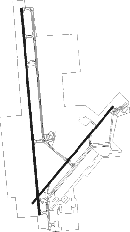
Runway info
Runway 17 / 35  | ||
| length | 4597m (15082ft) | |
| bearing | 179° / 359° | |
| width | 46m (150ft) | |
| surface | asphalt | |
| blast zone | 122m (400ft) / 122m (400ft) | |
| Runway 3 / 21 | ||
| length | 2786m (9140ft) | |
| bearing | 50° / 230° | |
| width | 46m (150ft) | |
| surface | asphalt | |
| blast zone | 255m (837ft) / 255m (837ft) | |
Nearby beacons
| code | identifier | dist | bearing | frequency |
|---|---|---|---|---|
| VCV | VICTORVILLE VOR/DME | 0.3 | 244° | 109.05 |
| EDW | EDWARDS VORTAC | 28.8 | 318° | 116.40 |
| SB | PETIS (SAN BERNARDINO) NDB | 32.5 | 178° | 397 |
| PMD | PALMDALE VORTAC | 33.7 | 273° | 114.50 |
| POM | POMONA VORTAC | 37 | 218° | 110.40 |
| RAL | RIVERSIDE VOR | 38.7 | 186° | 112.40 |
| PDZ | PARADISE (ONTARIO) VORTAC | 41.4 | 192° | 112.20 |
| RIV | MARCH (RIVERSIDE) TACAN | 41.8 | 171° | 113 |
| DAG | DAGGETT VORTAC | 45.3 | 66° | 113.20 |
| HEC | HECTOR VORTAC | 46.9 | 78° | 112.70 |
| HDF | HOMELAND (RIVERSIDE) VOR | 50.2 | 166° | 113.40 |
| ELB | EL TORO (SANTA ANA) VOR/DME | 57.9 | 201° | 117.20 |
| SLI | SEAL BEACH (LOS ALAMITOS) VORTAC | 59.2 | 220° | 115.70 |
| PSP | PALM SPRINGS VORTAC | 64.4 | 127° | 115.50 |
Instrument approach procedures
| runway | airway (heading) | route (dist, bearing) |
|---|---|---|
| RW17 | APLES (282°) | APLES NANCC (16mi, 343°) 7200ft SCCAT (8mi, 270°) 5200ft |
| RW17 | BASAL (253°) | BASAL NANCC (18mi, 276°) 7200ft SCCAT (8mi, 270°) 5200ft |
| RNAV | SCCAT 5200ft SUZZQ (6mi, 179°) 4300ft KVCV (6mi, 177°) 2869ft SPERG (3mi, 183°) RLONG (9mi, 270°) ETHER (12mi, 303°) 6000ft ETHER (turn) |
Disclaimer
The information on this website is not for real aviation. Use this data with the X-Plane flight simulator only! Data taken with kind consent from X-Plane 12 source code and data files. Content is subject to change without notice.