Tampa - Vandenberg
Airport details
| Country | United States of America |
| State | Florida |
| Region | K7 |
| Airspace | Jacksonville Ctr |
| Municipality | Hillsborough County |
| Elevation | 20ft (6m) |
| Timezone | GMT -5 |
| Coordinates | 28.01397, -82.34528 |
| Magnetic var | |
| Type | land |
| Available since | X-Plane v10.40 |
| ICAO code | KVDF |
| IATA code | n/a |
| FAA code | VDF |
Communication
| Vandenberg AWOS 3 | 121.125 |
| Vandenberg CTAF/UNICOM | 122.700 |
| Vandenberg TAMPA Approach/Departure | 119.900 |
Approach frequencies
| ILS-cat-I | RW23 | 111.35 | 18.00mi |
| 3.1° GS | RW23 | 111.35 | 18.00mi |
Nearby Points of Interest:
Temple Terrace Golf and Country Club
-Hermitage-Whitney Historic District
-Horace T. Robles House
-Captain William Parker Jackson House
-Ybor City Historic District
-Old People's Home
-Seminole Heights Residential District
-El Pasaje
-Ybor Factory Building
-William E. Curtis House
-St. James House of Prayer Episcopal Church
-Old Tampa Children's Home
-Floridan Palace Hotel
-Tampa Heights Historic District
-Jackson Rooming House
-Old Hillsborough County High School
-Masonic Temple No. 25
-Old Tampa Free Public Library
-Isaac Gardner, Sr., House
-North Franklin Street Historic District
-United States Courthouse Building and Downtown Postal Station
-S. H. Kress and Co. Building
-Tampa City Hall
-Old School House
-House at 36 Columbia Drive
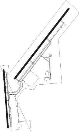
Runway info
Runway 5 / 23  | ||
| length | 1526m (5007ft) | |
| bearing | 46° / 226° | |
| width | 30m (100ft) | |
| surface | asphalt | |
| displ threshold | 0m (0ft) / 244m (801ft) | |
| blast zone | 45m (148ft) / 46m (151ft) | |
| Runway 18 / 36 | ||
| length | 998m (3274ft) | |
| bearing | 180° / 0° | |
| width | 23m (75ft) | |
| surface | asphalt | |
| displ threshold | 13m (43ft) / 0m (0ft) | |
Nearby beacons
| code | identifier | dist | bearing | frequency |
|---|---|---|---|---|
| TP | COSME (TAMPA) NDB | 10.4 | 292° | 368 |
| MCF | MACDILL (TAMPA) TACAN | 12.8 | 228° | 111 |
| LAL | LAKELAND VORTAC | 17.6 | 95° | 116 |
| PI | CAPOK(ST PETERSBURG-CLEARWATER NDB | 19 | 267° | 360 |
| PIE | SAINT PETERSBURG VORTAC | 19 | 253° | 116.40 |
| SRQ | SARASOTA VOR/DME | 38.2 | 200° | 117 |
| OR | HERNY (ORLANDO) NDB | 56.5 | 62° | 221 |
Departure and arrival routes
| Transition altitude | 18000ft |
| Transition level | 18000ft |
| STAR starting points | distance | inbound heading | |
|---|---|---|---|
| ALL | |||
| RAYZZ2 | 44.0 | 83° | |
| MAATY2 | 42.4 | 122° | |
| LZARD6 | 17.2 | 187° | |
| DADES8 | 21.5 | 195° | |
| BRDGE8 | 35.5 | 339° | |
| RW05 | |||
| BLFRG1 | 35.9 | 341° | |
| RW18 | |||
| BLFRG1 | 35.9 | 341° | |
| RW23 | |||
| BLFRG1 | 35.9 | 341° | |
| RW36 | |||
| BLFRG1 | 35.9 | 341° | |
Instrument approach procedures
| runway | airway (heading) | route (dist, bearing) |
|---|---|---|
| RW05 | SRQ (20°) | SRQ HUMKI (22mi, 30°) 2700ft ISOVE (11mi, 342°) 1900ft |
| RNAV | ISOVE 1900ft YATUG (4mi, 33°) 1200ft UHXAZ (1mi, 46°) 740ft KVDF (2mi, 46°) 59ft (5000mi, 109°) 600ft LAL (4982mi, 289°) 2000ft LAL (turn) | |
| RW18 | SAKGO (148°) | SAKGO 3000ft WELUP (6mi, 90°) 3000ft |
| RW18 | TOCOB (211°) | TOCOB 3000ft WELUP (6mi, 270°) 3000ft |
| RW18 | WELUP (179°) | WELUP 3000ft |
| RNAV | WELUP 3000ft IGDUF (6mi, 180°) 1900ft KVDF (5mi, 177°) 63ft (5000mi, 109°) 421ft COLUD (5000mi, 289°) 3000ft COLUD (turn) | |
| RW23 | URIVE (248°) | URIVE JUVAS (7mi, 302°) 2000ft |
| RNAV | JUVAS 1800ft ERKEY (10mi, 226°) 1800ft KVDF (6mi, 226°) 61ft (5000mi, 109°) 800ft LAL (4982mi, 289°) 2700ft LAL (turn) |
Holding patterns
| STAR name | hold at | type | turn | heading* | altitude | leg | speed limit |
|---|---|---|---|---|---|---|---|
| BLFRG1 | BLFRG | VHF | right | 137 (317)° | DME 10.0mi | ICAO rules | |
| BLFRG1 | COSAR | VHF | left | 148 (328)° | DME 10.0mi | ICAO rules | |
| BRDGE8 | BRDGE | VHF | right | 138 (318)° | < 17999ft | 1.0min timed | ICAO rules |
| DADES8 | EDISN | VHF | left | 359 (179)° | DME 10.0mi | ICAO rules | |
| DADES8 | OLENE | VHF | left | 3 (183)° | < 17999ft | 1.0min timed | ICAO rules |
| DADES8 | ZINGR | VHF | left | 75 (255)° | DME 10.0mi | ICAO rules | |
| LZARD6 | LZARD | VHF | right | 45 (225)° | < 17999ft | 1.0min timed | ICAO rules |
| LZARD6 | OLENE | VHF | left | 3 (183)° | < 17999ft | 1.0min timed | ICAO rules |
| MAATY2 | HEVVN | VHF | left | 336 (156)° | DME 10.0mi | ICAO rules | |
| MAATY2 | MAATY | VHF | right | 336 (156)° | DME 8.0mi | ICAO rules | |
| RAYZZ2 | DAAWG | VHF | right | 272 (92)° | DME 10.0mi | ICAO rules | |
| RAYZZ2 | RAYZZ | VHF | right | 270 (90)° | DME 10.0mi | ICAO rules | |
| *) magnetic outbound (inbound) holding course | |||||||
Disclaimer
The information on this website is not for real aviation. Use this data with the X-Plane flight simulator only! Data taken with kind consent from X-Plane 12 source code and data files. Content is subject to change without notice.