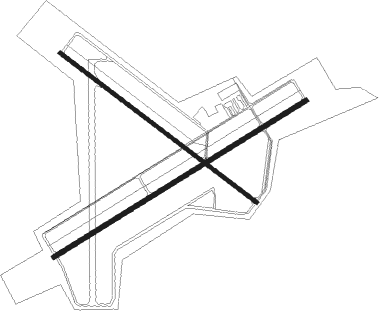
Vidalia - Vidalia Regl
Airport details
| Country | United States of America |
| State | Georgia |
| Region | K7 |
| Airspace | Jacksonville Ctr |
| Municipality | Vidalia |
| Elevation | 272ft (83m) |
| Timezone | GMT -5 |
| Coordinates | 32.19272, -82.37117 |
| Magnetic var | |
| Type | land |
| Available since | X-Plane v10.40 |
| ICAO code | KVDI |
| IATA code | VDI |
| FAA code | VDI |
Communication
| Vidalia Regl AWOS 3 | 119.925 |
| Vidalia Regl CTAF/UNICOM | 122.800 |
Approach frequencies
| ILS-cat-I | RW25 | 110.3 | 18.00mi |
| 3° GS | RW25 | 110.3 | 18.00mi |
Nearby Points of Interest:
Robert and Missouri Garbutt House
-Peterson-Wilbanks House
-Crawford W. Brazell House
-Leader–Rosansky House
-Citizens Bank of Vidalia
-Vidalia Commercial Historic District
-McLemore-Sharpe Farmstead
-Willie T. McArthur Farm
-Montgomery County Courthouse
-Jim Smith House
-Glenwood High School
-Treutlen County Courthouse
-First Methodist Episcopal Church
-Woodland
-South Metter Residential Historic District
-Candler County Courthouse
-Metter Downtown Historic District
-Candler County Jail
-Wheeler County Courthouse
-George W. DeLoach House
-Pace House
-Jeff Davis County Courthouse
-Evans County Courthouse
-Dr. James W. Daniel House
-Albert Neal Durden House

Nearby beacons
| code | identifier | dist | bearing | frequency |
|---|---|---|---|---|
| UQN | ONYUN (VIDALIA) NDB | 4.1 | 67° | 372 |
| AZE | HAZLEHURST NDB | 23.4 | 221° | 414 |
| MQW | MC RAE NDB | 26.6 | 259° | 280 |
| EEX | EMANUEL COUNTY (SWAINSBORO) NDB | 28.7 | 350° | 309 |
| BHC | BAXLEY NDB | 28.8 | 182° | 376 |
| DBN | DUBLIN VORTAC | 32.2 | 309° | 113.10 |
| DB | CREKE (DUBLIN) NDB | 36.8 | 294° | 251 |
| BZ | BULLO (STATESBORO) NDB | 38.3 | 73° | 407 |
| EZM | EASTMAN NDB | 39.9 | 266° | 366 |
| AMG | ALMA VORTAC | 40 | 192° | 115.10 |
| JYL | SYLVANIA NDB | 47.9 | 60° | 245 |
| MOQ | MC INTOSH (HINESVILLE) NDB | 48.9 | 113° | 263 |
| AY | WIKET (WAYCROSS) NDB | 52 | 182° | 219 |
| OWC | COFFEE COUNTY (DOUGLAS) NDB | 55 | 215° | 390 |
| AYS | WAYCROSS VORTAC | 56.2 | 191° | 110.20 |
| SUR | FITZGERALD NDB | 58.3 | 238° | 362 |
| UMB | CULVR (MILLEDGEVILLE) NDB | 70 | 321° | 380 |
Instrument approach procedures
| runway | airway (heading) | route (dist, bearing) |
|---|---|---|
| RW07 | FEVKO (66°) | FEVKO 2000ft |
| RW07 | HEKTO (92°) | HEKTO FEVKO (8mi, 149°) 2000ft |
| RW07 | LISOW (37°) | LISOW FEVKO (8mi, 329°) 2000ft |
| RNAV | FEVKO 2000ft DIOLS (8mi, 66°) 2000ft GRUBS (3mi, 66°) 1060ft KVDI (3mi, 65°) 332ft (5018mi, 111°) 524ft COBTA (5007mi, 291°) 2000ft COBTA (turn) | |
| RW25 | COBTA (247°) | COBTA 2000ft |
| RW25 | HOPIS (275°) | HOPIS COBTA (8mi, 329°) 2000ft |
| RW25 | NORIC (214°) | NORIC COBTA (8mi, 149°) 2000ft |
| RNAV | COBTA 2000ft LIYIN (8mi, 246°) 1500ft KVDI (4mi, 247°) 313ft (5018mi, 111°) 473ft FEVKO (5029mi, 291°) 2000ft FEVKO (turn) |
Disclaimer
The information on this website is not for real aviation. Use this data with the X-Plane flight simulator only! Data taken with kind consent from X-Plane 12 source code and data files. Content is subject to change without notice.