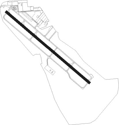
Visalia - Visalia Municipal
Airport details
| Country | United States of America |
| State | California |
| Region | K2 |
| Airspace | Oakland Ctr |
| Municipality | Visalia |
| Elevation | 293ft (89m) |
| Timezone | GMT -8 |
| Coordinates | 36.32521, -119.39936 |
| Magnetic var | |
| Type | land |
| Available since | X-Plane v10.40 |
| ICAO code | KVIS |
| IATA code | VIS |
| FAA code | VIS |
Communication
| Visalia Municipal AWOS 3 | 119.925 |
| Visalia Municipal CTAF/UNICOM | 123.050 |
| Visalia Municipal FRESNO ApproachROACH | 118.500 |
| Visalia Municipal FRESNO DepartureARTURE | 118.500 |
Approach frequencies
| ILS-cat-I | RW30 | 108.5 | 18.00mi |
| 3° GS | RW30 | 108.5 | 18.00mi |
Nearby Points of Interest:
The Pioneer
-US Post Office-Visalia Town Center Station
-Hyde House (Visalia, California)
-Bank of Italy
-Taoist Temple (Hanford, California)
-Kings County Courthouse
-Exeter Library
-Orosi Branch Library
-Orange Cove Santa Fe Railway Depot
-Fowler
-Zalud House
-United States Post Office (Porterville, California)
-Mineral King Road Cultural Landscape District
-East Fork Kaweah River Bridge
-Fresno Municipal Sanitary Landfill
-Mineral King Road
-Southern Pacific Depot
-San Joaquin Light and Power Corporation Building
-Fresno Bee Building
-Einstein House
Nearby beacons
| code | identifier | dist | bearing | frequency |
|---|---|---|---|---|
| VIS | VISALIA VOR/DME | 4.7 | 297° | 109.40 |
| NLC | NAVY LEMOORE TACAN | 27.4 | 272° | 113.30 |
| TTE | TULE VOR/DME | 30.8 | 137° | 109.20 |
| CZQ | CLOVIS (FRESNO) VORTAC | 39.1 | 323° | 112.90 |
| FRA | FRIANT VORTAC | 47.7 | 346° | 115.60 |
| AVE | AVENAL VOR/DME | 49.5 | 220° | 117.10 |
| EHF | SHAFTER (BAKERSFIELD) VORTAC | 52.5 | 160° | 115.40 |
Instrument approach procedures
| runway | airway (heading) | route (dist, bearing) |
|---|---|---|
| RW12 | ALTTA (198°) | ALTTA KARAH (4mi, 230°) 3200ft CALRY (9mi, 262°) 3200ft CALRY (turn) 3200ft |
| RW12 | FRAME (136°) | FRAME CALRY (10mi, 137°) 3200ft |
| RNAV | CALRY 3200ft ZIRES (6mi, 144°) 2300ft FIPAT (5mi, 129°) 780ft KVIS (1mi, 126°) 342ft (6804mi, 107°) 543ft PANES (6799mi, 287°) 2900ft PANES (turn) | |
| RW30 | EXTRA (269°) | EXTRA PANES (9mi, 182°) 2900ft PANES (turn) 2900ft |
| RW30 | LATON (109°) | LATON PANES (20mi, 121°) 2900ft PANES (turn) 2900ft |
| RW30 | PIXEY (2°) | PIXEY PANES (10mi, 64°) 2900ft PANES (turn) 2900ft |
| RW30 | TTE (317°) | TTE BRETT (13mi, 330°) 3200ft PANES (6mi, 309°) 2900ft |
| RNAV | PANES 2900ft PACOD (6mi, 309°) 2000ft HOTLI (4mi, 309°) 820ft KVIS (3mi, 310°) 347ft (6804mi, 107°) 502ft INOCI (6806mi, 287°) LATON (5mi, 279°) 3000ft LATON (turn) 3000ft |
Disclaimer
The information on this website is not for real aviation. Use this data with the X-Plane flight simulator only! Data taken with kind consent from X-Plane 12 source code and data files. Content is subject to change without notice.