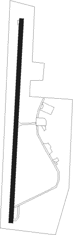
Vicksburg - Vicksburg Muni
Airport details
| Country | United States of America |
| State | Mississippi |
| Region | K7 |
| Airspace | Memphis Ctr |
| Municipality | Vicksburg |
| Elevation | 104ft (32m) |
| Timezone | GMT -6 |
| Coordinates | 32.23914, -90.92819 |
| Magnetic var | |
| Type | land |
| Available since | X-Plane v10.40 |
| ICAO code | KVKS |
| IATA code | VKS |
| FAA code | VKS |
Communication
| Vicksburg Muni AWOS-3 | 118.850 |
| Vicksburg Muni CTAF/UNICOM | 122.800 |
| Vicksburg Muni Memphis Approach | 132.500 |
Nearby Points of Interest:
Yokena Presbyterian Church
-Waterways Experiment Station
-Balfour House
-McRaven House
-Planters Hall
-Anchuca
-Big Black River Battlefield
-Big Black River Railroad Bridge
-Grand Gulf Military State Park
-Sacred Heart Roman Catholic Church (Port Gibson, Mississippi)
-Crescent Plantation
-Madison Parish Courthouse
-Scottland Plantation House
-A. J. Lewis House
-Idlewild
-Linwood Plantation Manager's House
-Winter Quarters State Historic Site
-Van Dorn House
-Canemount
-Alcorn State University Historic District
-Shelton House
-Dupree-Ratliff House
-Hinds County Courthouse
-Porter House
-Peyton House
Nearby beacons
| code | identifier | dist | bearing | frequency |
|---|---|---|---|---|
| TKH | TALLULAH (VICKSBURG/TALLULAH) NDB | 4.9 | 274° | 344 |
| JH | BRENZ (JACKSON) NDB | 35.4 | 75° | 260 |
| HAH | NATCHEZ-ADAMS COUNTY NDB | 37.8 | 214° | 388 |
| HEZ | NATCHEZ VOR/DME | 41.8 | 211° | 110 |
| JA | ALLEN (JACKSON) NDB | 42.3 | 78° | 365 |
| MHZ | MAGNOLIA (MADISON) VORTAC | 43.6 | 77° | 113.20 |
| BQP | BASTROP NDB | 57.4 | 298° | 329 |
| MC | FERNI (MCCOMB) NDB | 62.8 | 157° | 413 |
| MCB | MC COMB VORTAC | 65.7 | 144° | 116.70 |
Instrument approach procedures
| runway | airway (heading) | route (dist, bearing) |
|---|---|---|
| RW01 | ADIVE (9°) | ADIVE 6000ft ADIVE (turn) 2000ft |
| RNAV | ADIVE 2000ft DOGME (6mi, 9°) 1800ft CAVOD (3mi, 9°) 700ft KVKS (2mi, 9°) 151ft (5452mi, 110°) 507ft WIVNI (5451mi, 290°) 2000ft WIVNI (turn) | |
| RW19 | WIVNI (189°) | WIVNI 6000ft WIVNI (turn) 2000ft |
| RNAV | WIVNI 2000ft ZOKLU (6mi, 189°) 1800ft USEZU (3mi, 189°) 900ft KVKS (3mi, 189°) 157ft (5452mi, 110°) 507ft ADIVE (5454mi, 289°) 2000ft ADIVE (turn) |
Disclaimer
The information on this website is not for real aviation. Use this data with the X-Plane flight simulator only! Data taken with kind consent from X-Plane 12 source code and data files. Content is subject to change without notice.