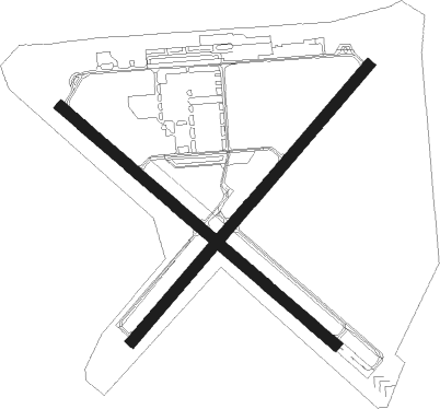
Venice - Venice Muni
Airport details
| Country | United States of America |
| State | Florida |
| Region | K7 |
| Airspace | Miami Oceanic Ctr |
| Municipality | Venice |
| Elevation | 18ft (5m) |
| Timezone | GMT -5 |
| Coordinates | 27.07161, -82.44033 |
| Magnetic var | |
| Type | land |
| Available since | X-Plane v10.40 |
| ICAO code | KVNC |
| IATA code | VNC |
| FAA code | VNC |
Communication
| Venice Muni AWOS 1 | 119.275 |
| Venice Muni CTAF/UNICOM | 122.700 |
| Venice Muni TAMPA Approach/Departure | 119.650 |
| Venice Muni TAMPA Approach/Departure | 124.950 |
Nearby Points of Interest:
John Nolen Plan of Venice Historic District
-Edgewood Historic District
-Armada Road Multi-Family District
-Blalock House
-House at 710 Armada Road South
-Levillain-Letton House
-Venice Seaboard Air Line Railway Station
-Johnson Schoolcraft Building
-Eagle Point Historic District
-Johnson Chapel Missionary Baptist Church
-Nokomis Beach Pavilion
-Lucienne Nielsen House
-Osprey School
-Waters and Elsa Burrows Historic District
-Osprey Archeological and Historic Site
-Bee Ridge Woman's Club
-Dr. C. B. Wilson House
-Edson Keith Estate
-Maine Colony Historic District
-Bispham-Wilson Historic District
-El Jobean Post Office and General Store
-Field Estate
-South Side School
-Revere Quality Institute House
-William Martin Armistead House

Nearby beacons
| code | identifier | dist | bearing | frequency |
|---|---|---|---|---|
| SRQ | SARASOTA VOR/DME | 21.1 | 340° | 117 |
| PGD | PUNTA GORDA VOR | 25.7 | 109° | 110.20 |
| FM | CALOO (FORT MYERS) NDB | 42.4 | 139° | 341 |
| MCF | MACDILL (TAMPA) TACAN | 47.5 | 355° | 111 |
| RSW | LEE COUNTY (FORT MYERS) VORTAC | 48.2 | 129° | 111.80 |
| PIE | SAINT PETERSBURG VORTAC | 51.8 | 344° | 116.40 |
| PI | CAPOK(ST PETERSBURG-CLEARWATER NDB | 57.2 | 344° | 360 |
| LAL | LAKELAND VORTAC | 59.4 | 25° | 116 |
| CYY | CYPRESS (NAPLES) VOR/DME | 65.6 | 144° | 108.60 |
Departure and arrival routes
| Transition altitude | 18000ft |
| Transition level | 18000ft |
| SID end points | distance | outbound heading | |
|---|---|---|---|
| ALL | |||
| SRKUS4 | 103mi | 292° | |
| STAR starting points | distance | inbound heading | |
|---|---|---|---|
| ALL | |||
| RAYZZ2 | 63.7 | 139° | |
| TEEGN3 | 78.4 | 148° | |
| LUBBR2 | 98.0 | 191° | |
| TRAPR3 | 97.0 | 192° | |
Instrument approach procedures
| runway | airway (heading) | route (dist, bearing) |
|---|---|---|
| RW05 | WUPOS (48°) | WUPOS 2900ft |
| RNAV | WUPOS 2900ft WURIK (8mi, 48°) 1700ft KVNC (6mi, 48°) 54ft (5001mi, 108°) 418ft ZATUB (4992mi, 288°) 2900ft ZATUB (turn) | |
| RW13 | FOVTA (132°) | FOVTA 2000ft |
| RNAV | FOVTA 2000ft JIVGA (7mi, 132°) 1600ft KVNC (5mi, 131°) 63ft (5001mi, 108°) 267ft LEYIC (4992mi, 288°) 2000ft LEYIC (turn) | |
| RW23 | ZATUB (229°) | ZATUB 2900ft |
| RNAV | ZATUB 2900ft CUKBU (8mi, 228°) 1700ft ZIKSA (3mi, 228°) 820ft KVNC (3mi, 229°) 66ft (5001mi, 108°) 360ft WUPOS (5010mi, 288°) 2900ft WUPOS (turn) | |
| RW31 | LEYIC (312°) | LEYIC 2000ft |
| RNAV | LEYIC 2000ft ANLEW (7mi, 312°) 1600ft ZARUK (3mi, 312°) 680ft KVNC (2mi, 313°) 56ft (5001mi, 108°) 267ft FOVTA (5010mi, 288°) 2000ft FOVTA (turn) |
Holding patterns
| STAR name | hold at | type | turn | heading* | altitude | leg | speed limit |
|---|---|---|---|---|---|---|---|
| LUBBR2 | LUBBR | VHF | right | 4 (184)° | DME 8.0mi | ICAO rules | |
| RAYZZ2 | DAAWG | VHF | right | 272 (92)° | DME 10.0mi | ICAO rules | |
| RAYZZ2 | RAYZZ | VHF | right | 270 (90)° | DME 10.0mi | ICAO rules | |
| TEEGN3 | AVTAR | VHF | right | 347 (167)° | DME 7.0mi | ICAO rules | |
| TRAPR3 | TRAPR | VHF | right | 357 (177)° | DME 8.0mi | ICAO rules | |
| *) magnetic outbound (inbound) holding course | |||||||
Disclaimer
The information on this website is not for real aviation. Use this data with the X-Plane flight simulator only! Data taken with kind consent from X-Plane 12 source code and data files. Content is subject to change without notice.