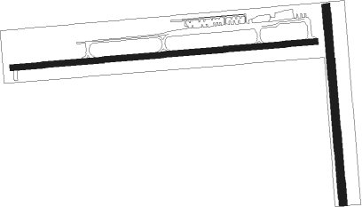
Van Wert - Van Wert Co
Airport details
| Country | United States of America |
| State | Ohio |
| Region | K5 |
| Airspace | Indianapolis Ctr |
| Municipality | Van Wert |
| Elevation | 785ft (239m) |
| Timezone | GMT -5 |
| Coordinates | 40.86383, -84.60636 |
| Magnetic var | |
| Type | land |
| Available since | X-Plane v10.40 |
| ICAO code | KVNW |
| IATA code | VNW |
| FAA code | VNW |
Communication
| Van Wert Co AWOS 3 | 125.175 |
| Van Wert Co CTAF/UNICOM | 123.000 |
| Van Wert Co FORT WAYNE Approach/Departure | 127.200 |
| Van Wert Co FORT WAYNE Approach/Departure | 132.150 |
Nearby Points of Interest:
Van Wert County Courthouse
-Van Wert Bandstand
-Round Barn
-Ben Colter Polygonal Barn
-Bredeick-Lang House
-Marks-Family House
-Lenhart Farmhouse
-John S. Bowers House
-Adams County Courthouse
-Charles Dugan House
-Miami and Erie Canal Deep Cut
-St. Louis, Besancon, Historic District
-Antwerp Norfolk and Western Depot
-Nickel Plate Road 765
-Craigville Depot
-Dr. Issac Elmer Williams House and Office
-Holy Trinity Catholic Church
-Griffith Breese Farm
-Wabash Railroad Depot
-Geneva Downtown Commercial Historic District
-Gene Stratton Porter Cabin
-Allen County Museum
-Neely-Sieber House
Nearby beacons
| code | identifier | dist | bearing | frequency |
|---|---|---|---|---|
| FWA | FORT WAYNE VORTAC | 27.2 | 281° | 117.80 |
| GW | SHENK (AUBURN) NDB | 30.7 | 323° | 227 |
| FBC | FLAG CITY VORTAC | 38.9 | 84° | 108.20 |
| ROD | ROSEWOOD VORTAC | 43 | 136° | 117.50 |
| AWW | WINCHESTER NDB | 44.1 | 204° | 212 |
| OLK | WEBSTER LAKE VOR | 46.4 | 293° | 110.40 |
| DQN | DAYTON VOR/DME | 51.7 | 166° | 114.50 |
| TO | TOPHR (TOLEDO) NDB | 51.7 | 45° | 219 |
| MIE | MUNCIE VOR/DME | 52 | 232° | 114.40 |
| JN | BALLL (MUNCIE) NDB | 52.4 | 226° | 365 |
| MI | BALLL (MUNCIE) NDB | 52.4 | 226° | 365 |
| TOL | TOLEDO TACAN | 57 | 48° | 112.50 |
| AI | VIDEO (ANDERSON) NDB | 63.1 | 229° | 394 |
| UWL | NEW CASTLE NDB | 67.4 | 216° | 385 |
| IRS | STURGIS NDB | 68.1 | 319° | 382 |
Instrument approach procedures
| runway | airway (heading) | route (dist, bearing) |
|---|---|---|
| RW09 | BOOKS (28°) | BOOKS UHDAX (17mi, 347°) 3000ft SUDJU (5mi, 359°) 3000ft |
| RW09 | CHIZM (176°) | CHIZM POJZI (11mi, 264°) 3000ft SUDJU (5mi, 179°) 3000ft |
| RNAV | SUDJU 3000ft UPIWE (6mi, 90°) 2400ft HUTAB (3mi, 90°) 1460ft KVNW (2mi, 91°) 823ft DRIFF (11mi, 90°) 3000ft DRIFF (turn) | |
| RW27 | BOOKS (28°) | BOOKS CEWFY (26mi, 57°) 3000ft DRIFF (5mi, 360°) 3000ft |
| RW27 | CHIZM (176°) | CHIZM AVFAX (12mi, 95°) 3000ft DRIFF (5mi, 180°) 3000ft |
| RW27 | DRIFF (270°) | DRIFF 3000ft |
| RNAV | DRIFF 3000ft OYNOV (6mi, 270°) 2400ft KVNW (5mi, 269°) 825ft (5160mi, 116°) 1185ft DRIFF (5149mi, 296°) 3000ft DRIFF (turn) |
Disclaimer
The information on this website is not for real aviation. Use this data with the X-Plane flight simulator only! Data taken with kind consent from X-Plane 12 source code and data files. Content is subject to change without notice.

