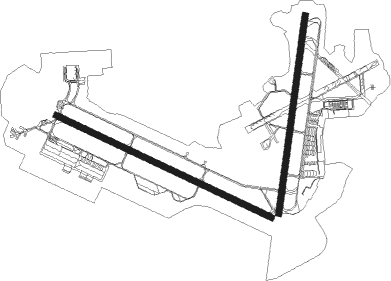
Valparaiso - Eglin Afb
Airport details
| Country | United States of America |
| State | Florida |
| Region | K7 |
| Airspace | Jacksonville Ctr |
| Municipality | Valparaiso |
| Elevation | 83ft (25m) |
| Timezone | GMT -6 |
| Coordinates | 30.48322, -86.52605 |
| Magnetic var | |
| Type | land |
| Available since | X-Plane v10.40 |
| ICAO code | KVPS |
| IATA code | VPS |
| FAA code | VPS |
Communication
| Eglin AFB ATIS | 134.625 |
| Eglin AFB Clearance DEL | 127.700 |
| Eglin AFB Ground Control | 121.800 |
| Eglin AFB Tower | 118.200 |
| Eglin AFB Arr | 132.100 |
| Eglin AFB Arr | 125.100 |
| Eglin AFB Departure | 132.100 |
| Eglin AFB Departure | 125.100 |
Approach frequencies
| ILS-cat-I | RW19 | 109.1 | 18.00mi |
| ILS-cat-I | RW30 | 109.1 | 18.00mi |
| 2.8° GS | RW19 | 109.1 | 18.00mi |
| 2.5° GS | RW30 | 109.1 | 18.00mi |
Nearby Points of Interest:
McKinley Climatic Laboratory
-Eglin Field Historic District
-Camp Pinchot Historic District
-Gulfview Hotel Historic District
-Governor Stone
-Crestview Commercial Historic District
-Sun Bright
-Perry L. Biddle House
-St. Agatha's Episcopal Church
-DeFuniak Springs Historic District
-Louisville and Nashville Depot
-Ollinger-Cobb House
-Milton Historic District
-Mt. Pilgrim African Baptist Church
-Arcadia Sawmill and Arcadia Cotton Mill
-Latimer Cabin
-Naval Live Oaks Reservation
-First American Road in Florida
-John Edmunds Apartment House

Nearby beacons
| code | identifier | dist | bearing | frequency |
|---|---|---|---|---|
| DWG | WARRINGTON (VALPARAISO) TACAN | 0.4 | 134° | 134.50 |
| HRT | HURLBURT (MARY ESTHER) TACAN | 9.1 | 251° | 110.80 |
| CEW | CRESTVIEW VORTAC | 22 | 336° | 115.90 |
| CE | KOBRA (CRESTVIEW) NDB | 22.2 | 358° | 201 |
| NGS | SANTA ROSA (MILTON) TACAN | 22.7 | 288° | 133.60 |
| NSE | WHITING (MILTON) TACAN | 29.2 | 296° | 112.30 |
| PKZ | PICKENS (PENSACOLA) NDB | 33.8 | 266° | 326 |
| PFN | LYNNE (PANAMA CITY) NDB | 39.6 | 102° | 278 |
| NPA | PENSACOLA TACAN | 41.6 | 261° | 117.20 |
| NUN | SAUFLEY (PENSACOLA) VOR | 41.9 | 269° | 108.80 |
| JUY | JUDD (ANDALUSIA) NDB | 49.8 | 9° | 264 |
| PAM | TYNDALL (PANAMA CITY) TACAN | 55.2 | 113° | 133.70 |
| OZ | RUCKR (FT RUCKER) NDB | 57.6 | 44° | 212 |
| EDN | ENTERPRISE VOR | 58.4 | 37° | 116.60 |
| BVG | BOLL WEEVIL (ENTERPRISE) NDB | 58.5 | 32° | 352 |
| OZR | CAIRNS (FT RUCKER) VOR/DME | 62.6 | 46° | 111.20 |
| LOR | LOWE (FORT RUCKER) NDB | 66.3 | 42° | 269 |
| HEY | HANCHEY (FT RUCKER) VOR | 69.9 | 44° | 110.60 |
| HYE | HANCHEY (FT RUCKER) NDB | 69.9 | 44° | 221 |
| MVC | MONROEVILLE VORTAC | 72.4 | 320° | 116.80 |
Instrument approach procedures
| runway | airway (heading) | route (dist, bearing) |
|---|---|---|
| RW01 | DDAWN (48°) | DDAWN 2000ft ELISS (8mi, 99°) 2000ft |
| RW01 | YOUNK (333°) | YOUNK 2000ft ELISS (8mi, 281°) 2000ft |
| RNAV | ELISS 2000ft TYLUR (6mi, 14°) 1600ft KVPS (6mi, 8°) 100ft YOUNK (14mi, 153°) 2000ft YOUNK (turn) 5000ft | |
| RW12 | HILTN (148°) | HILTN 2000ft RUBBN (8mi, 213°) 2000ft |
| RW12 | SIMNS (86°) | SIMNS 2000ft RUBBN (8mi, 34°) 2000ft |
| RNAV | RUBBN 2000ft SUAVE (6mi, 116°) 1700ft KVPS (6mi, 113°) 134ft JEEPP (9mi, 119°) 1600ft JEEPP (turn) 2000ft | |
| RW19 | HAWXX (164°) | HAWXX 2200ft CAJNN (8mi, 116°) 2200ft |
| RW19 | LEDAH (204°) | LEDAH 2200ft CAJNN (8mi, 214°) 2200ft |
| RNAV | CAJNN 2200ft TAMEE (6mi, 194°) 1500ft KVPS (6mi, 200°) 127ft ELISS (12mi, 191°) 2000ft ELISS (turn) 4000ft | |
| RW30 | AUSSE (297°) | AUSSE 1600ft GLIDR (8mi, 297°) 1600ft |
| RW30 | BRNDE (329°) | BRNDE 1600ft GLIDR (8mi, 23°) 1600ft |
| RNAV | GLIDR 1600ft HDSON (6mi, 296°) 1500ft KVPS (6mi, 300°) 128ft GLIDR (12mi, 118°) 2000ft GLIDR (turn) 5000ft |
Disclaimer
The information on this website is not for real aviation. Use this data with the X-Plane flight simulator only! Data taken with kind consent from X-Plane 12 source code and data files. Content is subject to change without notice.