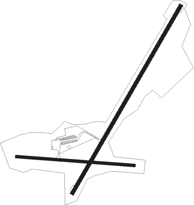
Springfield - Hartness State
Airport details
| Country | United States of America |
| State | Vermont |
| Region | K6 |
| Airspace | Boston Ctr |
| Municipality | Weathersfield |
| Elevation | 577ft (176m) |
| Timezone | GMT -5 |
| Coordinates | 43.34372, -72.51728 |
| Magnetic var | |
| Type | land |
| Available since | X-Plane v10.40 |
| ICAO code | KVSF |
| IATA code | VSF |
| FAA code | VSF |
Communication
| Hartness State ASOS | 121.425 |
| Hartness State CTAF/UNICOM | 122.800 |
Approach frequencies
| LDA | RW05 | 111.3 | 18.00mi |
Nearby Points of Interest:
Springfield Downtown Historic District
-Southview Housing Historic District
-Atherton Farmstead
-Iron Bridge at Howard Hill Road
-Spencer Hollow School
-Glimmerstone
-Eureka Schoolhouse
-Stone Village Historic District
-Pollard Block
-Chester Village Historic District
-Greenwood House
-North Charlestown Historic District
-Aaron Jr. and Susan Parker Farm
-Reading Town Hall
-Parker Hill Rural Historic District
-William Rossiter House
-Claremont Warehouse No. 34
-Zachariah Spaulding Farm
-Claremont City Hall
-David Dexter House
-Charlestown Town Hall
-Brook Farm
-Ludlow Graded School
-South Reading Schoolhouse
-Twing Buckman House
Nearby beacons
| code | identifier | dist | bearing | frequency |
|---|---|---|---|---|
| CNH | CLAREMONT NDB | 6.5 | 80° | 233 |
| RUT | DME | 21.8 | 293° | 111 |
| LEB | DME | 24 | 42° | 113.70 |
| LAH | HANOVER (LEBANON) NDB | 26.1 | 43° | 276 |
| DYO | SMUTO (RUTLAND) NDB | 28.9 | 310° | 221 |
| EEN | DME | 34.4 | 158° | 109.40 |
| CAM | CAMBRIDGE VOR/DME | 41.8 | 247° | 115 |
| CON | CONCORD VOR/DME | 41.8 | 97° | 112.90 |
| LC | BLNAP (LACONIA) NDB | 44.2 | 79° | 328 |
| MPV | MONTPELIER VOR/DME | 44.6 | 5° | 116.90 |
| GDM | GARDNER VOR/DME | 51.9 | 150° | 110.60 |
| MJ | FITZY (MANCHESTER) NDB | 52 | 116° | 209 |
Instrument approach procedures
| runway | airway (heading) | route (dist, bearing) |
|---|---|---|
| RW05 | DORIS (56°) | DORIS JUBUB (13mi, 63°) 6000ft LISBE (8mi, 63°) 4400ft |
| RW05 | KEYNN (338°) | KEYNN SAFAD (24mi, 308°) 4400ft LISBE (5mi, 356°) 4400ft |
| RW05 | LISBE (43°) | LISBE 4400ft |
| RNAV | LISBE 4400ft JIMEX (3mi, 43°) 3400ft DEVSE (1mi, 43°) 3200ft FIDER (4mi, 43°) 1820ft KVSF (4mi, 43°) 630ft (4647mi, 121°) 2100ft LISBE (4652mi, 301°) 4400ft LISBE (turn) |
Disclaimer
The information on this website is not for real aviation. Use this data with the X-Plane flight simulator only! Data taken with kind consent from X-Plane 12 source code and data files. Content is subject to change without notice.

