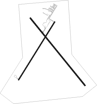
Valentine - Miller Field
Airport details
| Country | United States of America |
| State | Nebraska |
| Region | K3 |
| Airspace | Denver Ctr |
| Municipality | Cherry County |
| Elevation | 2595ft (791m) |
| Timezone | GMT -6 |
| Coordinates | 42.85669, -100.54897 |
| Magnetic var | |
| Type | land |
| Available since | X-Plane v10.40 |
| ICAO code | KVTN |
| IATA code | VTN |
| FAA code | VTN |
Communication
| Miller Field ASOS | 118.075 |
| Miller Field CTAF/UNICOM | 122.800 |
| Miller Field DENVER ApproachROACH | 127.950 |
| Miller Field DENVER DepartureARTURE | 127.950 |
Nearby Points of Interest:
Valentine Public School
-Cherry County Courthouse
-F.M. Walcott House
-Adamson Bridge
-Berry State Aid Bridge
-Brewer Bridge
-St. Francis Mission
Nearby beacons
| code | identifier | dist | bearing | frequency |
|---|---|---|---|---|
| VTN | VALENTINE NDB | 0.2 | 352° | 314 |
| ANW | AINSWORTH VOR/DME | 30.1 | 117° | 112.70 |
| TDD | THEDFORD VOR/DME | 53 | 191° | 108.60 |
Instrument approach procedures
| runway | airway (heading) | route (dist, bearing) |
|---|---|---|
| RW03 | KILEA (45°) | KILEA 5000ft |
| RNAV | KILEA 5000ft FABIS (5mi, 45°) 4500ft HIGIS (4mi, 45°) 3260ft KVTN (2mi, 47°) 2634ft (5868mi, 113°) 2845ft MAIMS (5861mi, 293°) 5000ft MAIMS (turn) | |
| RW14 | AHOFU (137°) | AHOFU 6000ft AHOFU (turn) 5000ft |
| RNAV | AHOFU 5000ft CITBO (5mi, 137°) 4400ft HAKNO (3mi, 137°) 3320ft KVTN (2mi, 138°) 2628ft (5868mi, 113°) 2861ft GIYIT (5863mi, 293°) 5000ft GIYIT (turn) | |
| RW21 | MAIMS (225°) | MAIMS 6000ft MAIMS (turn) 5000ft |
| RNAV | MAIMS 5000ft STAPH (5mi, 225°) 4300ft WADAB (3mi, 225°) 3220ft KVTN (2mi, 222°) 2631ft (5868mi, 113°) 2845ft KILEA (5876mi, 293°) 5000ft KILEA (turn) | |
| RW32 | GIYIT (317°) | GIYIT 5000ft |
| RW32 | ILHOV (346°) | ILHOV 5000ft GIYIT (5mi, 63°) 5000ft |
| RW32 | VEBAW (294°) | VEBAW 5000ft GIYIT (5mi, 243°) 5000ft |
| RNAV | GIYIT 5000ft EBUWI (5mi, 317°) 4400ft KVTN (6mi, 316°) 2623ft (5868mi, 113°) 2840ft AHOFU (5873mi, 293°) 5000ft AHOFU (turn) |
Disclaimer
The information on this website is not for real aviation. Use this data with the X-Plane flight simulator only! Data taken with kind consent from X-Plane 12 source code and data files. Content is subject to change without notice.

