Albemarle - Stanly Co
Airport details
| Country | United States of America |
| State | North Carolina |
| Region | K7 |
| Airspace | Atlanta Ctr |
| Municipality | Stanly County |
| Elevation | 606ft (185m) |
| Timezone | GMT -5 |
| Coordinates | 35.41004, -80.15581 |
| Magnetic var | |
| Type | land |
| Available since | X-Plane v10.40 |
| ICAO code | KVUJ |
| IATA code | n/a |
| FAA code | VUJ |
Communication
| Stanly Co AWOS 3 | 128.175 |
| Stanly Co UNICOM | 123.000 |
| Stanly Co CTAF | 126.275 |
| Stanly Co Ground Control | 121.750 |
| Stanly Co Tower | 126.275 |
| Stanly Co Approach | 128.325 |
| Stanly Co Departure | 128.325 |
Approach frequencies
| ILS-cat-I | RW22L | 110.55 | 18.00mi |
| 3° GS | RW22L | 110.55 | 18.00mi |
Nearby Points of Interest:
Narrows Dam and Power Plant Complex
-Pee Dee Avenue Historic District
-Thomas Marcellus Denning House
-Second Street Historic District
-Five Points Historic District
-Isaiah Wilson Snugs House
-Albemarle Opera House
-Downtown Albemarle Historic District
-Randle House
-Montgomery County Courthouse
-First Congregational Church
-Mount Pleasant Historic District
-Mount Pleasant Collegiate Institute Historic District
-Kerr Mill
-Lewis-Thornburg Farm
-Reed Gold Mine
-Michael Braun House
-Cabarrus County Courthouse
-Barber–Scotia College
-Odell-Locke-Randolph Cotton Mill
-North Long Street-Park Avenue Historic District
-Southern Railway's Spencer Shops
-Bernhardt House
-Community Building
-Salisbury Historic District
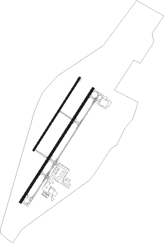
Runway info
Runway 4R / 22L  | ||
| length | 1678m (5505ft) | |
| bearing | 43° / 223° | |
| width | 30m (98ft) | |
| surface | asphalt | |
| Runway 4L / 22R | ||
| length | 1069m (3507ft) | |
| bearing | 43° / 223° | |
| width | 23m (75ft) | |
| surface | asphalt | |
| blast zone | 93m (305ft) / 90m (295ft) | |
Nearby beacons
| code | identifier | dist | bearing | frequency |
|---|---|---|---|---|
| VU | ALLER (ALBEMARLE) NDB | 5.9 | 42° | 346 |
| RU | ROVDY (SALISBURY) NDB | 25.3 | 314° | 275 |
| SDZ | SANDHILLS (SOUTHERN PINES VORTAC | 30.1 | 109° | 111.80 |
| LIB | LIBERTY VORTAC | 35.8 | 54° | 113 |
| GSO | GREENSBORO VORTAC | 39.1 | 16° | 116.20 |
| IN | REENO (WINSTON SALEM) NDB | 39.6 | 359° | 317 |
| CLT | CHARLOTTE VOR/DME | 41.1 | 255° | 115 |
| HB | ALAMM NDB | 44 | 45° | 361 |
| CTF | CHESTERFIELD VOR/DME | 45.9 | 189° | 108.20 |
| BES | BENNETTSVILLE NDB | 51.7 | 152° | 230 |
| ME | MAXTN (MAXTON) NDB | 53.6 | 134° | 257 |
| LKR | LANCASTER NDB | 53.8 | 226° | 400 |
| UZ | RALLY (ROCK HILL) NDB | 55.1 | 241° | 227 |
| UDG | DARLINGTON NDB | 59.5 | 164° | 245 |
| SIF | SLAMMER (REIDSVILLE) NDB | 61.4 | 22° | 423 |
| DLC | DILLON NDB | 69.4 | 141° | 274 |
Departure and arrival routes
| Transition altitude | 18000ft |
| Transition level | 18000ft |
| SID end points | distance | outbound heading | |
|---|---|---|---|
| ALL | |||
| KILNS4 | 81mi | 60° | |
| BARMY4 | 124mi | 77° | |
| KNI2 | 18mi | 125° | |
| LILLS2 | 31mi | 155° | |
| KWEEN4 | 79mi | 208° | |
| ICONS4 | 96mi | 212° | |
| BEAVY5 | 110mi | 216° | |
| ESTRR4 | 147mi | 248° | |
| BOBZY4 | 92mi | 260° | |
| JOJJO4 | 244mi | 277° | |
| KRITR5 | 46mi | 307° | |
| WEAZL4 | 77mi | 316° | |
| RW04R | |||
| KER3 | 154mi | 209° | |
| RW22L | |||
| KER3 | 154mi | 209° | |
| STAR starting points | distance | inbound heading | |
|---|---|---|---|
| ALL | |||
| KABEE3 | 44.9 | 1° | |
| CHPTR3 | 85.2 | 57° | |
| UNARM6 | 86.0 | 63° | |
| NASCR4 | 18.9 | 97° | |
Instrument approach procedures
| runway | airway (heading) | route (dist, bearing) |
|---|---|---|
| RW04R | HINUM (64°) | HINUM 3000ft OCDAM (5mi, 122°) 3000ft |
| RW04R | OCDAM (43°) | OCDAM 3000ft |
| RW04R | WAXIB (18°) | WAXIB 3000ft OCDAM (5mi, 302°) 3000ft |
| RNAV | OCDAM 3000ft RENZI (6mi, 43°) 2500ft KVUJ (6mi, 43°) 648ft PPAGE (6mi, 43°) HEPEP (11mi, 284°) OCDAM (18mi, 182°) 3000ft OCDAM (turn) | |
| RW22L | EWUKO (223°) | EWUKO 4000ft FIKBI (3mi, 223°) 3300ft |
| RW22L | OMDOE (199°) | OMDOE 4000ft EWUKO (5mi, 122°) 4000ft FIKBI (3mi, 223°) 3300ft |
| RW22L | PIBTE (243°) | PIBTE 4000ft EWUKO (5mi, 302°) 4000ft FIKBI (3mi, 223°) 3300ft |
| RNAV | FIKBI 3300ft PPAGE (3mi, 223°) 2400ft KVUJ (6mi, 223°) 617ft RENZI (6mi, 223°) HUNOS (11mi, 322°) EWUKO (18mi, 75°) 4000ft EWUKO (turn) |
Holding patterns
| STAR name | hold at | type | turn | heading* | altitude | leg | speed limit |
|---|---|---|---|---|---|---|---|
| CHPTR3 | EYPAD | VHF | right | 218 (38)° | DME 10.0mi | ICAO rules | |
| CHPTR3 | GRD | NDB | right | 227 (47)° | < 17999ft | 1.0min timed | ICAO rules |
| KABEE3 | FLO | NDB | left | 140 (320)° | 1.0min timed | ICAO rules | |
| KABEE3 | KABEE | VHF | left | 145 (325)° | DME 10.0mi | ICAO rules | |
| UNARM6 | GRD | NDB | right | 227 (47)° | < 17999ft | 1.0min timed | ICAO rules |
| UNARM6 | LOCKS | VHF | right | 232 (52)° | < 17999ft | 1.0min timed | ICAO rules |
| UNARM6 | UNARM | VHF | right | 233 (53)° | DME 4.0mi | ICAO rules | |
| *) magnetic outbound (inbound) holding course | |||||||
Disclaimer
The information on this website is not for real aviation. Use this data with the X-Plane flight simulator only! Data taken with kind consent from X-Plane 12 source code and data files. Content is subject to change without notice.