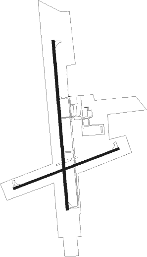
Peru - Illinois Valley Rgnl
Airport details
| Country | United States of America |
| State | Illinois |
| Region | K5 |
| Airspace | Chicago Ctr |
| Municipality | Peru |
| Elevation | 650ft (198m) |
| Timezone | GMT -6 |
| Coordinates | 41.35014, -89.15295 |
| Magnetic var | |
| Type | land |
| Available since | X-Plane v10.40 |
| ICAO code | KVYS |
| IATA code | VYS |
| FAA code | VYS |
Communication
| Illinois Valley Rgnl AWOS | 120.025 |
| Illinois Valley Rgnl CTAF/UNICOM | 123.000 |
| Illinois Valley Rgnl KVYS | 119.000 |
Nearby Points of Interest:
LaSalle Downtown Commercial District
-LaSalle City Building
-Hegeler Carus Mansion
-Julius W. Hegeler I House
-Grand Village of the Illinois
-Edward Pulsifer House
-Putnam County Courthouse
-Wood-Tellkamp House
-Fisher-Nash-Griggs House
-Owen Lovejoy House
-Richard M. Skinner House
-Greenwood Cottage
-Knuessl Building
-Ottawa Commercial Historic District
-Washington Park Historic District
-John Hossack House
-Princeton Chapter House
-Princeton North Main Street Historic District
-Jeremiah Strawn House
-Andrew J. O'Conor III House
-Cortland Condit House
-Stevens House
-Nisbet Homestead Farm
-Marseilles Lock and Dam Historic District
-Marseilles Hydro Plant

Nearby beacons
| code | identifier | dist | bearing | frequency |
|---|---|---|---|---|
| BDF | BRADFORD VORTAC | 22.7 | 246° | 114.70 |
| DTG | DWIGHT NDB | 34.9 | 107° | 344 |
| PNT | PONTIAC VOR/DME | 37 | 142° | 109.60 |
| JOT | JOLIET VOR/DME | 39.3 | 77° | 112.30 |
| PLL | POLO VOR/DME | 40.5 | 329° | 111.20 |
| DPA | DUPAGE (CHICAGO) VOR/DME | 48.4 | 56° | 108.40 |
| PI | TUNGG (PEORIA) NDB | 48.9 | 211° | 356 |
| LH | EGROW (BLOOMINGTON-NORMAL) NDB | 49 | 161° | 334 |
| PIA | PEORIA VORTAC | 49.5 | 224° | 115.20 |
| RFD | DME | 52.6 | 357° | 110.80 |
| BMI | BLOOMINGTON VOR/DME | 53.1 | 166° | 108.20 |
| RBS | ROBERTS VOR/DME | 64.3 | 128° | 116.80 |
Instrument approach procedures
| runway | airway (heading) | route (dist, bearing) |
|---|---|---|
| RW18 | BDF (66°) | BDF JITSA (30mi, 48°) 2500ft JITSA (turn) 2500ft |
| RW18 | KELSI (241°) | KELSI JITSA (10mi, 303°) 2500ft JITSA (turn) 2500ft |
| RW18 | SHOOF (191°) | SHOOF JITSA (13mi, 201°) 2500ft |
| RNAV | JITSA 2500ft FIREP (6mi, 179°) 2300ft HORAH (3mi, 179°) 1320ft KVYS (3mi, 180°) 694ft (5367mi, 115°) 904ft MRKWL (5367mi, 295°) 2500ft MRKWL (turn) | |
| RW36 | BDF (66°) | BDF MRKWL (20mi, 90°) 2500ft MRKWL (turn) 2500ft |
| RW36 | SMARS (307°) | SMARS MRKWL (13mi, 276°) 2500ft |
| RNAV | MRKWL 2500ft JODYS (6mi, 359°) 2300ft COYAR (3mi, 359°) 1300ft KVYS (2mi, 360°) 678ft (5367mi, 115°) 900ft JITSA (5367mi, 295°) 2500ft JITSA (turn) |
Disclaimer
The information on this website is not for real aviation. Use this data with the X-Plane flight simulator only! Data taken with kind consent from X-Plane 12 source code and data files. Content is subject to change without notice.