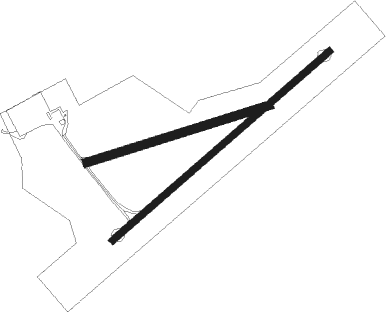
Wilkes-barre - Wilkes Barre Wyoming Valley
Airport details
| Country | United States of America |
| State | Pennsylvania |
| Region | K6 |
| Airspace | New York Ctr |
| Municipality | Wyoming |
| Elevation | 542ft (165m) |
| Timezone | GMT -5 |
| Coordinates | 41.29731, -75.85224 |
| Magnetic var | |
| Type | land |
| Available since | X-Plane v10.40 |
| ICAO code | KWBW |
| IATA code | WBW |
| FAA code | WBW |
Communication
| WILKES BARRE WYOMING VALLEY CTAF/UNICOM | 122.800 |
| WILKES BARRE WYOMING VALLEY Approach/Departure | 126.300 |
Nearby Points of Interest:
Swetland Homestead
-Wyoming Monument
-Forty Fort Meetinghouse
-St. John the Evangelist Roman Catholic Church and School Building
-George W. Guthrie School
-Luzerne County Courthouse
-Kingston Armory
-Market Street Bridge
-McClintock Hall
-River Street Historic District
-Catlin Hall
-Weiss Hall
-Wilkes-Barre
-Ashley Planes
-Bear Creek Village Historic District
-Luzerne County Fresh Air Camp
-Roger Williams Public School No. 10
-Delaware, Lackawanna and Western Railroad Yard-Dickson Manufacturing Co. Site
-Scranton
-Lackawanna Avenue Commercial Historic District
-Dime Bank Building
-Terence V. Powderly House
-Lackawanna County Courthouse
-Grand Army of the Republic Building
-Ad-Lin Building
Nearby beacons
| code | identifier | dist | bearing | frequency |
|---|---|---|---|---|
| LVZ | WILKES-BARRE VORTAC | 7.4 | 99° | 111.60 |
| FJC | ALLENTOWN VORTAC | 38.7 | 145° | 117.50 |
| MIP | MILTON VORTAC | 40.2 | 251° | 109.20 |
| FQM | WILLIAMSPORT VOR/DME | 41.6 | 273° | 114.40 |
| ETX | EAST TEXAS VOR/DME | 43.6 | 167° | 110.20 |
| STW | STILLWATER VOR/DME | 48 | 107° | 109.60 |
| HNK | HANCOCK VOR/DME | 51.8 | 35° | 116.80 |
| CFB | BINGHAMTON VOR/DME | 53.2 | 342° | 112.20 |
| RAV | RAVINE VORTAC | 56 | 225° | 114.60 |
| BZJ | BELLGROVE (INDIANTOWN GAP) NDB | 60.7 | 219° | 328 |
| DNY | DE LANCEY VOR/DME | 66.4 | 45° | 112.10 |
| ALP | ALPINE (ELMIRA) NDB | 69.7 | 316° | 245 |
Instrument approach procedures
| runway | airway (heading) | route (dist, bearing) |
|---|---|---|
| RW07 | COBEK (61°) | COBEK 3700ft |
| RW07 | LYTEL (3°) | LYTEL URLAW (11mi, 319°) 4000ft COBEK (6mi, 319°) 3700ft |
| RW07 | MEATS (80°) | MEATS COBEK (7mi, 115°) 3700ft |
| RNAV | COBEK 3700ft YERDU (6mi, 61°) 2600ft OVXEQ (3mi, 61°) 1760ft KWBW (4mi, 60°) 583ft (4770mi, 119°) 943ft CILGI (4761mi, 299°) 3800ft CILGI (turn) | |
| RW25 | CILGI (241°) | CILGI 3800ft |
| RW25 | LACIE (132°) | LACIE ZIMUD (22mi, 92°) 4000ft CILGI (7mi, 168°) 3800ft |
| RW25 | TALLI (268°) | TALLI LATME (18mi, 281°) 3800ft CILGI (6mi, 281°) 3800ft |
| RNAV | CILGI 3800ft WEBTI (6mi, 241°) 2600ft FEGSI (4mi, 241°) 1400ft KWBW (3mi, 242°) 582ft (4770mi, 119°) 943ft COBEK (4778mi, 298°) 3700ft COBEK (turn) |
Disclaimer
The information on this website is not for real aviation. Use this data with the X-Plane flight simulator only! Data taken with kind consent from X-Plane 12 source code and data files. Content is subject to change without notice.

