Enid - Enid Woodring Regl
Airport details
| Country | United States of America |
| State | Oklahoma |
| Region | K4 |
| Airspace | Kansas City Ctr |
| Municipality | Enid |
| Elevation | 1166ft (355m) |
| Timezone | GMT -6 |
| Coordinates | 36.37595, -97.78943 |
| Magnetic var | |
| Type | land |
| Available since | X-Plane v10.40 |
| ICAO code | KWDG |
| IATA code | WDG |
| FAA code | WDG |
Communication
| Enid Woodring Regl AWOS 3 | 120.625 |
| Enid Woodring Regl CTAF | 118.900 |
| Enid Woodring Regl Ground Control | 121.925 |
| Enid Woodring Regl Tower | 118.900 |
| Enid Woodring Regl Approach | 121.300 |
| Enid Woodring Regl Departure | 121.300 |
Approach frequencies
| ILS-cat-I | RW35 | 108.3 | 18.00mi |
| 3° GS | RW35 | 108.3 | 18.00mi |
Nearby Points of Interest:
Jackson School
-Clay Hall
-Enid Armory
-Rock Island Depot
-Broadway Tower
-Garfield County Courthouse
-H. H. Champlin House
-Lamerton House
-Waverley Historic District
-Perry Armory
-Perry Courthouse Square Historic District
-Wolleson–Nicewander Building
-Noble County Courthouse
-First National Bank and Trust Company Building
-Grant County Courthouse
-Tonkawa Lodge No. 157 A.F. & A.M.
-First Presbyterian Church of Tonkawa
-Salt Plains National Wildlife Refuge
-Kingfisher Post Office
-Governor Seay Mansion
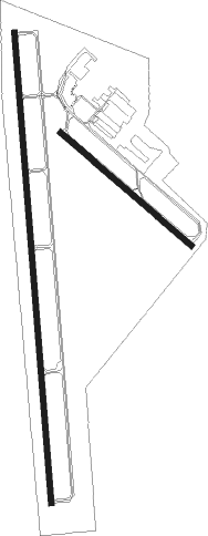
Runway info
Runway 17 / 35  | ||
| length | 2631m (8632ft) | |
| bearing | 180° / 0° | |
| width | 30m (100ft) | |
| surface | concrete | |
| displ threshold | 187m (614ft) / 0m (0ft) | |
| blast zone | 47m (154ft) / 0m (0ft) | |
| Runway 13 / 31 | ||
| length | 960m (3150ft) | |
| bearing | 129° / 309° | |
| width | 34m (110ft) | |
| surface | asphalt | |
| displ threshold | 34m (112ft) / 0m (0ft) | |
Nearby beacons
| code | identifier | dist | bearing | frequency |
|---|---|---|---|---|
| ODG | WOODRING (ENID) VOR/DME | 0.1 | 149° | 109 |
| EI | GARFY (ENID) NDB | 6 | 181° | 341 |
| END | VANCE (ENID) VORTAC | 6.5 | 256° | 115.40 |
| SW | BLAKI (STILLWATER) NDB | 35 | 101° | 255 |
| SWO | STILLWATER VOR/DME | 35.4 | 102° | 108.40 |
| IFI | KINGFISHER VORTAC | 35.8 | 201° | 114.70 |
| PER | PIONEER (PONCA CITY) VORTAC | 37.6 | 60° | 113.20 |
| PN | PONCA (PONCA CITY) NDB | 42.7 | 57° | 515 |
| ANY | ANTHONY TACAN | 50.4 | 334° | 112.90 |
| PWA | WILEY POST (OKLAHOMA CITY VOR/DME | 51 | 170° | 113.40 |
| TIK | TINKER (OKLAHOMA CITY) TACAN | 59.8 | 156° | 115.80 |
Instrument approach procedures
| runway | airway (heading) | route (dist, bearing) |
|---|---|---|
| RW17 | HUDCU (163°) | HUDCU NIDME (12mi, 147°) 3000ft |
| RW17 | NIDME (180°) | NIDME 3000ft |
| RW17 | PER (240°) | PER EDEWO (23mi, 254°) 3200ft NIDME (9mi, 254°) 3000ft |
| RNAV | NIDME 3000ft OYIKI (6mi, 180°) 2800ft RIVDE (3mi, 180°) 1820ft KWDG (2mi, 178°) 1215ft (5781mi, 110°) 1415ft KJACK (5783mi, 290°) 3600ft KJACK (turn) | |
| RW35 | PENYN (14°) | PENYN KJACK (10mi, 35°) 3600ft |
| RW35 | PER (240°) | PER KJACK (49mi, 225°) 3600ft KJACK (turn) 3600ft |
| RW35 | WENDY (332°) | WENDY KJACK (16mi, 307°) 3600ft |
| RNAV | KJACK 3600ft JUPMI (9mi, 0°) 3100ft KWDG (7mi, 1°) 1197ft (5781mi, 110°) 1347ft NIDME (5781mi, 291°) 3000ft NIDME (turn) |
Disclaimer
The information on this website is not for real aviation. Use this data with the X-Plane flight simulator only! Data taken with kind consent from X-Plane 12 source code and data files. Content is subject to change without notice.