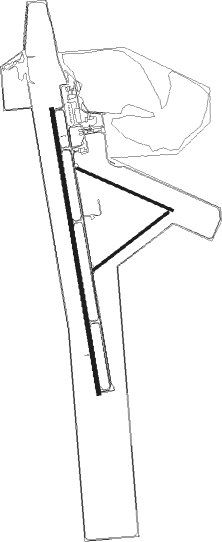
Worland - Worland Muni
Airport details
| Country | United States of America |
| State | Wyoming |
| Region | K1 |
| Airspace | Salt Lake City Ctr |
| Municipality | Worland |
| Elevation | 4227ft (1288m) |
| Timezone | GMT -7 |
| Coordinates | 43.96289, -107.95053 |
| Magnetic var | |
| Type | land |
| Available since | X-Plane v10.40 |
| ICAO code | KWRL |
| IATA code | WRL |
| FAA code | WRL |
Communication
| Worland Muni ASOS | 135.475 |
| Worland Muni CTAF/UNICOM | 123.050 |
Nearby Points of Interest:
Kirby Jail and Town Hall
-Downtown Thermopolis Historic District
-CQA Four Mile Bridge
-EFP Bridge over Owl Creek
Nearby beacons
| code | identifier | dist | bearing | frequency |
|---|---|---|---|---|
| RLY | WORLAND VOR/DME | 0 | 346° | 114.80 |
| GEY | GREYBULL NDB | 33.4 | 346° | 275 |
| BOY | BOYSEN RESERVOIR VOR/DME | 33.6 | 215° | 117.80 |
| RIW | RIVERTON VOR/DME | 58.1 | 209° | 114.05 |
| HCY | COWLEY NDB | 60.9 | 333° | 257 |
| POY | POWELL NDB | 65 | 317° | 344 |
| SHR | SHERIDAN VOR/DME | 65.1 | 45° | 115.30 |
Instrument approach procedures
| runway | airway (heading) | route (dist, bearing) |
|---|---|---|
| RW16 | CRANY (123°) | CRANY COVGO (20mi, 104°) 7500ft |
| RW16 | RLY (166°) | RLY COVGO (11mi, 353°) 7500ft COVGO (turn) 7500ft |
| RNAV | COVGO 7500ft PEYIP (6mi, 173°) 5800ft PITOY (2mi, 173°) 5040ft KWRL (3mi, 171°) 4229ft (6175mi, 112°) 4424ft WAPSU (6176mi, 292°) ZURNA (14mi, 229°) 9600ft ZURNA (turn) | |
| RW34 | JITIP (297°) | JITIP WUKUX (14mi, 278°) 9600ft HOLUT (11mi, 282°) 7000ft |
| RW34 | ZURNA (35°) | ZURNA HOLUT (11mi, 71°) 7000ft |
| RNAV | HOLUT 7000ft JUNIV (4mi, 353°) 6700ft WAPSU (2mi, 353°) 6000ft IKAME (3mi, 353°) 5000ft KWRL (3mi, 356°) 4292ft (6175mi, 112°) 4652ft PEYIP (6174mi, 292°) CRANY (23mi, 295°) 8500ft CRANY (turn) |
Disclaimer
The information on this website is not for real aviation. Use this data with the X-Plane flight simulator only! Data taken with kind consent from X-Plane 12 source code and data files. Content is subject to change without notice.

