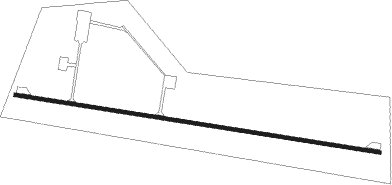
White Sands - Condron Aaf
Airport details
| Country | United States of America |
| State | New Mexico |
| Region | K2 |
| Airspace | Albuquerque Ctr |
| Municipality | Doña Ana County |
| Elevation | 3934ft (1199m) |
| Timezone | GMT -7 |
| Coordinates | 32.34148, -106.40277 |
| Magnetic var | |
| Type | land |
| Available since | X-Plane v10.40 |
| ICAO code | KWSD |
| IATA code | WSD |
| FAA code | WSD |
Communication
Nearby Points of Interest:
White Sands V-2 Launching Site
-Foster Hall
-Goddard Hall
-Nason House
-Hadley-Ludwick House
-Mesilla Park Elementary School
-Thomas Branigan Memorial Library
-Rio Grande Theatre
-Mesilla Park Historic District
-Alameda-Depot Historic District
-Frank and Amelia Jones House
-Mesilla Plaza
-Dona Ana Village Historic District
-Rio Grande Bridge at Radium Springs
-O. T. Bassett Tower
-White Sands National Park Historic District
-Hueco Tanks
-Fort Bliss Main Post Historic District
Nearby beacons
| code | identifier | dist | bearing | frequency |
|---|---|---|---|---|
| EWM | NEWMAN VORTAC | 24.3 | 162° | 112.40 |
| EL | VALTR (EL PASO) NDB | 29.2 | 170° | 242 |
| ELP | EL PASO VORTAC | 32.1 | 167° | 115.20 |
| HMN | HOLLOMAN (ALAMOGORDO) TACAN | 34.6 | 29° | 114.50 |
| BWS | (ALAMOGORDO) DME | 34.9 | 39° | 109.60 |
| CJS | JUAREZ (CIUDAD JUAREZ) VOR/DME | 42.3 | 182° | 116.70 |
| TCS | TRUTH OR CONSEQUENCES VORTAC | 71.8 | 317° | 112.70 |
Disclaimer
The information on this website is not for real aviation. Use this data with the X-Plane flight simulator only! Data taken with kind consent from X-Plane 12 source code and data files. Content is subject to change without notice.
