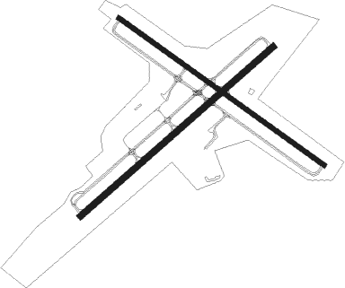
Westerly - Westerly State
Airport details
| Country | United States of America |
| State | Rhode Island |
| Region | K6 |
| Airspace | Boston Ctr |
| Municipality | Westerly |
| Elevation | 81ft (25m) |
| Timezone | GMT -5 |
| Coordinates | 41.34721, -71.80418 |
| Magnetic var | |
| Type | land |
| Available since | X-Plane v10.40 |
| ICAO code | KWST |
| IATA code | WST |
| FAA code | WST |
Communication
| Westerly State ASOS | 132.375 |
| Westerly State CTAF/UNICOM | 123.000 |
| Westerly State PROVIDENCE Approach/Departure | 119.450 |
Approach frequencies
| LOC | RW07 | 108.9 | 18.00mi |
Nearby Points of Interest:
Perry Homestead Historic District
-Main Street Historic District
-United States Post Office
-Robert Stanton House
-North End Historic District
-Lewis-Card-Perry House
-Flying Horse Carousel
-Babcock House
-Joseph Stanton House
-Stonington High School
-John Palmer House
-Capt. Nathaniel B. Palmer House
-James Merrill House
-John Randall House
-Pequotsepos Manor
-Hopkinton City Historic District
-Whitehall Mansion
-Samuel Miner House
-District Schoolhouse No. 2
-Sabino
-Mystic Bank
-Pequot Fort
-Joseph Jeffrey House
-Edward Yeomans House
-Shubel Smith House

Nearby beacons
| code | identifier | dist | bearing | frequency |
|---|---|---|---|---|
| GON | GROTON VOR/DME | 11.2 | 266° | 110.85 |
| SEY | SANDY POINT (BLOCK ISLAND VOR/DME | 14.9 | 128° | 117.80 |
| ORW | NORWICH VOR/DME | 15.3 | 317° | 110 |
| PVD | PROVIDENCE VOR/DME | 28.2 | 45° | 115.60 |
| HTO | HAMPTON (EAST HAMPTON) VORTAC | 34.6 | 230° | 113.60 |
| PUT | PUTNAM VOR/DME | 36.5 | 356° | 117.40 |
| HFD | HARTFORD VOR/DME | 37.8 | 292° | 114.90 |
| MAD | MADISON VOR/DME | 40 | 268° | 110.40 |
| FOK | SUFFOLK CO (WESTHAMPTON B TACAN | 48.3 | 238° | 111 |
| CCC | CALVERTON VOR/DME | 51.5 | 247° | 117.20 |
| OW | STOGE (NORWOOD) NDB | 55.4 | 41° | 397 |
| CEF | WESTOVER(SPRINGFIELD/CHIC TACAN | 60.4 | 320° | 114 |
| BAF | BARNES (WESTFIELD/SPRINGF VORTAC | 63.7 | 312° | 113 |
Instrument approach procedures
| runway | airway (heading) | route (dist, bearing) |
|---|---|---|
| RW07 | BOROS (62°) | BOROS DELCI (8mi, 64°) 3000ft |
| RW07 | GARRD (53°) | GARRD DELCI (5mi, 32°) 3000ft |
| RW07 | GON (86°) | GON DELCI (6mi, 157°) 3000ft DELCI (turn) 3000ft |
| RW07 | KURTY (90°) | KURTY DELCI (14mi, 114°) 3000ft |
| RW07 | SEY (308°) | SEY DELCI (20mi, 278°) 3000ft DELCI (turn) 3000ft |
| RNAV | DELCI 3000ft TRAIT (5mi, 60°) 2000ft KWST (6mi, 61°) 103ft (4591mi, 120°) 481ft LAFAY (4589mi, 300°) 2100ft LAFAY (turn) |
Disclaimer
The information on this website is not for real aviation. Use this data with the X-Plane flight simulator only! Data taken with kind consent from X-Plane 12 source code and data files. Content is subject to change without notice.