Watsonville - Watsonville Muni
Airport details
| Country | United States of America |
| State | California |
| Region | K2 |
| Airspace | Oakland Ctr |
| Municipality | Watsonville |
| Elevation | 163ft (50m) |
| Timezone | GMT -8 |
| Coordinates | 36.93572, -121.78964 |
| Magnetic var | |
| Type | land |
| Available since | X-Plane v10.40 |
| ICAO code | KWVI |
| IATA code | WVI |
| FAA code | WVI |
Communication
| Watsonville Muni ASOS | 132.275 |
| Watsonville Muni CTAF/UNICOM | 122.800 |
| Watsonville Muni NORCAL Approach/Departure | 127.150 |
| Watsonville Muni NORCAL Approach/Departure | 133.000 |
Approach frequencies
| LOC | RW02 | 108.3 | 18.00mi |
Nearby Points of Interest:
Castro Adobe
-Godfrey M. Bockius House
-California State Route 152
-Redman Hirahara Farmstead
-Porter-Vallejo Mansion
-Frank Norris Cabin
-Elkhorn Slough
-Venetian Court
-Glen Canyon Covered Bridge
-Santa Cruz Looff Carousel and Roller Coaster
-Branciforte Adobe
-Gilroy Free Library
-Edgar Holloway House
-Octagon Building
-Cowell Lime Works
-Rozas House
-New Almaden
-Felton Presbyterian Church
-Peter J. Bontadelli House
-Fort Ord Station Veterinary Hospital
-B. V. Sargent House
-Monterey County Jail
-Monterey County Court House
-Samuel M. Black House
-Yung See San Fong House
Runway info
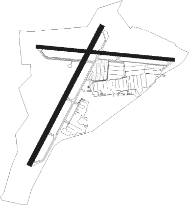
Runway 2 / 20  | ||
| length | 1369m (4491ft) | |
| bearing | 38° / 218° | |
| width | 46m (151ft) | |
| surface | asphalt | |
| displ threshold | 0m (0ft) / 183m (600ft) | |
| blast zone | 12m (39ft) / 0m (0ft) | |
| Runway 9 / 27 | ||
| length | 1217m (3993ft) | |
| bearing | 98° / 278° | |
| width | 30m (98ft) | |
| surface | asphalt | |
| blast zone | 2m (7ft) / 0m (0ft) | |
Nearby beacons
| code | identifier | dist | bearing | frequency |
|---|---|---|---|---|
| SNS | SALINAS VORTAC | 18.6 | 146° | 117.30 |
| MR | MUNSO (MONTEREY) NDB | 20.2 | 205° | 385 |
| SJC | SAN JOSE VOR/DME | 27.3 | 341° | 114.10 |
| UAD | CHUALAR (SALINAS) NDB | 30.7 | 145° | 263 |
| NUQ | MOFFETT (MOUNTAIN VIEW) TACAN | 32.4 | 332° | 117.60 |
| OSI | WOODSIDE VOR/DME | 36.1 | 313° | 113.90 |
| LV | REIGA (LIVERMORE) NDB | 45.7 | 8° | 374 |
| BSR | BIG SUR VORTAC | 45.8 | 169° | 114 |
| SFO | SAN FRANCISCO VOR/DME | 49.6 | 319° | 115.80 |
| OAK | OAKLAND VOR/DME | 51.7 | 331° | 116.80 |
| MOD | MODESTO VOR/DME | 57.4 | 50° | 114.60 |
| HGT | HUNTER LIGGETT NDB | 65.3 | 148° | 209 |
| SAU | SAUSALITO VOR/DME | 65.3 | 321° | 116.20 |
Departure and arrival routes
| Transition altitude | 18000ft |
| Transition level | 18000ft |
| SID end points | distance | outbound heading | |
|---|---|---|---|
| RW02 | |||
| WVI4 | 19mi | 146° | |
| RW09 | |||
| GARLK1 | 37mi | 140° | |
| WVI4 | 19mi | 146° | |
| RW20 | |||
| GARLK1 | 37mi | 140° | |
| WVI4 | 19mi | 146° | |
Instrument approach procedures
| runway | airway (heading) | route (dist, bearing) |
|---|---|---|
| RW02 | SANTY (99°) | SANTY LEPWU (10mi, 175°) 4000ft IFAFY (7mi, 117°) 3000ft |
| RW02 | SNS (326°) | SNS RISPE (11mi, 276°) 4000ft IFAFY (7mi, 297°) 3000ft |
| RNAV | IFAFY 3000ft FOXOV (7mi, 38°) 2000ft KWVI (6mi, 39°) 195ft (6901mi, 107°) 700ft SHOEY (6920mi, 287°) 6000ft SHOEY (turn) 6000ft |
Disclaimer
The information on this website is not for real aviation. Use this data with the X-Plane flight simulator only! Data taken with kind consent from X-Plane 12 source code and data files. Content is subject to change without notice.