Wildwood - Cape May County
Airport details
| Country | United States of America |
| State | New Jersey |
| Region | K6 |
| Airspace | Washington Ctr |
| Municipality | Lower Township |
| Elevation | 20ft (6m) |
| Timezone | GMT -5 |
| Coordinates | 39.00850, -74.90858 |
| Magnetic var | |
| Type | land |
| Available since | X-Plane v10.40 |
| ICAO code | KWWD |
| IATA code | WWD |
| FAA code | WWD |
Communication
| Cape May County AWOS 3 | 118.275 |
| Cape May County CTAF/UNICOM | 122.700 |
| Cape May County Approach/Departure | 124.600 |
Approach frequencies
| LOC | RW19 | 108.9 | 18.00mi |
Nearby Points of Interest:
TBM-3E "Avenger" Torpedo Bomber Warplane
-Fishing Creek Schoolhouse
-Octagonal Poultry House
-George Hildreth House
-Rio Grande Station
-Owen Coachman House
-Cape May Historic District
-Whilldin-Miller House
-Marine National Bank
-J. Thompson Baker House
-Jonathan Pyne House
-Old Cape May County Courthouse Building
-John Holmes House
-Thomas Beesley Jr. House
-New Asbury Methodist Episcopal Meetinghouse
-Thomas Leaming House
-Thomas Ludlam Jr. House
-Joseph Falkinburg House
-Avalon Life Saving Station
-Henry Ludlam House
-William S. Townsend House
-Calvary Baptist Church
-Delaware Bay
-Woodbine Brotherhood Synagogue
-Reeves-Iszard-Godfey House
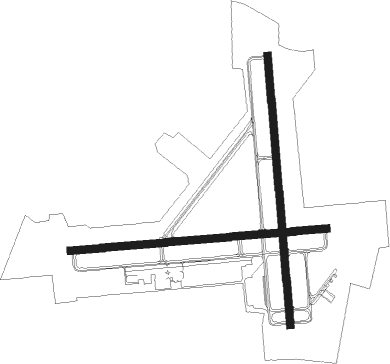
Runway info
Runway 1 / 19  | ||
| length | 1605m (5266ft) | |
| bearing | 360° / 180° | |
| width | 46m (151ft) | |
| surface | asphalt | |
| displ threshold | 0m (0ft) / 66m (217ft) | |
| Runway 10 / 28 | ||
| length | 1525m (5003ft) | |
| bearing | 90° / 270° | |
| width | 46m (150ft) | |
| surface | asphalt | |
Nearby beacons
| code | identifier | dist | bearing | frequency |
|---|---|---|---|---|
| SIE | SEA ISLE VORTAC | 7.2 | 51° | 114.80 |
| ATR | WATERLOO VOR/DME | 18.5 | 237° | 112.60 |
| RNB | RAINBOW (MILLVILLE) NDB | 26.7 | 331° | 363 |
| DOV | DOVER TACAN | 27 | 283° | 110 |
| ACY | ATLANTIC CITY VORTAC | 30.9 | 37° | 108.60 |
| ENO | SMYRNA (KENTON) VORTAC | 31.3 | 290° | 111.40 |
| VCN | CEDAR LAKE (MILLVILLE) VOR/DME | 31.8 | 354° | 115.20 |
| OX | LANDY (OCEAN CITY) NDB | 41 | 204° | 407 |
| OOD | WOODSTOWN VORTAC | 41.9 | 328° | 112.80 |
| IL | HADIN (WILMINGTON) NDB | 47.5 | 309° | 248 |
| SBY | SALISBURY VORTAC | 48.8 | 222° | 111.20 |
| DQO | DUPONT (WILMINGTON) VORTAC | 51.6 | 314° | 114 |
| CYN | COYLE VORTAC | 53.3 | 31° | 113.40 |
| SWL | SNOW HILL VORTAC | 62.8 | 210° | 112.40 |
| MXE | MODENA VORTAC | 65 | 320° | 113.20 |
Instrument approach procedures
| runway | airway (heading) | route (dist, bearing) |
|---|---|---|
| RW01 | RADDS (27°) | RADDS SPRUE (14mi, 45°) 2500ft |
| RNAV | SPRUE 2500ft ENOWS (5mi, 360°) 1700ft JINIR (4mi, 360°) 540ft KWWD (2mi, 354°) 62ft (4704mi, 118°) 422ft ATR (4716mi, 297°) 3000ft ATR (turn) | |
| RW10 | ATR (57°) | ATR UHULU (12mi, 15°) 2500ft |
| RW10 | GROUT (91°) | GROUT UHULU (12mi, 93°) 2500ft |
| RNAV | UHULU 2500ft UHOZO (6mi, 90°) 1700ft KWWD (6mi, 89°) 72ft (4704mi, 118°) 500ft SIE (4700mi, 298°) 2000ft SIE (turn) | |
| RW19 | ACY (217°) | ACY KAGYS (21mi, 234°) 2500ft |
| RW19 | ENO (110°) | ENO KAGYS (28mi, 92°) 2500ft |
| RW19 | KAGYS (180°) | KAGYS 2500ft |
| RW19 | VCN (174°) | VCN KAGYS (20mi, 170°) 2500ft |
| RNAV | KAGYS 2500ft KIMBA (7mi, 179°) 1700ft ZULTA (4mi, 180°) 560ft KWWD (2mi, 184°) 55ft (4704mi, 118°) 269ft SEWEL (4703mi, 297°) 2500ft SEWEL (turn) | |
| RW28 | ATR (57°) | ATR OGHAM (27mi, 69°) 2500ft OGHAM (turn) 2500ft |
| RNAV | OGHAM 2500ft TOVIE (5mi, 270°) 1700ft KWWD (5mi, 270°) 76ft (4704mi, 118°) 422ft ATR (4716mi, 297°) 2500ft ATR (turn) |
Disclaimer
The information on this website is not for real aviation. Use this data with the X-Plane flight simulator only! Data taken with kind consent from X-Plane 12 source code and data files. Content is subject to change without notice.