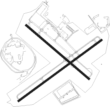
Allentown - Allentown Queen City Muni
Airport details
| Country | United States of America |
| State | Pennsylvania |
| Region | K6 |
| Airspace | New York Ctr |
| Municipality | Allentown |
| Elevation | 396ft (121m) |
| Timezone | GMT -5 |
| Coordinates | 40.57478, -75.48937 |
| Magnetic var | |
| Type | land |
| Available since | X-Plane v10.30 |
| ICAO code | KXLL |
| IATA code | n/a |
| FAA code | XLL |
Communication
| Allentown Queen City Muni CTAF/UNICOM | 122.700 |
| Allentown Queen City Muni Approach/Departure | 118.200 |
| Allentown Queen City Muni Approach/Departure | 119.650 |
| Allentown Queen City Muni Approach/Departure | 124.450 |
Nearby Points of Interest:
Allentown Masonic Temple
-Dorneyville Crossroad Settlement
-Albertus L. Meyers Bridge
-Kemmerer House
-Gauff-Roth House
-Dime Savings and Trust Company
-Zollinger-Harned Company Building
-Rodale Organic Gardening Experimental Farm
-Allentown National Bank
-Old Lehigh County Courthouse
-Haines Mill
-Jacob Jr. Ehrenhardt House
-Neuweiler Brewery
-Shelter House
-Helfrich's Springs Grist Mill
-Dent Hardware Company Factory Complex
-Biery's Port Historic District
-Lehigh Valley Silk Mills
-Valentine Weaver House
-Coopersburg Historic District
-Catasauqua Residential Historic District
-Fountain Hill Historic District
-Centennial Bridge
-Lehigh Valley Railroad Headquarters Building
-Bethlehem Armory

Nearby beacons
| code | identifier | dist | bearing | frequency |
|---|---|---|---|---|
| ETX | EAST TEXAS VOR/DME | 8.8 | 272° | 110.20 |
| FJC | ALLENTOWN VORTAC | 9.2 | 13° | 117.50 |
| PTW | POTTSTOWN VORTAC | 21.4 | 191° | 116.50 |
| ING | AMBLER NDB | 28.5 | 156° | 275 |
| ARD | YARDLEY VOR/DME | 32.8 | 119° | 108.20 |
| BWZ | BROADWAY (SCHOOLEY'S MT) VOR/DME | 33.2 | 71° | 114.20 |
| SBJ | SOLBERG VOR/DME | 34.1 | 89° | 112.90 |
| STW | STILLWATER VOR/DME | 37.8 | 56° | 109.60 |
| MXE | MODENA VORTAC | 40.3 | 195° | 113.20 |
| LVZ | WILKES-BARRE VORTAC | 42.8 | 344° | 111.60 |
| LRP | LANCASTER VOR/DME | 45.7 | 240° | 117.30 |
| RBV | ROBBINSVILLE VORTAC | 50.6 | 111° | 113.80 |
| SAX | SPARTA VORTAC | 52.3 | 63° | 115.70 |
| GXU | MC GUIRE (WRIGHTSTOWN) VORTAC | 53.1 | 122° | 110.60 |
| DQO | DUPONT (WILMINGTON) VORTAC | 54.1 | 187° | 114 |
| OOD | WOODSTOWN VORTAC | 57 | 169° | 112.80 |
| IL | HADIN (WILMINGTON) NDB | 59.9 | 187° | 248 |
| HUO | HUGUENOT VOR/DME | 64.5 | 47° | 116.10 |
Instrument approach procedures
| runway | airway (heading) | route (dist, bearing) |
|---|---|---|
| RW07 | FLOAT (70°) | FLOAT DOSTR (8mi, 79°) 3000ft |
| RW07 | KATVE (50°) | KATVE DOSTR (4mi, 345°) 3000ft |
| RW07 | PINNA (96°) | PINNA DOSTR (10mi, 141°) 3000ft DOSTR (turn) 3000ft |
| RNAV | DOSTR 3000ft YEZJO (6mi, 65°) 2300ft CADAX (2mi, 65°) 1700ft KXLL (4mi, 61°) 427ft (4746mi, 118°) 940ft DOSTR (4755mi, 298°) 3000ft DOSTR (turn) |
Disclaimer
The information on this website is not for real aviation. Use this data with the X-Plane flight simulator only! Data taken with kind consent from X-Plane 12 source code and data files. Content is subject to change without notice.