Williston - Williston Basin Intl.
Airport details
| Country | United States of America |
| State | North Dakota |
| Region | |
| Airspace | Salt Lake City Ctr |
| Municipality | Williams County |
| Elevation | 2353ft (717m) |
| Timezone | GMT -6 |
| Coordinates | 48.25422, -103.75689 |
| Magnetic var | |
| Type | land |
| Available since | X-Plane v10.40 |
| ICAO code | KXWA |
| IATA code | n/a |
| FAA code | XWA |
Communication
| Williston Basin Intl. Williston ASOS | 125.925 |
| Williston Basin Intl. Williston CTAF | 122.800 |
Approach frequencies
| ILS-cat-I | RW32 | 109.1 | 18.00mi |
| 3° GS | RW32 | 109.1 | 18.00mi |
Nearby Points of Interest:
James Memorial Library
-Old U.S. Post Office
-Old Armory
-Ray Opera House
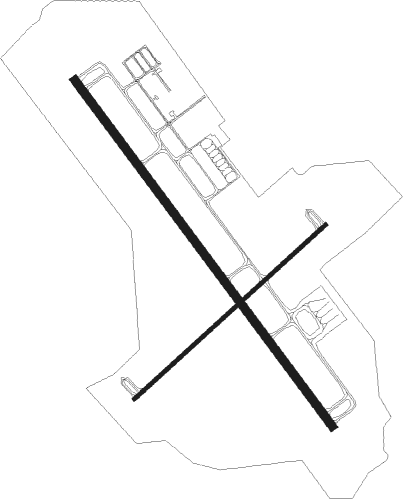
Runway info
Runway 4 / 22  | ||
| length | 1369m (4491ft) | |
| bearing | 63° / 243° | |
| width | 22m (72ft) | |
| surface | concrete | |
| Runway 14 / 32 | ||
| length | 2282m (7487ft) | |
| bearing | 137° / 317° | |
| width | 46m (150ft) | |
| surface | concrete | |
| blast zone | 61m (200ft) / 61m (200ft) | |
Nearby beacons
| code | identifier | dist | bearing | frequency |
|---|---|---|---|---|
| ISN | WILLISTON VOR/DME | 0.2 | 97° | 116.30 |
Departure and arrival routes
| Transition altitude | 18000ft |
| Transition level | 18000ft |
| SID end points | distance | outbound heading | |
|---|---|---|---|
| RW04 | |||
| ISN6 | 20mi | 265° | |
| RW14 | |||
| ISN6 | 20mi | 265° | |
| RW22 | |||
| ISN6 | 20mi | 265° | |
| RW32 | |||
| ISN6 | 20mi | 265° | |
Instrument approach procedures
| runway | airway (heading) | route (dist, bearing) |
|---|---|---|
| RW04 | PACIL (63°) | PACIL 4300ft |
| RNAV | PACIL 4300ft MABBI (9mi, 63°) 3700ft BALYN (2mi, 63°) 3060ft KXWA (2mi, 63°) 2396ft (5952mi, 115°) 2556ft QASSY (5940mi, 295°) 4300ft QASSY (turn) | |
| RW14 | JOSVA (139°) | JOSVA 4300ft |
| RNAV | JOSVA 4300ft ZERAG (6mi, 136°) 3700ft TUNOE (2mi, 137°) 3060ft KXWA (3mi, 145°) 2353ft (5952mi, 115°) 2516ft VUYUC (5948mi, 295°) 4300ft VUYUC (turn) | |
| RW22 | QASSY (243°) | QASSY 4300ft |
| RNAV | QASSY 4300ft MAAXX (9mi, 243°) 3700ft NECKS (2mi, 243°) 3020ft KXWA (3mi, 243°) 2358ft (5952mi, 115°) 2544ft PACIL (5964mi, 295°) 4300ft PACIL (turn) | |
| RW32 | VUYUC (314°) | VUYUC 4300ft |
| RNAV | VUYUC 4300ft FAVPA (6mi, 317°) 3700ft KXWA (4mi, 311°) 2400ft (5952mi, 115°) 2550ft JOSVA (5956mi, 295°) 4300ft JOSVA (turn) |
Disclaimer
The information on this website is not for real aviation. Use this data with the X-Plane flight simulator only! Data taken with kind consent from X-Plane 12 source code and data files. Content is subject to change without notice.