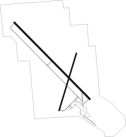
Yankton - Chan Gurney Municipal
Airport details
| Country | United States of America |
| State | South Dakota |
| Region | K3 |
| Airspace | Minneapolis Ctr |
| Municipality | Yankton |
| Elevation | 1306ft (398m) |
| Timezone | GMT -6 |
| Coordinates | 42.91669, -97.38595 |
| Magnetic var | |
| Type | land |
| Available since | X-Plane v10.40 |
| ICAO code | KYKN |
| IATA code | YKN |
| FAA code | YKN |
Communication
| Chan Gurney Municipal AWOS-3PT | 119.050 |
| Chan Gurney Municipal CTAF/UNICOM | 122.800 |
| Chan Gurney Municipal MINNEAPOLIS ApproachROACH | 128.000 |
| Chan Gurney Municipal MINNEAPOLIS DepartureARTURE | 128.000 |
Approach frequencies
| ILS-cat-I | RW31 | 109.5 | 18.00mi |
| 3° GS | RW31 | 109.5 | 18.00mi |
Nearby Points of Interest:
Human Services Center
-Yankton College
-Chicago, Milwaukee and St. Paul Depot
-Dr. B.M. Banton House
-Governor John L. Pennington House
-Harold A. (H.A.) Doyle House
-Dr. John Trierweiler House
-Van Osdel House
-United Church of Christ
-Utica Fire and City Hall
-DeJong House
-St. Agnes Church
-Volin Town Hall
-William Andre House
-Mathias Merkwan Rubblestone Barn
-Old St. Wenceslaus Catholic Parish House
-Argo Hotel
-St. Wenceslaus Catholic Church and Parish House
-Aggergaard Manor
-Saints Philip and James Parochial School
-John Frydrych Farmstead
-Hartington Hotel
-Hartington City Hall and Auditorium
-Cedar County Courthouse
-Methodist Episcopal Church
Nearby beacons
| code | identifier | dist | bearing | frequency |
|---|---|---|---|---|
| YKN | YANKTON VOR/DME | 0.1 | 30° | 111.40 |
| YK | CAGUR (YANKTON) NDB | 5.7 | 131° | 347 |
| AGZ | WAGNER NDB | 40.8 | 279° | 392 |
| FS | ROKKY (SIOUX FALLS) NDB | 42.3 | 44° | 245 |
| OI | TOMMI (SIOUX CITY) NDB | 49.1 | 116° | 305 |
| FSD | SIOUX FALLS VORTAC | 51.3 | 40° | 115 |
| OFK | NORFOLK VOR/DME | 55.8 | 183° | 109.60 |
| MHE | MITCHELL VOR/DME | 58.9 | 323° | 109.20 |
Instrument approach procedures
| runway | airway (heading) | route (dist, bearing) |
|---|---|---|
| RW13 | PUKIC (143°) | PUKIC TUYBO (6mi, 174°) 4000ft |
| RW13 | TYNDA (102°) | TYNDA ZODAP (6mi, 95°) 4000ft TUYBO (7mi, 59°) 4000ft |
| RW13 | YKN (210°) | YKN TUYBO (12mi, 310°) 4000ft TUYBO (turn) 4000ft |
| RNAV | TUYBO 4000ft YOTUS (6mi, 131°) 3100ft BACUS (3mi, 131°) 2140ft KYKN (3mi, 131°) 1351ft (5730mi, 114°) 1556ft KUYEP (5728mi, 294°) ZUSBU (7mi, 111°) 4000ft ZUSBU (turn) 4000ft | |
| RW31 | HARDS (3°) | HARDS HUGAT (14mi, 50°) 3500ft |
| RW31 | OBERT (298°) | OBERT HUGAT (9mi, 280°) 3500ft |
| RW31 | YKN (210°) | YKN HUGAT (13mi, 131°) 3500ft HUGAT (turn) 3500ft |
| RNAV | HUGAT 3500ft WINEL (7mi, 311°) 3100ft ZIMUK (3mi, 311°) 2100ft KYKN (3mi, 311°) 1322ft (5730mi, 114°) 1485ft YOTUS (5733mi, 294°) 3500ft YOTUS (turn) 3500ft |
Disclaimer
The information on this website is not for real aviation. Use this data with the X-Plane flight simulator only! Data taken with kind consent from X-Plane 12 source code and data files. Content is subject to change without notice.

