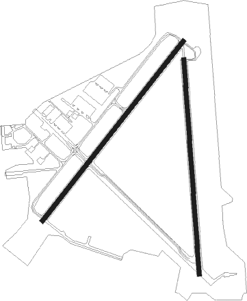
Zephyrhills - Zephyrhills Muni
Airport details
| Country | United States of America |
| State | Florida |
| Region | K7 |
| Airspace | Jacksonville Ctr |
| Municipality | Zephyrhills |
| Elevation | 85ft (26m) |
| Timezone | GMT -5 |
| Coordinates | 28.22799, -82.15600 |
| Magnetic var | |
| Type | land |
| Available since | X-Plane v10.40 |
| ICAO code | KZPH |
| IATA code | ZPH |
| FAA code | ZPH |
Communication
| Zephyrhills Muni ASOS | 118.975 |
| Zephyrhills Muni CTAF/UNICOM | 123.075 |
| Zephyrhills Muni TAMPA Approach/Departure | 119.900 |
Nearby Points of Interest:
Capt. Howard B. Jeffries House
-Zephyrhills Downtown Historic District
-Dade City Atlantic Coast Line Railroad Depot
-Church Street Historic District
-Pasco County Courthouse
-Standard Oil Service Station
-North Plant City Residential District
-Downtown Plant City Historic Residential District
-Plant City High School
-Bing Rooming House
-Old Lakeland High School
-Lake Hunter Terrace Historic District
-Polk Theatre
-Oates Building
-Frances Langford Promenade
-Dixieland Historic District
-East Lake Morton Residential District
-Biltmore-Cumberland Historic District
-South Lake Morton Historic District
-Beacon Hill-Alta Vista Residential District
-Child of the Sun
-Temple Terrace Golf and Country Club
-Spring Lake Community Center
-Withlacoochee State Trail
-Horace T. Robles House

Nearby beacons
| code | identifier | dist | bearing | frequency |
|---|---|---|---|---|
| LAL | LAKELAND VORTAC | 16.3 | 150° | 116 |
| TP | COSME (TAMPA) NDB | 21.3 | 249° | 368 |
| MCF | MACDILL (TAMPA) TACAN | 29 | 224° | 111 |
| PI | CAPOK(ST PETERSBURG-CLEARWATER NDB | 32.2 | 247° | 360 |
| PIE | SAINT PETERSBURG VORTAC | 33.9 | 239° | 116.40 |
| OR | HERNY (ORLANDO) NDB | 41.6 | 69° | 221 |
| ORL | ORLANDO VORTAC | 47.3 | 69° | 112.20 |
| SRQ | SARASOTA VOR/DME | 53.8 | 206° | 117 |
| OCF | OCALA VORTAC | 57.1 | 356° | 113.70 |
Instrument approach procedures
| runway | airway (heading) | route (dist, bearing) |
|---|---|---|
| RW01 | ELIJE (30°) | ELIJE UFSOP (6mi, 90°) 2000ft |
| RW01 | ICZOR (329°) | ICZOR UFSOP (6mi, 270°) 2000ft |
| RW01 | UFSOP (360°) | UFSOP 2000ft |
| RNAV | UFSOP 2000ft ERKAF (6mi, 0°) 1700ft DATRY (2mi, 0°) 940ft KZPH (3mi, 357°) 120ft (4990mi, 109°) 337ft IXROV (4991mi, 289°) 2000ft IXROV (turn) | |
| RW05 | BRUNT (47°) | BRUNT 2000ft |
| RW05 | CANSA (71°) | CANSA BRUNT (5mi, 129°) 2000ft |
| RW05 | DARPE (20°) | DARPE BRUNT (5mi, 309°) 2000ft |
| RNAV | BRUNT 2000ft AIMER (5mi, 46°) 1700ft KZPH (5mi, 48°) 140ft (4990mi, 109°) 373ft FIFES (4984mi, 289°) 2000ft FIFES (turn) | |
| RW19 | IXROV (181°) | IXROV 2000ft |
| RW19 | OZGUB (150°) | OZGUB IXROV (6mi, 90°) 2000ft |
| RW19 | UTAWI (212°) | UTAWI IXROV (6mi, 270°) 2000ft |
| RNAV | IXROV 2000ft WOVLU (6mi, 180°) 1700ft JEGPI (3mi, 180°) 860ft KZPH (3mi, 184°) 129ft (4990mi, 109°) 340ft UFSOP (4990mi, 289°) 2000ft UFSOP (turn) | |
| RW23 | FIFES (225°) | FIFES 2000ft |
| RW23 | GLUEY (252°) | GLUEY 2000ft FIFES (6mi, 309°) 2000ft |
| RW23 | HAWKX (196°) | HAWKX 2000ft FIFES (6mi, 129°) 2000ft |
| RNAV | FIFES 2000ft ELOME (5mi, 226°) 1700ft KZPH (5mi, 225°) 141ft (4990mi, 109°) 377ft BRUNT (4997mi, 289°) 2000ft BRUNT (turn) |
Disclaimer
The information on this website is not for real aviation. Use this data with the X-Plane flight simulator only! Data taken with kind consent from X-Plane 12 source code and data files. Content is subject to change without notice.