Rosamond - Rosamond Skypark
Airport details
| Country | United States of America |
| State | California |
| Region | K2 |
| Airspace | Los Angeles Ctr |
| Municipality | Rosamond |
| Elevation | 2415ft (736m) |
| Timezone | GMT -8 |
| Coordinates | 34.87050, -118.20541 |
| Magnetic var | |
| Type | land |
| Available since | X-Plane v10.40 |
| ICAO code | L00 |
| IATA code | n/a |
| FAA code | n/a |
Communication
| ROSAMOND SKYPARK CTAF | 122.900 |
Nearby Points of Interest:
Rogers Dry Lake
-Tehachapi Railroad Depot
-Courtlandt Gross House
-Vasquez Rocks
-Tehachapi Loop
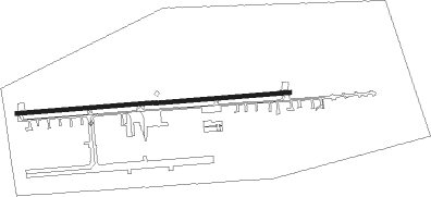
Runway info
| Runway 8 / 26 | ||
| length | 1087m (3566ft) | |
| bearing | 90° / 270° | |
| width | 15m (50ft) | |
| surface | asphalt | |
| displ threshold | 89m (292ft) / 58m (190ft) | |
Nearby beacons
| code | identifier | dist | bearing | frequency |
|---|---|---|---|---|
| PMD | PALMDALE VORTAC | 15.9 | 149° | 114.50 |
| LHS | LAKE HUGHES VORTAC | 21.5 | 243° | 114.35 |
| EDW | EDWARDS VORTAC | 24.2 | 77° | 116.40 |
| GMN | GORMAN VORTAC | 32.5 | 264° | 116.10 |
| VNY | VAN NUYS VOR/DME | 41.3 | 204° | 113.10 |
| VCV | VICTORVILLE VOR/DME | 43.5 | 109° | 109.05 |
| FIM | FILLMORE VORTAC | 45.4 | 233° | 112.50 |
| POM | POMONA VORTAC | 51.8 | 152° | 110.40 |
| SMO | SANTA MONICA VOR/DME | 53.1 | 196° | 110.80 |
| NID | CHINA LAKE TACAN | 55.2 | 32° | 111.60 |
| EHF | SHAFTER (BAKERSFIELD) VORTAC | 57.2 | 305° | 115.40 |
| LAX | LOS ANGELES VORTAC | 57.4 | 194° | 113.60 |
| CMA | CAMARILLO VOR/DME | 59.1 | 233° | 115.80 |
| VTU | VENTURA (OXNARD) VOR/DME | 61.6 | 228° | 108.20 |
| NTD | POINT MUGU (OXNARD) TACAN | 63.8 | 231° | 110.60 |
| SB | PETIS (SAN BERNARDINO) NDB | 64.1 | 134° | 397 |
| PDZ | PARADISE (ONTARIO) VORTAC | 66.2 | 145° | 112.20 |
| RAL | RIVERSIDE VOR | 66.5 | 140° | 112.40 |
| RIV | MARCH (RIVERSIDE) TACAN | 74 | 136° | 113 |
Disclaimer
The information on this website is not for real aviation. Use this data with the X-Plane flight simulator only! Data taken with kind consent from X-Plane 12 source code and data files. Content is subject to change without notice.