Holtville
Airport details
| Country | United States of America |
| State | California |
| Region | K2 |
| Airspace | Los Angeles Ctr |
| Municipality | CAL Fire San Diego Unit |
| Elevation | 59ft (18m) |
| Timezone | GMT -8 |
| Coordinates | 32.84494, -115.26850 |
| Magnetic var | |
| Type | land |
| Available since | X-Plane v10.40 |
| ICAO code | L04 |
| IATA code | n/a |
| FAA code | n/a |
Communication
| HOLTVILLE CTAF/UNICOM | 123.000 |
Nearby Points of Interest:
Algodones Dunes
-El Centro Main Post Office
-Calexico Carnegie Library
-Southern Pacific Railroad Passenger Coach Car-S.P. X7
-Masonic Temple
-Yuma County Courthouse
-Brown House
-Methodist Episcopal Church
-St. Paul's Episcopal Church
-Cactus Press-Plaza Paint Building
-United States Post Office–Yuma Main
-Southern Pacific Freight Depot
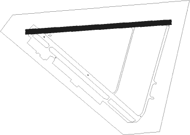
Runway info
| Runway 8 / 26 | ||
| length | 1827m (5994ft) | |
| bearing | 90° / 270° | |
| width | 62m (203ft) | |
| surface | concrete | |
Nearby beacons
| code | identifier | dist | bearing | frequency |
|---|---|---|---|---|
| MXL | MEXICALI VOR/DME | 12.9 | 172° | 115 |
| IPL | IMPERIAL VORTAC | 13.4 | 248° | 115.90 |
| NJK | EL CENTRO TACAN | 20.8 | 268° | 111 |
| BZA | BARD (YUMA) VORTAC | 33.9 | 97° | 116.80 |
| NYL | YUMA TACAN | 35.1 | 107° | 113.70 |
| BLH | BLYTHE VORTAC | 51.8 | 34° | 117.40 |
| TRM | THERMAL VORTAC | 64.9 | 311° | 116.20 |
Disclaimer
The information on this website is not for real aviation. Use this data with the X-Plane flight simulator only! Data taken with kind consent from X-Plane 12 source code and data files. Content is subject to change without notice.