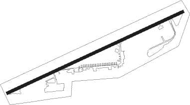
Yucca Valley
Airport details
| Country | United States of America |
| State | California |
| Region | K2 |
| Airspace | Los Angeles Ctr |
| Municipality | Yucca Valley |
| Elevation | 3224ft (983m) |
| Timezone | GMT -8 |
| Coordinates | 34.12983, -116.40689 |
| Magnetic var | |
| Type | land |
| Available since | X-Plane v10.40 |
| ICAO code | L22 |
| IATA code | n/a |
| FAA code | n/a |
Communication
| Yucca Valley CTAF/UNICOM | 123.000 |
Nearby Points of Interest:
Integratron
-Keys Desert Queen Ranch
-Cow Camp
-Ryan House and Lost Horse Well
-Desert Queen Mine
-Coachella Valley Savings No. 2
-Kenaston House
-Palm Springs Aerial Tramway Mountain Station
-Long Valley Ranger Station
-Peak Shelter Cabin
-Gilman Ranch
Nearby beacons
| code | identifier | dist | bearing | frequency |
|---|---|---|---|---|
| PSP | PALM SPRINGS VORTAC | 15.6 | 185° | 115.50 |
| TNP | TWENTYNINE PALMS VORTAC | 31.6 | 92° | 114.20 |
| TRM | THERMAL VORTAC | 32.5 | 154° | 116.20 |
| HEC | HECTOR VORTAC | 40.1 | 355° | 112.70 |
| HDF | HOMELAND (RIVERSIDE) VOR | 44.2 | 246° | 113.40 |
| RIV | MARCH (RIVERSIDE) TACAN | 45.2 | 256° | 113 |
| SB | PETIS (SAN BERNARDINO) NDB | 47.9 | 266° | 397 |
| DAG | DAGGETT VORTAC | 50.7 | 348° | 113.20 |
| VCV | VICTORVILLE VOR/DME | 56.1 | 295° | 109.05 |
| JLI | JULIAN VORTAC | 60 | 190° | 114 |
| NFG | CAMP PENDLETON (OCEANSIDE TACAN | 70.9 | 229° | 111.80 |
Disclaimer
The information on this website is not for real aviation. Use this data with the X-Plane flight simulator only! Data taken with kind consent from X-Plane 12 source code and data files. Content is subject to change without notice.