Saint Joseph - Tensas Parish
Airport details
| Country | United States of America |
| State | Louisiana |
| Region | K4 |
| Airspace | Memphis Ctr |
| Municipality | Tensas Parish |
| Elevation | 74ft (23m) |
| Timezone | GMT -6 |
| Coordinates | 31.97322, -91.23873 |
| Magnetic var | |
| Type | land |
| Available since | X-Plane v10.40 |
| ICAO code | L33 |
| IATA code | n/a |
| FAA code | n/a |
Communication
| TENSAS PARISH CTAF | 122.900 |
Nearby Points of Interest:
Winter Quarters State Historic Site
-Linwood Plantation Manager's House
-Rodney Presbyterian Church
-Alcorn State University Historic District
-Canemount
-Sacred Heart Roman Catholic Church (Port Gibson, Mississippi)
-Van Dorn House
-Grand Gulf Military State Park
-Idlewild
-Springfield Plantation
-Christ Church
-Yokena Presbyterian Church
-Edgewood
-Brandon Hall
-Selma Plantation
-Jefferson College
-Assembly Hall
-Washington Methodist Church
-Crescent Plantation
-Elizabeth Female Academy
-Lansdowne
-Cemetery Bluff District
-Weymouth Hall
-Airlie
-Cottage Gardens
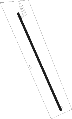
Runway info
| Runway 16 / 34 | ||
| length | 1070m (3510ft) | |
| bearing | 157° / 337° | |
| width | 23m (75ft) | |
| surface | asphalt | |
Nearby beacons
| code | identifier | dist | bearing | frequency |
|---|---|---|---|---|
| HAH | NATCHEZ-ADAMS COUNTY NDB | 17.2 | 191° | 388 |
| TKH | TALLULAH (VICKSBURG/TALLULAH) NDB | 19.6 | 38° | 344 |
| HEZ | NATCHEZ VOR/DME | 21.5 | 190° | 110 |
| MLU | MONROE VORTAC | 52 | 304° | 117.20 |
| ML | SABAR (MONROE) NDB | 52.6 | 299° | 392 |
| JH | BRENZ (JACKSON) NDB | 56.2 | 66° | 260 |
| MC | FERNI (MCCOMB) NDB | 57 | 135° | 413 |
| BQP | BASTROP NDB | 57.2 | 320° | 329 |
| MCB | MC COMB VORTAC | 64.2 | 124° | 116.70 |
Disclaimer
The information on this website is not for real aviation. Use this data with the X-Plane flight simulator only! Data taken with kind consent from X-Plane 12 source code and data files. Content is subject to change without notice.