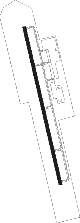
Gonzales - Louisiana Rgnl
Airport details
| Country | United States of America |
| State | Louisiana |
| Region | K4 |
| Airspace | Houston Oceanic Ctr |
| Municipality | Ascension Parish |
| Elevation | 15ft (5m) |
| Timezone | GMT -6 |
| Coordinates | 30.17100, -90.94000 |
| Magnetic var | |
| Type | land |
| Available since | X-Plane v10.40 |
| ICAO code | L38 |
| IATA code | n/a |
| FAA code | REG |
Communication
| Louisiana Rgnl AWOS | 121.175 |
| Louisiana Rgnl CTAF/UNICOM | 123.000 |
| Louisiana Rgnl Baton Rouge Approach/Departure | 126.500 |
Nearby Points of Interest:
Ashland Plantation
-Tezcuco
-Mulberry Grove
-Evan Hall
-Palo Alto Plantation
-St. Emma Plantation
-Robert Penn Warren House
-Belle Alliance Plantation
-St. Gabriel Roman Catholic Church
-Castleberry Boarding House
-Audubon Plantation
-Tally-Ho Plantation House
-St. Elizabeth Catholic Church
-Mather House
-Madewood Plantation House
-Mount Hope Plantation House
-Iberville Parish Courthouse
-Evergreen Plantation
-Desire Plantation House
-San Francisco Plantation House
-LSU Campus Mounds
-Garden District
-Reiley-Reeves House
-Antonia
-Sandbar Plantation
Nearby beacons
| code | identifier | dist | bearing | frequency |
|---|---|---|---|---|
| RQR | RESERVE VOR/DME | 18.9 | 103° | 110.80 |
| LSU | FIGHTING TIGER (BATON ROU VORTAC | 26.3 | 312° | 116.50 |
| BT | RUNDI (BATON ROUGE) NDB | 28.4 | 327° | 284 |
| MS | KINTE (NEW ORLEANS) NDB | 29.3 | 105° | 338 |
| TBD | TIBBY (THIBODAUX) VOR/DME | 30.9 | 168° | 112 |
| HP | ANGER (HAMMOND) NDB | 37.4 | 50° | 212 |
| LF | LAFFS (LAFARETTE) NDB | 50.7 | 277° | 375 |
| HRV | HARVEY (NEW ORLEANS) VORTAC | 52.4 | 109° | 114.10 |
| LEV | LEEVILLE (GRAND ISLE) VORTAC | 74 | 140° | 113.50 |
Disclaimer
The information on this website is not for real aviation. Use this data with the X-Plane flight simulator only! Data taken with kind consent from X-Plane 12 source code and data files. Content is subject to change without notice.
