Oceano - Oceano County
Airport details
| Country | United States of America |
| State | California |
| Region | |
| Airspace | Los Angeles Ctr |
| Municipality | Oceano |
| Elevation | 14ft (4m) |
| Timezone | GMT -8 |
| Coordinates | 35.10152, -120.62230 |
| Magnetic var | |
| Type | land |
| Available since | X-Plane v10.40 |
| ICAO code | L52 |
| IATA code | n/a |
| FAA code | L52 |
Communication
| Oceano County AWOS-3 | 118.375 |
| Oceano County CTAF | 122.700 |
Nearby Points of Interest:
Arroyo Grande IOOF Hall
-John Price House
-Guadalupe-Nipomo Dunes National Wildlife Refuge
-Guadalupe-Nipomo Dunes
-Pacific Coast Railway Company Grain Warehouse
-Tribune-Republic Building
-Myron Angel House
-San Luis Obispo Carnegie Library
-William Shipsey House
-The Powerhouse (San Luis Obispo, California)
-Rancho Cañada de los Osos y Pecho y Islay
-Morro Rock
-Vandenberg SFB Space Launch Complex 10
-Atascadero Administration Building
-Atascadero Printery
-Los Alamos Ranch House
-Bank of Italy
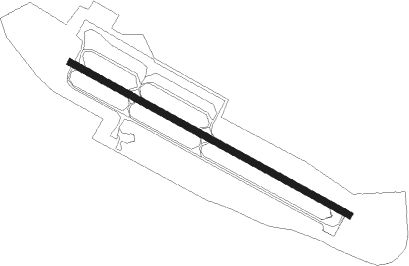
Runway info
| Runway 11 / 29 | ||
| length | 709m (2326ft) | |
| bearing | 118° / 298° | |
| width | 16m (52ft) | |
| surface | asphalt | |
Nearby beacons
| code | identifier | dist | bearing | frequency |
|---|---|---|---|---|
| GLJ | GUADALUPE (SANTA MARIA) VOR | 10.2 | 146° | 111 |
| MQO | MORRO BAY (SAN LUIS OBISP VORTAC | 11.2 | 318° | 112.40 |
| VBG | VANDENBERG (LOMPOC) TACAN | 22.2 | 174° | 112.25 |
| PRB | PASO ROBLES VORTAC | 34.2 | 360° | 114.30 |
| FLW | FELLOWS VOR/DME | 37.1 | 91° | 117.50 |
| GVO | GAVIOTA VORTAC | 43.1 | 137° | 113.80 |
| AVE | AVENAL VOR/DME | 45.4 | 50° | 117.10 |
| RZS | SAN MARCUS (SANTA BARBARA VORTAC | 55 | 125° | 114.90 |
| HGT | HUNTER LIGGETT NDB | 58.5 | 327° | 209 |
Disclaimer
The information on this website is not for real aviation. Use this data with the X-Plane flight simulator only! Data taken with kind consent from X-Plane 12 source code and data files. Content is subject to change without notice.