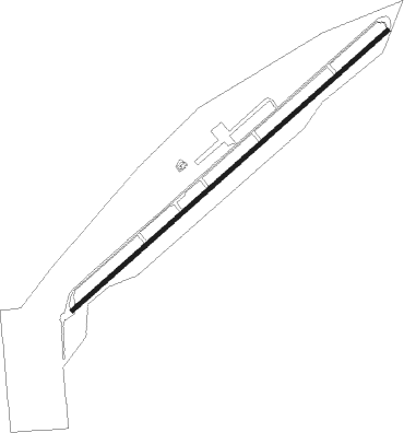
Agua Dulce - Agua Dulce Airpark
Airport details
| Country | United States of America |
| State | California |
| Region | K2 |
| Airspace | Los Angeles Ctr |
| Municipality | Los Angeles County |
| Elevation | 2660ft (811m) |
| Timezone | GMT -8 |
| Coordinates | 34.50257, -118.31464 |
| Magnetic var | |
| Type | land |
| Available since | X-Plane v10.30 |
| ICAO code | L70 |
| IATA code | n/a |
| FAA code | n/a |
Communication
| Agua Dulce Airpark CTAF | 122.800 |
| Agua Dulce Airpark Tower | 128.800 |
Nearby Points of Interest:
Vasquez Rocks
-Lopez Adobe
-Convento Building
-Rómulo Pico Adobe
-Pico Canyon Oilfield
-Portal of the Folded Wings Shrine to Aviation
-Ard Eevin
-Gabrielino Trail
-Catalina Verdugo Adobe
-Mount Lowe Railway
-Van Nuys Branch
-Gen. Charles S. Farnsworth County Park
-The Great Wall of Los Angeles
-Scripps Hall
-North Hollywood Amelia Earhart Regional Library
-Zane Grey Estate
-Villa Carlotta
-Christmas Tree Lane
-Minnie Hill Palmer House
-Andrew McNally House
-Woodbury-Story House
-James Daniel Derby House
-Pacific Electric Railway Company Substation No. 8
-Keyes Bungalow
-Samuel Merrill House
Runway info
| Runway 4 / 22 | ||
| length | 1404m (4606ft) | |
| bearing | 58° / 238° | |
| width | 15m (49ft) | |
| surface | asphalt | |
Nearby beacons
| code | identifier | dist | bearing | frequency |
|---|---|---|---|---|
| PMD | PALMDALE VORTAC | 14.6 | 63° | 114.50 |
| LHS | LAKE HUGHES VORTAC | 16.8 | 305° | 114.35 |
| VNY | VAN NUYS VOR/DME | 18.9 | 212° | 113.10 |
| FIM | FILLMORE VORTAC | 29.4 | 256° | 112.50 |
| SMO | SANTA MONICA VOR/DME | 30.3 | 196° | 110.80 |
| GMN | GORMAN VORTAC | 32.5 | 299° | 116.10 |
| LAX | LOS ANGELES VORTAC | 34.6 | 192° | 113.60 |
| POM | POMONA VORTAC | 36.5 | 129° | 110.40 |
| EDW | EDWARDS VORTAC | 40.6 | 51° | 116.40 |
| CMA | CAMARILLO VOR/DME | 42.4 | 250° | 115.80 |
| VTU | VENTURA (OXNARD) VOR/DME | 43.2 | 242° | 108.20 |
| SLI | SEAL BEACH (LOS ALAMITOS) VORTAC | 45 | 160° | 115.70 |
| NTD | POINT MUGU (OXNARD) TACAN | 46 | 245° | 110.60 |
| VCV | VICTORVILLE VOR/DME | 46 | 84° | 109.05 |
| PDZ | PARADISE (ONTARIO) VORTAC | 52.4 | 127° | 112.20 |
| RAL | RIVERSIDE VOR | 54 | 122° | 112.40 |
| SB | PETIS (SAN BERNARDINO) NDB | 54.1 | 115° | 397 |
| ELB | EL TORO (SANTA ANA) VOR/DME | 57.5 | 145° | 117.20 |
| EHF | SHAFTER (BAKERSFIELD) VORTAC | 70.4 | 321° | 115.40 |
Disclaimer
The information on this website is not for real aviation. Use this data with the X-Plane flight simulator only! Data taken with kind consent from X-Plane 12 source code and data files. Content is subject to change without notice.
