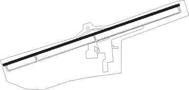
California City - California City Muni
Airport details
| Country | United States of America |
| State | California |
| Region | K2 |
| Airspace | Los Angeles Ctr |
| Municipality | California City |
| Elevation | 2435ft (742m) |
| Timezone | GMT -8 |
| Coordinates | 35.14941, -118.01715 |
| Magnetic var | |
| Type | land |
| Available since | X-Plane v10.40 |
| ICAO code | L71 |
| IATA code | n/a |
| FAA code | n/a |
Communication
| CALIFORNIA CITY MUNI AWOS 1 | 120.875 |
| CALIFORNIA CITY MUNI CTAF/UNICOM | 122.700 |
| CALIFORNIA CITY MUNI JOSHUA Approach/Departure | 133.650 |
Nearby Points of Interest:
Last Chance Canyon
-Rogers Dry Lake
-Burro Schmidt Tunnel
-Tehachapi Railroad Depot
-Courtlandt Gross House
-Tehachapi Loop
-Walker Pass
Nearby beacons
| code | identifier | dist | bearing | frequency |
|---|---|---|---|---|
| EDW | EDWARDS VORTAC | 17.2 | 120° | 116.40 |
| PMD | PALMDALE VORTAC | 31.1 | 185° | 114.50 |
| NID | CHINA LAKE TACAN | 36 | 31° | 111.60 |
| LHS | LAKE HUGHES VORTAC | 39.3 | 230° | 114.35 |
| VCV | VICTORVILLE VOR/DME | 45.4 | 132° | 109.05 |
| GMN | GORMAN VORTAC | 46.4 | 248° | 116.10 |
| VNY | VAN NUYS VOR/DME | 60.3 | 207° | 113.10 |
| FIM | FILLMORE VORTAC | 63.9 | 227° | 112.50 |
Departure and arrival routes
| Transition altitude | 18000ft |
| Transition level | 18000ft |
| SID end points | distance | outbound heading | |
|---|---|---|---|
| RW06 | |||
| L711 | 39mi | 230° | |
| RW24 | |||
| L711 | 39mi | 230° | |
Instrument approach procedures
| runway | airway (heading) | route (dist, bearing) |
|---|---|---|
| RW06 | GOVVE (58°) | GOVVE 9000ft COTBA (6mi, 52°) 7000ft |
| RNAV | COTBA 7000ft JODIP (6mi, 52°) 5100ft ODACE (8mi, 65°) 2664ft (6763mi, 107°) 2854ft HETOM (6757mi, 287°) BACRA (14mi, 345°) BACRA (turn) 9000ft | |
| RW24 | PEXOE (226°) | PEXOE 9000ft CIBIV (7mi, 216°) 6900ft ICINA (4mi, 216°) 5600ft |
| RNAV | ICINA 5600ft RAKVE (4mi, 216°) 4500ft FEKIG (6mi, 245°) 2610ft (6761mi, 107°) 2854ft MIVDE (6763mi, 287°) JERID (23mi, 232°) JERID (turn) 9000ft |
Disclaimer
The information on this website is not for real aviation. Use this data with the X-Plane flight simulator only! Data taken with kind consent from X-Plane 12 source code and data files. Content is subject to change without notice.
