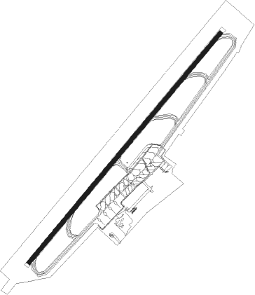
Burgas
Airport details
| Country | Bulgaria |
| State | Burgas Province |
| Region | LB |
| Airspace | Sofia Ctr |
| Municipality | Burgas |
| Elevation | 132ft (40m) |
| Timezone | GMT +2 |
| Coordinates | 42.57028, 27.51528 |
| Magnetic var | |
| Type | land |
| Available since | X-Plane v10.40 |
| ICAO code | LBBG |
| IATA code | BOJ |
| FAA code | n/a |
Communication
| Burgas ATIS | 126.975 |
| Burgas Tower | 120.000 |
| Burgas Tower | 118.000 |
| Burgas Approach | 125.100 |
| Burgas Approach | 119.650 |
Approach frequencies
| ILS-cat-I | RW22 | 110.3 | 18.00mi |
| 3° GS | RW22 | 110.3 | 18.00mi |
Nearby Points of Interest:
Lake Atanasovsko
-Armenian Church the Holy Cross
-Poda Protected Area
-Nesebar
-Ropotamo
Nearby beacons
| code | identifier | dist | bearing | frequency |
|---|---|---|---|---|
| BGS | BURGAS VOR/DME | 1.4 | 53° | 112 |
| KMN | KAMENAR NDB | 4.6 | 53° | 399 |
| EMO | DME | 15.3 | 53° | 113.65 |
| DWN | DEVNYA NDB | 41.2 | 12° | 350 |
| WRN | VARNA VOR/DME | 41.8 | 25° | 112.40 |
| VRB | DME | 43 | 293° | 114.55 |
Departure and arrival routes
| Transition altitude | 12000ft |
| SID end points | distance | outbound heading | |
|---|---|---|---|
| RW04 | |||
| TUGS1S | 22mi | 10° | |
| XILT2S | 28mi | 83° | |
| MEDE3S | 23mi | 111° | |
| IXUK2S | 33mi | 273° | |
| ARNO2S | 35mi | 283° | |
| GONG1S | 38mi | 318° | |
| BUVA1S | 25mi | 350° | |
| RW22 | |||
| TUGS1V | 22mi | 10° | |
| XILT2T, XILT2V | 28mi | 83° | |
| MEDE2T, MEDE2V | 23mi | 111° | |
| IXUK1V | 33mi | 273° | |
| ARNO3V | 35mi | 283° | |
| GONG2V | 38mi | 318° | |
| BUVA1V | 25mi | 350° | |
| STAR starting points | distance | inbound heading | |
|---|---|---|---|
| RW04 | |||
| IXUK4D | 33.1 | 93° | |
| ESEN4D | 39.4 | 125° | |
| RUTA4D | 29.1 | 238° | |
| NESA4D | 31.1 | 249° | |
| VABU3D | 24.4 | 277° | |
| UVUD3D | 24.3 | 320° | |
| RW22 | |||
| IXUK4F | 33.1 | 93° | |
| ESEN3F | 39.4 | 125° | |
| RUTA3F | 29.1 | 238° | |
| NESA3F | 31.1 | 249° | |
| VABU3F | 24.4 | 277° | |
| UVUD3F | 24.3 | 320° | |
Instrument approach procedures
| runway | airway (heading) | route (dist, bearing) |
|---|---|---|
| RW04 | BGS (233°) | BGS BG374 (10mi, 198°) OTLOG (4mi, 233°) 3000ft GEBSU (5mi, 306°) 2700ft |
| RW04 | ELTOG (53°) | ELTOG 4000ft GEBSU (4mi, 53°) 2700ft |
| RNAV | GEBSU 2700ft BG768 (5mi, 53°) 1700ft LBBG (6mi, 53°) 139ft BG379 (7mi, 53°) (2963mi, 213°) 1600ft BGS (2957mi, 33°) 4000ft BGS (turn) 4000ft | |
| RW22 | BGS (233°) | BGS 4000ft BG390 (5mi, 126°) AMGUG (12mi, 53°) IVKOR (5mi, 306°) 3400ft |
| RW22 | GIGPU (233°) | GIGPU 4000ft IVKOR (4mi, 233°) 3400ft |
| RNAV | IVKOR 3400ft BG717 (5mi, 233°) 2400ft LBBG (8mi, 233°) 170ft BG420 (1mi, 233°) BG421 (3mi, 242°) (2952mi, 213°) 1700ft BGS (2957mi, 33°) 4000ft BGS (turn) 4000ft |
Disclaimer
The information on this website is not for real aviation. Use this data with the X-Plane flight simulator only! Data taken with kind consent from X-Plane 12 source code and data files. Content is subject to change without notice.
