Dolna Banya
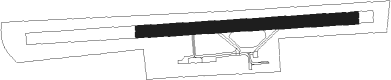
Airport details
| Country | Bulgaria |
| State | Sofia Province |
| Region | LB |
| Airspace | Sofia Ctr |
| Municipality | Dolna Bania |
| Elevation | 1777ft (542m) |
| Timezone | GMT +2 |
| Coordinates | 42.30851, 23.82042 |
| Magnetic var | |
| Type | land |
| Available since | X-Plane v11.51r1 |
| ICAO code | LBDB |
| IATA code | n/a |
| FAA code | n/a |
Communication
| Dolna Banya Dolna Banya Center | 121.750 |
| Dolna Banya Dolna Banya Tower | 118.850 |
Nearby Points of Interest:
Aleksandar Stamboliyski ossuary
-Aleksandar Stamboliyski museum
-Church of St Demetrius, Patalenitsa
-Pazardzhik Synagogues
-Small Synagogue of Pazardzhik
-Tsaritchina Biosphere Reserve
-Pchelino Convent
Nearby beacons
| code | identifier | dist | bearing | frequency |
|---|---|---|---|---|
| WAK | VAKAREL NDB | 16.8 | 336° | 490 |
| BLO | BAILOVO VOR/DME | 21.5 | 359° | 117.50 |
| VIT | DME | 28.1 | 296° | 113.45 |
| SOF | SOFIA VOR/DME | 30.1 | 312° | 112.60 |
| BOZ | BOZHOURISHTE NDB | 39.2 | 306° | 312 |
| GOL | GOLYAMA VOR/DME | 50.4 | 27° | 114.10 |
| ROZ | DME | 54.9 | 124° | 115.15 |
| KAL | DME | 56.7 | 304° | 117.55 |
Disclaimer
The information on this website is not for real aviation. Use this data with the X-Plane flight simulator only! Data taken with kind consent from X-Plane 12 source code and data files. Content is subject to change without notice.