Dubrovnik
Airport details
| Country | Croatia |
| State | Dubrovnik-Neretva County |
| Region | LD |
| Airspace | Zagreb Ctr |
| Municipality | Općina Konavle |
| Elevation | 524ft (160m) |
| Timezone | GMT +1 |
| Coordinates | 42.56135, 18.26824 |
| Magnetic var | |
| Type | land |
| Available since | X-Plane v10.40 |
| ICAO code | LDDU |
| IATA code | DBV |
| FAA code | n/a |
Communication
| Dubrovnik ATIS | 118.425 |
| Dubrovnik Dubrovnik Tower | 129.500 |
| Dubrovnik Dubrovnik Radar | 123.600 |
Approach frequencies
| ILS-cat-I | RW11 | 110.1 | 18.00mi |
| 3° GS | RW11 | 110.1 | 18.00mi |
Nearby Points of Interest:
Trebinje Transfiguration Cathedral
-Mičevac
-Roman bridge Vučija
-église Saint-Mitre de Ravno
-Dobrićevo Monastery
-Grebnice-Bunčići necropolis
-Natural and Culturo-Historical Region of Kotor
-Fortifications of Kotor
-Church of the Nativity of Holy Virgin Mary Ljubinje
-église Saint-Basile-d'Ostrog de Mišljen
-église Saint-Lazare de Vlahovići
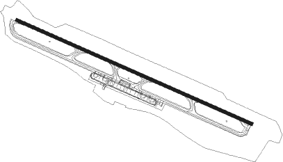
Runway info
| Runway 11 / 29 | ||
| length | 3226m (10584ft) | |
| bearing | 112° / 292° | |
| width | 45m (148ft) | |
| surface | asphalt | |
| displ threshold | 82m (269ft) / 0m (0ft) | |
| blast zone | 98m (322ft) / 67m (220ft) | |
Nearby beacons
| code | identifier | dist | bearing | frequency |
|---|---|---|---|---|
| DBK | DUBROVNIK VOR/DME | 0.6 | 129° | 115.40 |
| GR | GRUDA (DUBROVNIK) NDB | 2.6 | 112° | 414 |
| CV | CAVTAT (DUBROVNIK) NDB | 2.8 | 293° | 397 |
| KLP | KOLOCEP NDB | 12.7 | 294° | 318 |
| RO | TIVAT NDB | 15.2 | 116° | 332 |
| TAZ | TIVAT NDB | 28.9 | 118° | 345 |
| NIK | NIKSIC NDB | 31.7 | 72° | 302 |
| GAC | GACKO NDB | 37.1 | 26° | 370 |
| DAN | PODGORICA NDB | 37.8 | 91° | 312 |
| DNC | MOSTAR NDB | 39.2 | 324° | 425 |
| MA | MOSTAR NDB | 43.4 | 328° | 355 |
| POD | PODGORICA NDB | 44.9 | 100° | 335 |
| MSR | MOSTAR VOR/DME | 45.7 | 329° | 116.90 |
| GO | PODGORICA NDB | 46.1 | 105° | 420 |
Departure and arrival routes
| Transition altitude | 10000ft |
| Transition level | 11000ft |
| SID end points | distance | outbound heading | |
|---|---|---|---|
| RW11 | |||
| MOKU5C, MOKU2E | 12mi | 118° | |
| RIGV2W | 18mi | 186° | |
| BEVI4C | 38mi | 187° | |
| LOKR3C | 20mi | 237° | |
| AMUG4C, AMUG2F, AMUG2E | 30mi | 269° | |
| RW29 | |||
| MOKU4D, MOKU1V | 12mi | 118° | |
| BEVI3D | 38mi | 187° | |
| LOKR2D | 20mi | 237° | |
| AMUG2D | 30mi | 269° | |
| ORAK1V | 47mi | 269° | |
| LASD1V, LASD2D | 51mi | 281° | |
| DOPU4D | 19mi | 295° | |
| NERA1V, NERA9D | 38mi | 295° | |
| STAR starting points | distance | inbound heading | |
|---|---|---|---|
| ALL | |||
| BEVI3A | 37.8 | 7° | |
| LOKR2A | 19.5 | 57° | |
| AMUG2A | 30.2 | 89° | |
| NERA8A | 38.0 | 115° | |
| MOKU4A | 11.5 | 298° | |
| RW11 | |||
| BEVI2Z | 37.8 | 7° | |
| LOKR2Z | 19.5 | 57° | |
| ORAK2Z | 47.2 | 89° | |
| NERA2Z, NERA2X | 38.0 | 115° | |
| SIPA2Z | 62.9 | 116° | |
| TIKS2Z | 50.1 | 116° | |
| MOKU3Z | 11.5 | 298° | |
| RW29 | |||
| BEVI1Y | 37.8 | 7° | |
| AIOS1Y | 59.1 | 58° | |
| ORAK1Y | 47.2 | 89° | |
| NERA1Y | 38.0 | 115° | |
| TIKS1Y | 50.1 | 116° | |
| SIPA1Y | 62.9 | 116° | |
| MOKU1Y | 11.5 | 298° | |
Instrument approach procedures
| runway | airway (heading) | route (dist, bearing) |
|---|---|---|
| RW11 | ERASO (90°) | ERASO 5000ft DU402 (7mi, 36°) 4000ft |
| RW11 | PILAP (112°) | PILAP 5000ft DU402 (7mi, 111°) 4000ft |
| RNAV | DU402 4000ft DU400 (6mi, 112°) 2600ft LDDU (7mi, 112°) 571ft DU399 (turn) DU900 (15mi, 190°) 4000ft DU900 (turn) 4000ft | |
| RW29 | OLEGU (61°) | OLEGU 4000ft DU500 (8mi, 112°) 2500ft |
| RNAV | DU500 2500ft DU502 (6mi, 66°) DU504 (2mi, 333°) 2500ft DU506 (turn) 2180ft LDDU (6mi, 292°) 535ft PILAP (20mi, 292°) 5000ft PILAP (turn) 5000ft |
Holding patterns
| STAR name | hold at | type | turn | heading* | altitude | leg | speed limit |
|---|---|---|---|---|---|---|---|
| AIOS1Y | OLEGU | VHF | right | 294 (114)° | > 4000ft | 1.0min timed | 230 |
| AMUG2A | KLP | FIX | right | 288 (108)° | > 4000ft | DME 3.7mi | 210 |
| BEVI1Y | OLEGU | VHF | right | 294 (114)° | > 4000ft | 1.0min timed | 230 |
| BEVI2Z | PILAP | VHF | right | 277 (97)° | > 5000ft | 1.0min timed | 210 |
| BEVI3A | D182O | VHF | left | 182 (2)° | > 4000ft | DME 4.0mi | 210 |
| BEVI3A | KLP | FIX | right | 288 (108)° | > 4000ft | DME 3.7mi | 210 |
| LOKR2A | KLP | FIX | right | 288 (108)° | > 4000ft | DME 3.7mi | 210 |
| LOKR2Z | PILAP | VHF | right | 277 (97)° | > 5000ft | 1.0min timed | 210 |
| MOKU1Y | OLEGU | VHF | right | 294 (114)° | > 4000ft | 1.0min timed | 230 |
| MOKU3Z | PILAP | VHF | right | 277 (97)° | > 5000ft | 1.0min timed | 210 |
| MOKU4A | KLP | FIX | right | 288 (108)° | > 4000ft | DME 3.7mi | 210 |
| NERA1Y | OLEGU | VHF | right | 294 (114)° | > 4000ft | 1.0min timed | 230 |
| NERA2X | NERRA | VHF | right | 300 (120)° | > 5000ft | 1.0min timed | 250 |
| NERA2X | PILAP | VHF | right | 277 (97)° | > 5000ft | 1.0min timed | 210 |
| NERA2Z | NERRA | VHF | right | 300 (120)° | > 5000ft | 1.0min timed | 250 |
| NERA2Z | PILAP | VHF | right | 277 (97)° | > 5000ft | 1.0min timed | 210 |
| NERA8A | KLP | FIX | right | 288 (108)° | > 4000ft | DME 3.7mi | 210 |
| ORAK1Y | OLEGU | VHF | right | 294 (114)° | > 4000ft | 1.0min timed | 230 |
| ORAK2Z | ORAKA | VHF | right | 269 (89)° | > 5000ft | 1.0min timed | 250 |
| ORAK2Z | PILAP | VHF | right | 277 (97)° | > 5000ft | 1.0min timed | 210 |
| SIPA1Y | OLEGU | VHF | right | 294 (114)° | > 4000ft | 1.0min timed | 230 |
| SIPA2Z | PILAP | VHF | right | 277 (97)° | > 5000ft | 1.0min timed | 210 |
| TIKS1Y | OLEGU | VHF | right | 294 (114)° | > 4000ft | 1.0min timed | 230 |
| TIKS2Z | PILAP | VHF | right | 277 (97)° | > 5000ft | 1.0min timed | 210 |
| *) magnetic outbound (inbound) holding course | |||||||
Disclaimer
The information on this website is not for real aviation. Use this data with the X-Plane flight simulator only! Data taken with kind consent from X-Plane 12 source code and data files. Content is subject to change without notice.