Palafolls
Airport details
| Country | Spain |
| State | Catalonia |
| Region | |
| Airspace | Barcelona Ctr |
| Municipality | Palafolls |
| Elevation | 44ft (13m) |
| Timezone | GMT +1 |
| Coordinates | 41.68811, 2.74537 |
| Magnetic var | |
| Type | land |
| Available since | X-Plane v10.40 |
| ICAO code | LE05 |
| IATA code | n/a |
| FAA code | n/a |
Communication
| Palafolls Tower | 123.500 |
Nearby Points of Interest:
Molí d'en Puigvert
-Can Puigvert
-Can Tió
-can Toni Joan
-Mas Comes (Palafolls)
-Can Florit
-Conjunt de cases al carrer Joaquim Ruhi
-Can Calau
-Can Pruna
-Santa Maria Assumpta de Palafolls
-Casa Comú de Palafolls
-Plaça Major de Palafolls
-Sant Pere de Vivelles
-Mas Sant Jaume (Tordera)
-Carrer de Santa Llúcia
-Carrer dels Ferrers
-Mirador de la plaça de la Vila
-Ca n'Oms
-Ermita de Sant Pere de Tordera
-Hospital Asil de Sant Jaume
-Can Bofill
-Mare de Déu del Vilar
-Capella de l'Antiga
-Capella de la Salut (Blanes)
-Can Carbó
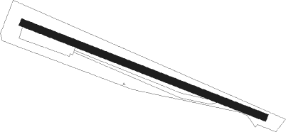
Runway info
| Runway 13 / 31 | ||
| length | 508m (1667ft) | |
| bearing | 110° / 290° | |
| width | 14m (46ft) | |
| surface | dirt | |
Nearby beacons
| code | identifier | dist | bearing | frequency |
|---|---|---|---|---|
| CLE | CALELLA VOR/DME | 5.7 | 247° | 115.35 |
| G | GIRONA NDB | 14.3 | 6° | 330 |
| GIR | GERONA (GIRONA) VOR/DME | 14.6 | 6° | 114.10 |
| GRN | GERONA (GIRONA) NDB | 20.4 | 10° | 412 |
| BGR | BAGUR VOR/DME | 25.9 | 61° | 112.20 |
| SLL | SABADELL VOR/DME | 30.2 | 255° | 112 |
| BCN | BARCELONA VOR/DME | 36.6 | 239° | 116.70 |
| PRA | EL PRAT VOR/DME | 38.5 | 239° | 114.30 |
| SAL | SAINTE LEOCADIE NDB | 56 | 316° | 418 |
| PL | RIVESALTES (PERPIGNAN) NDB | 60 | 10° | 351 |
Disclaimer
The information on this website is not for real aviation. Use this data with the X-Plane flight simulator only! Data taken with kind consent from X-Plane 12 source code and data files. Content is subject to change without notice.