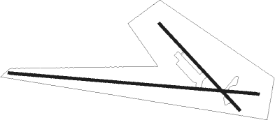
Jaen - Beas De Segura
Airport details
| Country | Spain |
| State | Andalusia |
| Region | LE |
| Airspace | Madrid Ctr |
| Municipality | Beas de Segura |
| Elevation | 1788ft (545m) |
| Timezone | GMT +1 |
| Coordinates | 38.27111, -2.94889 |
| Magnetic var | |
| Type | land |
| Available since | X-Plane v10.40 |
| ICAO code | LEBE |
| IATA code | n/a |
| FAA code | n/a |
Communication
| Beas de Segura Tower | 123.500 |
Nearby Points of Interest:
Convento de Carmelitas Descalzas de San José del Salvador
-Torreón con espadaña
-Centro Histórico de Iznatoraf
-Castillo de Cardete
-Castillo de Montizón
-Torre del Campanario de la Iglesia
-Muralla urbana
-Terrinches tower
-Renaissance Monumental Ensembles of Úbeda and Baeza
-Colonia Salaria
-Casa Solar de los Bustos, Villanueva de los Infantes
-Torre Castellón de Fique
-Puente Romano del Piélago
-Centro Histórico de Baeza
-Palacio de Jabalquinto
-Casas Consistoriales Altas
-Casa del Pópulo
-Church of La Asunción, Yeste
-Torre de Almorox
-Torre de Ferrer
Nearby beacons
| code | identifier | dist | bearing | frequency |
|---|---|---|---|---|
| YES | YESTE VOR/DME | 28.6 | 81° | 115.20 |
| BLN | BAILEN VOR/DME | 32.6 | 260° | 116.20 |
| EAL | ALMAGRO (CIUDAD REAL) NDB | 55.7 | 310° | 332 |
Disclaimer
The information on this website is not for real aviation. Use this data with the X-Plane flight simulator only! Data taken with kind consent from X-Plane 12 source code and data files. Content is subject to change without notice.

