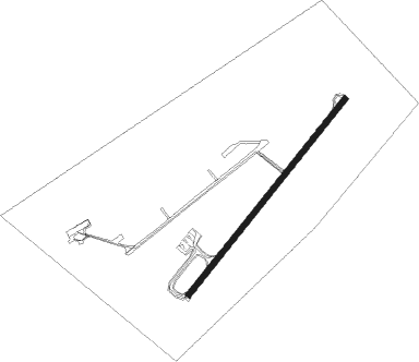
Burgos
Airport details
| Country | Spain |
| State | Castile and León |
| Region | LE |
| Airspace | Madrid Ctr |
| Municipality | Burgos |
| Elevation | 2961ft (903m) |
| Timezone | GMT +1 |
| Coordinates | 42.35490, -3.63303 |
| Magnetic var | |
| Type | land |
| Available since | X-Plane v10.40 |
| ICAO code | LEBG |
| IATA code | RGS |
| FAA code | n/a |
Communication
| Burgos Ground Control | 125.425 |
| Burgos Tower | 118.450 |
Nearby Points of Interest:
Hospital Divino Vallés
-Biblioteca Pública del Estado en Burgos
-Burgos
-Monasterio de la Trinidad de Burgos
-Paseo del Espolón
-San Agustín Royal Monastery
-Church-Convent of the Salesas, Burgos
-Antiguo Seminario Mayor, Burgos
-Puente de Castilla
-Estación del Norte
-Paseo de la Isla
-Hospital del Rey
-Archaeological site of Atapuerca
-Castillo de Sotopalacios
-Hermitage of Nuestra Señora del Valle, Monasterio de Rodilla
-Castillo de Mazuelo de Muñó
-Monastery of Santa Clara, Briviesca
-Conjunto Histórico de la Villa de Covarrubias
-Church of Santiago, Villamorón
-Church of Santa María la Mayor, Aguilar de Bureba
-Rollo de justicia de Mahamud
-Salinas de Poza de la Sal
-Church of Nuestra Señora de la Asunción, Jaramillo de la Fuente
-Hermitage of Castarruyo, Sandoval de la Reina
-Castrillo Mota de Judíos
Nearby beacons
| code | identifier | dist | bearing | frequency |
|---|---|---|---|---|
| BUR | BURGOS VOR/DME | 0.8 | 90° | 111.40 |
| NEA | TABANERA VOR/DME | 28.8 | 235° | 116.75 |
| DGO | DOMINGO VOR/DME | 33.8 | 83° | 112.60 |
| VRA | VITORIA VOR/DME | 40.8 | 64° | 116.60 |
| VT | VITORIA NDB | 45.4 | 62° | 308 |
| VFD | VITORIA-FORONDA VOR/DME | 51 | 60° | 112.90 |
| VTA | VITORIA NDB | 54.3 | 59° | 345 |
| BLV | BILBAO VOR/DME | 64.7 | 36° | 115.90 |
Departure and arrival routes
| Transition altitude | 6000ft |
| SID end points | distance | outbound heading | |
|---|---|---|---|
| RW04 | |||
| NEA3C | 143mi | 62° | |
| AMGA2C | 21mi | 62° | |
| ARLU3C | 20mi | 177° | |
| RATA3C | 22mi | 299° | |
| UNGA2C | 20mi | 348° | |
| RW22 | |||
| AMGA3E | 21mi | 62° | |
| NEA3G | 143mi | 62° | |
| ARLU4E | 20mi | 177° | |
| RATA3K | 22mi | 299° | |
| UNGA3E | 20mi | 348° | |
| STAR starting points | distance | inbound heading | |
|---|---|---|---|
| ALL | |||
| RATA2J | 22.0 | 119° | |
| UNGA1A | 19.8 | 168° | |
| AMGA1A | 20.6 | 242° | |
| NEA3A | 142.6 | 242° | |
| ARLU2A | 20.0 | 357° | |
Holding patterns
| STAR name | hold at | type | turn | heading* | altitude | leg | speed limit |
|---|---|---|---|---|---|---|---|
| AMGA1A | BUR | NDB | right | 39 (219)° | > 6000ft | 1.0min timed | ICAO rules |
| ARLU2A | BUR | NDB | right | 39 (219)° | > 6000ft | 1.0min timed | ICAO rules |
| DGO1H | BUR | NDB | right | 39 (219)° | > 6000ft | 1.0min timed | ICAO rules |
| NEA3A | BUR | NDB | right | 39 (219)° | > 6000ft | 1.0min timed | ICAO rules |
| RATA2J | BUR | NDB | right | 39 (219)° | > 6000ft | 1.0min timed | ICAO rules |
| UNGA1A | BUR | NDB | right | 39 (219)° | > 6000ft | 1.0min timed | ICAO rules |
| *) magnetic outbound (inbound) holding course | |||||||
Disclaimer
The information on this website is not for real aviation. Use this data with the X-Plane flight simulator only! Data taken with kind consent from X-Plane 12 source code and data files. Content is subject to change without notice.
