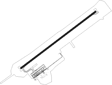
Calamocha - Castellon-costa Azahar
Airport details
| Country | Spain |
| State | Valencian Community |
| Region | LE |
| Airspace | Barcelona Ctr |
| Municipality | Vilanova d'Alcolea |
| Elevation | 1181ft (360m) |
| Timezone | GMT +1 |
| Coordinates | 40.21417, 0.07361 |
| Magnetic var | |
| Type | land |
| Available since | X-Plane v10.40 |
| ICAO code | LECH |
| IATA code | n/a |
| FAA code | n/a |
Communication
| Castellon-Costa Azahar AWOS | 128.800 |
| Castellon-Costa Azahar Castellon Ground Control | 121.825 |
| Castellon-Costa Azahar Castellon Tower | 120.675 |
| Castellon-Costa Azahar Valencia Control Approach/Dep | 120.100 |
Approach frequencies
| ILS-cat-I | RW06 | 111.95 | 18.00mi |
| 3° GS | RW06 | 111.95 | 18.00mi |
Nearby Points of Interest:
Palau municipal de Cabanes
-Recinte emmurallat de Cabanes
-Castillo de Albalat
-Ermita fortificada d'Albalat
-Torre de Na Blanca (Torreblanca)
-Palau dels Casalduch
-Torreblanca Calvary and Ancient Church
-iglesia de San Francisco de Torreblanca
-Tossal de la Vila
-Torre de la Sal
-Torre Nostra
-Església de la Mare de Déu dels Àngels de la Barona
-Ermita de Nuestra Señora de los Desamparados de Los Ibarzos
-Church of Saint Michael
-Castle and Walls in Oropesa del Mar
-Torre Matella
-Escut de la Casa Abadia de Vilafamés
-Casa Babiloni-Bardoll
-La Torreta
-Roca Grossa
-Ermita de San Ramón
-Torre de Capicorb
-Hermitage of Saint Paul
-Capella de la Mare de Déu dels Desemparats d'Alcalà de Xivert
-Sants Joans hermitage, Albocàsser
Nearby beacons
| code | identifier | dist | bearing | frequency |
|---|---|---|---|---|
| CTN | CASTELLON VOR/DME | 0.7 | 73° | 117.05 |
| SGO | SAGUNTO (VALENCIA) NDB | 34.9 | 208° | 356 |
| EBT | BETERA NDB | 43.3 | 223° | 362 |
| PND | PINEDO (VALENCIA) NDB | 50.5 | 208° | 340 |
| VLC | VALENCIA VOR/DME | 50.7 | 217° | 116.10 |
| MLA | MAELLA VOR/DME | 55.1 | 6° | 112.10 |
| CLS | CALLES (VALENCIA) VOR/DME | 57.5 | 244° | 117.55 |
Departure and arrival routes
| Transition altitude | 6000ft |
| SID end points | distance | outbound heading | |
|---|---|---|---|
| RW06 | |||
| MATE2P | 22mi | 29° | |
| NAVA2P | 23mi | 70° | |
| TATO2P | 21mi | 239° | |
| RW24 | |||
| MATE2Q | 22mi | 29° | |
| NAVA2Q | 23mi | 70° | |
| TATO2Q | 21mi | 239° | |
| STAR starting points | distance | inbound heading | |
|---|---|---|---|
| RW06 | |||
| SOPE3S | 23.1 | 12° | |
| RIME2S | 21.5 | 158° | |
| TORD2S | 23.7 | 265° | |
| RW24 | |||
| SOPE2R | 23.1 | 12° | |
| RIME2R | 21.5 | 158° | |
| TORD2R | 23.7 | 265° | |
Holding patterns
| STAR name | hold at | type | turn | heading* | altitude | leg | speed limit |
|---|---|---|---|---|---|---|---|
| RIME2R | OSPES | VHF | left | 51 (231)° | > 5000ft | DME 5.0mi | ICAO rules |
| RIME2S | SAURA | VHF | left | 279 (99)° | 7500ft - 9000ft | DME 4.8mi | ICAO rules |
| SOPE2R | OSPES | VHF | left | 51 (231)° | > 5000ft | DME 5.0mi | ICAO rules |
| SOPE3S | NIBEN | VHF | left | 238 (58)° | 7000ft - 9000ft | DME 4.6mi | ICAO rules |
| TORD2R | OSPES | VHF | left | 51 (231)° | > 5000ft | DME 5.0mi | ICAO rules |
| TORD2S | CTN | NDB | right | 57 (237)° | > 5000ft | 1.0min timed | ICAO rules |
| *) magnetic outbound (inbound) holding course | |||||||
Disclaimer
The information on this website is not for real aviation. Use this data with the X-Plane flight simulator only! Data taken with kind consent from X-Plane 12 source code and data files. Content is subject to change without notice.
