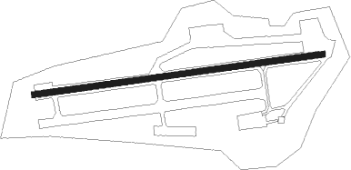
Huesca - Santa Cilia-los Pirineos
Airport details
| Country | Spain |
| State | Aragon |
| Region | LE |
| Airspace | Madrid Ctr |
| Municipality | Santa Cilia |
| Elevation | 2244ft (684m) |
| Timezone | GMT +1 |
| Coordinates | 42.56738, -0.72459 |
| Magnetic var | |
| Type | land |
| Available since | X-Plane v10.40 |
| ICAO code | LECI |
| IATA code | n/a |
| FAA code | n/a |
Communication
| Santa Cilia-Los Pirineos A/A | 123.500 |
Nearby Points of Interest:
Iglesia de San Miguel Arcángel
-Santa Cruz de la Serós
-Bailo
-San Pedro Apóstol (Caniás)
-San Juan Bautista (Banaguás)
-San Adrián (Guasillo)
-Torre de la Pardina de Larbesa
-Castiello de Jaca
-San Juan Bautista (Aratorés)
-Villanúa
-Iglesia de San Esteban
-Torre de los Pomar
-Castillo de Sibirana
-Somport Rail Tunnel
-Tower of San Pedro, Ayerbe
-Palacio de Ayerbe
-Torre del Reloj, Ayerbe
-Torraza de Lárrede
-Church of Santa María del Campo, Navascués
-Iglesia de San Nicolás de Bari (El Frago)
-Aztaparreta
-Uncastillo
-Church and abbey of Javier
-Town hall of Uncastillo
-Muralla de Sos del Rey Católico
Nearby beacons
| code | identifier | dist | bearing | frequency |
|---|---|---|---|---|
| HUE | HUESCA VOR/DME | 34.7 | 141° | 114.55 |
| TON | TORRALBA DE ARAGON NDB | 39.5 | 162° | 335 |
| TBR | BARDENAS REALES TACAN | 40 | 244° | 108.60 |
| PAM | PAMPLONA NDB | 41.3 | 279° | 422 |
| PAP | PAMPLONA SOUTH VOR/DME | 42 | 277° | 113.55 |
| PPN | PAMPLONA VOR/DME | 44.3 | 280° | 112.30 |
| PP | PAMPLONA NDB | 47.3 | 287° | 354 |
| PU | PAU/PYRENEES NDB | 48.8 | 29° | 364 |
| PO | PAU/PYRENEES NDB | 51.1 | 37° | 397 |
| ZRZ | ZARAGOZA NDB | 54.4 | 209° | 389 |
| TL | TARBES NDB | 55 | 47° | 321 |
| ZZA | ZARAGOZA TACAN | 55.4 | 201° | 133.70 |
| ZAR | ZARAGOZA VOR/DME | 56.2 | 199° | 113 |
| TBO | TARBES VOR/DME | 59.7 | 49° | 113.90 |
| BZ | BIARRITZ PAYS BASQUE NDB | 61.8 | 323° | 341 |
| LMB | LEMBEYE VOR | 62.2 | 38° | 111.80 |
| BTZ | BIARRITZ PAYS BASQUE VOR/DME | 64 | 319° | 114.15 |
Disclaimer
The information on this website is not for real aviation. Use this data with the X-Plane flight simulator only! Data taken with kind consent from X-Plane 12 source code and data files. Content is subject to change without notice.